Forest Beach Topo Map Michigan
To zoom in, hover over the map of Forest Beach
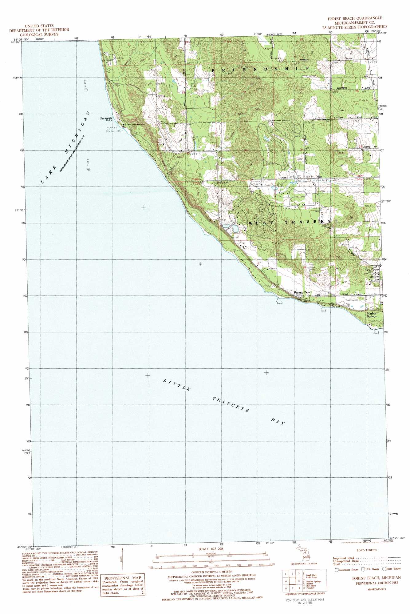
USGS Topo Quad 45085d1 - 1:25,000 scale
| Topo Map Name: | Forest Beach |
| USGS Topo Quad ID: | 45085d1 |
| Print Size: | ca. 21 1/4" wide x 27" high |
| Southeast Coordinates: | 45.375° N latitude / 85° W longitude |
| Map Center Coordinates: | 45.4375° N latitude / 85.0625° W longitude |
| U.S. State: | MI |
| Filename: | l45085d1.jpg |
| Download Map JPG Image: | Forest Beach topo map 1:25,000 scale |
| Map Type: | Topographic |
| Topo Series: | 7.5´ |
| Map Scale: | 1:25,000 |
| Source of Map Images: | United States Geological Survey (USGS) |
| Alternate Map Versions: |
Forest Beach MI 1983, updated 1984 Download PDF Buy paper map |
1:24,000 Topo Quads surrounding Forest Beach
Cross Village |
Bliss |
Levaring |
||
Goodhart |
Larks Lake |
Pellston |
||
Forest Beach |
Harbor Springs |
Alanson |
||
Charlevoix |
Ironton |
Bayshore |
Petoskey |
Epsilon |
Atwood |
Ellsworth |
Boyne City |
Boyne Falls |
Thumb Lake |
> Back to 45085a1 at 1:100,000 scale
> Back to 45084a1 at 1:250,000 scale
> Back to U.S. Topo Maps home
Forest Beach topo map: Gazetteer
Forest Beach: Bays
Little Traverse Bay elevation 177m 580′Forest Beach: Capes
Sevenmile Point elevation 184m 603′Forest Beach: Populated Places
Forest Beach elevation 203m 666′Forest Beach: Streams
Fivemile Creek elevation 177m 580′Forest Beach digital topo map on disk
Buy this Forest Beach topo map showing relief, roads, GPS coordinates and other geographical features, as a high-resolution digital map file on DVD: