Clear Lake Topo Map Minnesota
To zoom in, hover over the map of Clear Lake
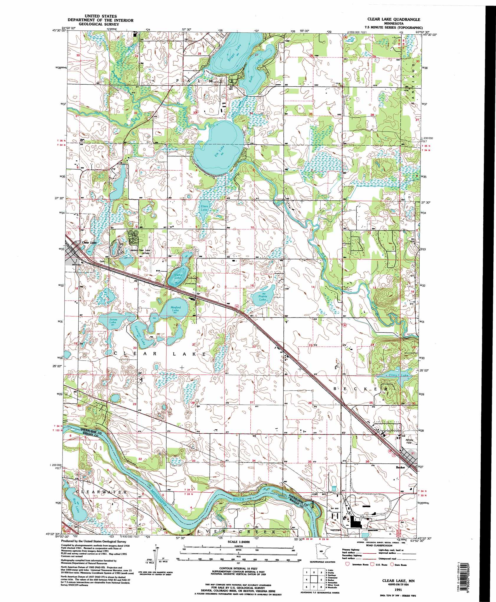
USGS Topo Quad 45093d8 - 1:24,000 scale
| Topo Map Name: | Clear Lake |
| USGS Topo Quad ID: | 45093d8 |
| Print Size: | ca. 21 1/4" wide x 27" high |
| Southeast Coordinates: | 45.375° N latitude / 93.875° W longitude |
| Map Center Coordinates: | 45.4375° N latitude / 93.9375° W longitude |
| U.S. State: | MN |
| Filename: | o45093d8.jpg |
| Download Map JPG Image: | Clear Lake topo map 1:24,000 scale |
| Map Type: | Topographic |
| Topo Series: | 7.5´ |
| Map Scale: | 1:24,000 |
| Source of Map Images: | United States Geological Survey (USGS) |
| Alternate Map Versions: |
Clear Lake MN 1961, updated 1963 Download PDF Buy paper map Clear Lake MN 1961, updated 1980 Download PDF Buy paper map Clear Lake MN 1961, updated 1987 Download PDF Buy paper map Clear Lake MN 1991, updated 1995 Download PDF Buy paper map Clear Lake MN 2010 Download PDF Buy paper map Clear Lake MN 2013 Download PDF Buy paper map Clear Lake MN 2016 Download PDF Buy paper map |
1:24,000 Topo Quads surrounding Clear Lake
Little Rock Lake |
Mayhew |
Foley |
Ronneby |
Foreston |
Saint Cloud |
Cable |
Duelm |
Santiago |
Princeton Sw |
Saint Augusta |
Clearwater |
Clear Lake |
Becker |
Orrock |
South Haven |
Annandale |
Silver Creek |
Monticello |
Big Lake |
French Lake |
Albion Center |
Buffalo West |
Buffalo East |
Saint Michael |
> Back to 45093a1 at 1:100,000 scale
> Back to 45092a1 at 1:250,000 scale
> Back to U.S. Topo Maps home
Clear Lake topo map: Gazetteer
Clear Lake: Airports
Leaders Clear Lake Airport elevation 302m 990′Clear Lake: Lakes
Briggs Lake elevation 293m 961′Camp Lake elevation 294m 964′
Clitty Lake elevation 294m 964′
Crescent Lake elevation 294m 964′
Eilers Lake elevation 294m 964′
Elk Lake elevation 295m 967′
Jones Lake elevation 294m 964′
Mosford Lake elevation 294m 964′
Prairie Lake elevation 293m 961′
Rice Lake elevation 287m 941′
Rush Lake elevation 295m 967′
Clear Lake: Parks
Becker City Park elevation 295m 967′Clear Lake: Populated Places
Becker elevation 296m 971′Clear Lake elevation 303m 994′
Clear Lake: Streams
Lilly Creek elevation 294m 964′Rice Creek elevation 294m 964′
Silver Creek elevation 282m 925′
Clear Lake digital topo map on disk
Buy this Clear Lake topo map showing relief, roads, GPS coordinates and other geographical features, as a high-resolution digital map file on DVD: