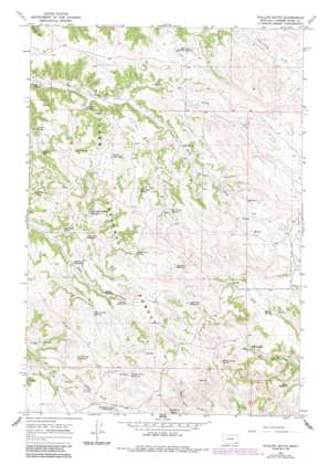
Phillips Butte Topo Map Montana
To zoom in, hover over the map of Phillips Butte
USGS Topo Quad 45105c8 - 1:24,000 scale
| Topo Map Name: | Phillips Butte |
| USGS Topo Quad ID: | 45105c8 |
| Print Size: | ca. 21 1/4" wide x 27" high |
| Southeast Coordinates: | 45.25° N latitude / 105.875° W longitude |
| Map Center Coordinates: | 45.3125° N latitude / 105.9375° W longitude |
| U.S. State: | MT |
| Filename: | o45105c8.jpg |
| Download Map JPG Image: | Phillips Butte topo map 1:24,000 scale |
| Map Type: | Topographic |
| Topo Series: | 7.5´ |
| Map Scale: | 1:24,000 |
| Source of Map Images: | United States Geological Survey (USGS) |
| Alternate Map Versions: |
Phillips Butte MT 1966, updated 1969 Download PDF Buy paper map Phillips Butte MT 1966, updated 1986 Download PDF Buy paper map Phillips Butte MT 1995, updated 1998 Download PDF Buy paper map Phillips Butte MT 2011 Download PDF Buy paper map Phillips Butte MT 2014 Download PDF Buy paper map |
| FStopo: | US Forest Service topo Phillips Butte is available: Download FStopo PDF Download FStopo TIF |
1:24,000 Topo Quads surrounding Phillips Butte
> Back to 45105a1 at 1:100,000 scale
> Back to 45104a1 at 1:250,000 scale
> Back to U.S. Topo Maps home
Phillips Butte topo map: Gazetteer
Phillips Butte: Reservoirs
Anderson Reservoir elevation 1246m 4087′Basin Reservoir elevation 1167m 3828′
Canyon Reservoir elevation 1168m 3832′
Crowfoot Reservoir elevation 1247m 4091′
Elk Creek Reservoir Number One elevation 1181m 3874′
Halfway Reservoir elevation 1151m 3776′
Lyon Creek Divide Reservoir elevation 1161m 3809′
Mason Reservoir elevation 1174m 3851′
Mud Turtle Reservoir elevation 1206m 3956′
Pierce Reservoir elevation 1194m 3917′
Rocky Crossing Reservoir elevation 1209m 3966′
Sand Rock Reservoir elevation 1151m 3776′
Slough Grass Reservoir elevation 1238m 4061′
Phillips Butte: Springs
Canyon Spring elevation 1132m 3713′Coal Hollow Spring elevation 1137m 3730′
Coal Mine Spring elevation 1209m 3966′
Deadman Spring elevation 1203m 3946′
Elk Creek Spring elevation 1082m 3549′
Lyon Creek Spring elevation 1196m 3923′
Mason Prong Spring elevation 1248m 4094′
May Springs elevation 1179m 3868′
Mud Turtle Spring elevation 1200m 3937′
Pierce Spring elevation 1188m 3897′
Red Shale Spring elevation 1136m 3727′
Rock Spring elevation 1191m 3907′
Schwind Spring elevation 1120m 3674′
Skull Springs elevation 1191m 3907′
Snell Spring elevation 1161m 3809′
Two Trough Spring elevation 1200m 3937′
Willow Spring elevation 1192m 3910′
Phillips Butte: Streams
North Fork Elk Creek elevation 1121m 3677′South Fork Elk Creek elevation 1121m 3677′
Phillips Butte: Summits
Phillips Butte elevation 1265m 4150′Phillips Butte: Wells
North Fork Taylor Creek Well elevation 1169m 3835′Phillips Butte digital topo map on disk
Buy this Phillips Butte topo map showing relief, roads, GPS coordinates and other geographical features, as a high-resolution digital map file on DVD:
Eastern Montana & Western North Dakota
Buy digital topo maps: Eastern Montana & Western North Dakota


