Wade Topo Map Montana
To zoom in, hover over the map of Wade
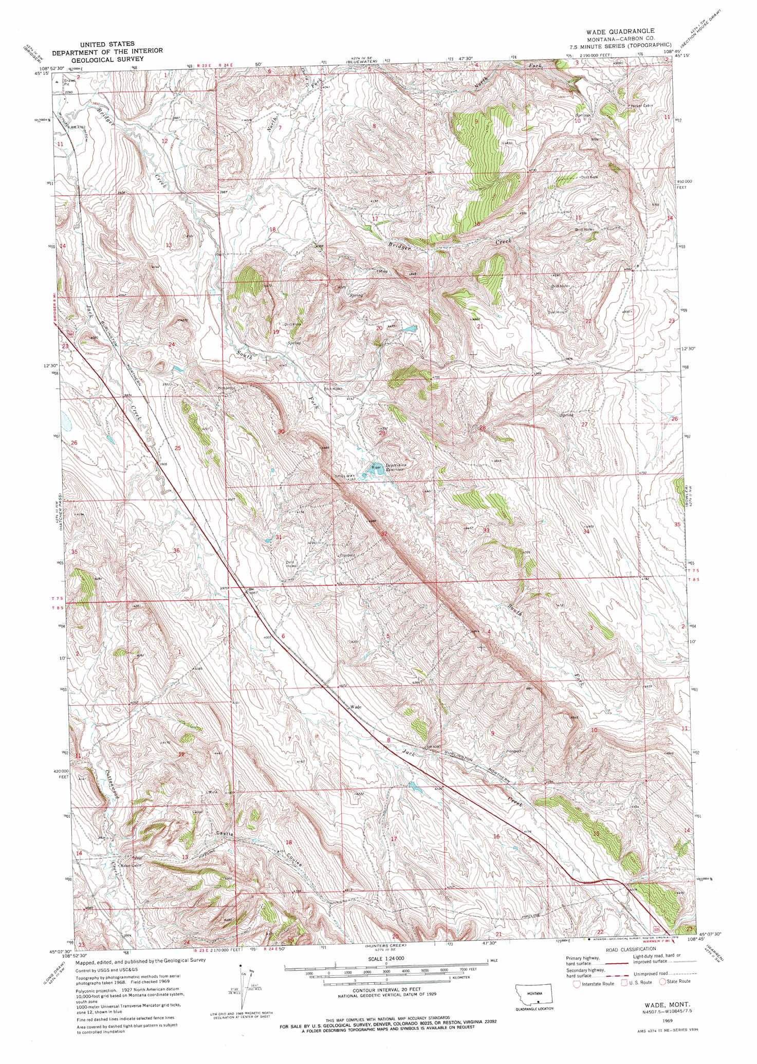
USGS Topo Quad 45108b7 - 1:24,000 scale
| Topo Map Name: | Wade |
| USGS Topo Quad ID: | 45108b7 |
| Print Size: | ca. 21 1/4" wide x 27" high |
| Southeast Coordinates: | 45.125° N latitude / 108.75° W longitude |
| Map Center Coordinates: | 45.1875° N latitude / 108.8125° W longitude |
| U.S. State: | MT |
| Filename: | o45108b7.jpg |
| Download Map JPG Image: | Wade topo map 1:24,000 scale |
| Map Type: | Topographic |
| Topo Series: | 7.5´ |
| Map Scale: | 1:24,000 |
| Source of Map Images: | United States Geological Survey (USGS) |
| Alternate Map Versions: |
Wade MT 1969, updated 1973 Download PDF Buy paper map Wade MT 1969, updated 1978 Download PDF Buy paper map Wade MT 2011 Download PDF Buy paper map Wade MT 2014 Download PDF Buy paper map |
1:24,000 Topo Quads surrounding Wade
Boyd |
Fromberg |
Edgar |
Pryor Nw |
Pryor |
The Big Slide |
Bridger |
Bluewater |
Section House Draw |
Castle Rocks |
Belfry |
Hatcher Pass |
Wade |
Bowler |
Indian Spring |
Hollenbeck Draw |
Long Draw |
Hunters Creek |
Warren |
Bear Canyon |
Badger Basin |
Elk Basin Nw |
Elk Basin |
Deaver Reservoir |
Frannie |
> Back to 45108a1 at 1:100,000 scale
> Back to 45108a1 at 1:250,000 scale
> Back to U.S. Topo Maps home
Wade topo map: Gazetteer
Wade: Dams
Depression Detention Dam elevation 1208m 3963′Wade: Populated Places
Wade elevation 1240m 4068′Wade: Post Offices
Musgrave Post Office (historical) elevation 1230m 4035′Wade: Reservoirs
Depression Reservoir elevation 1203m 3946′Wade: Streams
Cherry Creek elevation 1226m 4022′North Fork Bridger Creek elevation 1196m 3923′
South Fork Beaver Creek elevation 1180m 3871′
South Fork Bridger Creek elevation 1180m 3871′
Wade: Valleys
Castle Coulee elevation 1205m 3953′Wade: Wells
07S24E20ADCD01 Well elevation 1346m 4416′08S23E11DCAD01 Well elevation 1186m 3891′
Wade digital topo map on disk
Buy this Wade topo map showing relief, roads, GPS coordinates and other geographical features, as a high-resolution digital map file on DVD: