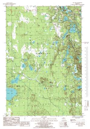
The Lake Topo Map Michigan
To zoom in, hover over the map of The Lake
USGS Topo Quad 46086b6 - 1:24,000 scale
| Topo Map Name: | The Lake |
| USGS Topo Quad ID: | 46086b6 |
| Print Size: | ca. 21 1/4" wide x 27" high |
| Southeast Coordinates: | 46.125° N latitude / 86.625° W longitude |
| Map Center Coordinates: | 46.1875° N latitude / 86.6875° W longitude |
| U.S. State: | MI |
| Filename: | o46086b6.jpg |
| Download Map JPG Image: | The Lake topo map 1:24,000 scale |
| Map Type: | Topographic |
| Topo Series: | 7.5´ |
| Map Scale: | 1:24,000 |
| Source of Map Images: | United States Geological Survey (USGS) |
| Alternate Map Versions: |
Tie Lake MI 1985, updated 1985 Download PDF Buy paper map Tie Lake MI 2011 Download PDF Buy paper map Tie Lake MI 2014 Download PDF Buy paper map Tie Lake MI 2017 Download PDF Buy paper map |
| FStopo: | US Forest Service topo Tie Lake is available: Download FStopo PDF Download FStopo TIF |
1:24,000 Topo Quads surrounding The Lake
> Back to 46086a1 at 1:100,000 scale
> Back to 46086a1 at 1:250,000 scale
> Back to U.S. Topo Maps home
The Lake topo map: Gazetteer
The Lake: Forests
Hiawatha National Forest elevation 245m 803′The Lake: Lakes
Baldy Lake elevation 241m 790′Bar Lake elevation 235m 770′
Blue Lake elevation 232m 761′
Carp Lake elevation 235m 770′
Cluster Lakes elevation 244m 800′
Connor Lake elevation 241m 790′
Council Lake elevation 241m 790′
Cranberry Lake elevation 238m 780′
Crow Lake elevation 239m 784′
Dam Lake elevation 239m 784′
Fish Lake elevation 235m 770′
Hammond Lake elevation 239m 784′
Hidden Lake elevation 241m 790′
Hike Lake elevation 247m 810′
Irwin Lake elevation 242m 793′
Jones Lake elevation 241m 790′
Lion Lake elevation 241m 790′
Man Lake elevation 241m 790′
McComb Lake elevation 241m 790′
Mink Lake elevation 238m 780′
Muskrat Lake elevation 238m 780′
Pan Lake elevation 239m 784′
Red Jack Lake elevation 241m 790′
Rock Lake elevation 241m 790′
Round Lake elevation 238m 780′
Scout Lake elevation 241m 790′
Skeels Pond elevation 231m 757′
Slowfoot Lake elevation 238m 780′
Snipe Lake elevation 241m 790′
Squaw Lake elevation 247m 810′
Squaw Ponds elevation 240m 787′
Temple Lake elevation 242m 793′
Tie Lake elevation 241m 790′
Turtle Lake elevation 249m 816′
West Branch Lake elevation 238m 780′
The Lake: Streams
Camp R Creek elevation 237m 777′Squaw Creek elevation 240m 787′
West Branch Sturgeon River elevation 234m 767′
The Lake digital topo map on disk
Buy this The Lake topo map showing relief, roads, GPS coordinates and other geographical features, as a high-resolution digital map file on DVD:


