Baxter Topo Map Minnesota
To zoom in, hover over the map of Baxter
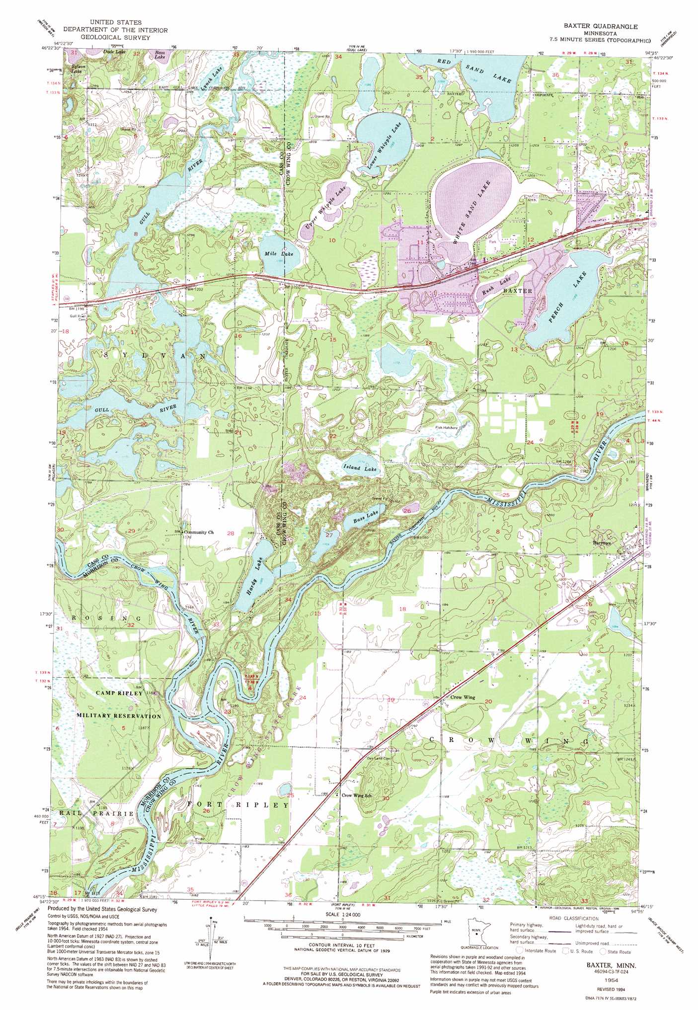
USGS Topo Quad 46094c3 - 1:24,000 scale
| Topo Map Name: | Baxter |
| USGS Topo Quad ID: | 46094c3 |
| Print Size: | ca. 21 1/4" wide x 27" high |
| Southeast Coordinates: | 46.25° N latitude / 94.25° W longitude |
| Map Center Coordinates: | 46.3125° N latitude / 94.3125° W longitude |
| U.S. State: | MN |
| Filename: | o46094c3.jpg |
| Download Map JPG Image: | Baxter topo map 1:24,000 scale |
| Map Type: | Topographic |
| Topo Series: | 7.5´ |
| Map Scale: | 1:24,000 |
| Source of Map Images: | United States Geological Survey (USGS) |
| Alternate Map Versions: |
Baxter MN 1954, updated 1955 Download PDF Buy paper map Baxter MN 1954, updated 1977 Download PDF Buy paper map Baxter MN 1954, updated 1980 Download PDF Buy paper map Baxter MN 1954, updated 1995 Download PDF Buy paper map Baxter MN 2010 Download PDF Buy paper map Baxter MN 2013 Download PDF Buy paper map Baxter MN 2016 Download PDF Buy paper map |
1:24,000 Topo Quads surrounding Baxter
Graff |
Pine River Sw |
Nisswa |
Pelican Lake |
Trommald |
Casino |
Wilson Bay |
Gull Lake |
Merrifield |
Riverton |
Motley Se |
Pillager |
Baxter |
Brainerd |
South Long Lake |
Cushing |
Belle Prairie Nw |
Fort Ripley |
Lastrup Nw |
Shephard |
Randall West |
Randall |
Belle Prairie |
Freedhem |
Lastrup |
> Back to 46094a1 at 1:100,000 scale
> Back to 46094a1 at 1:250,000 scale
> Back to U.S. Topo Maps home
Baxter topo map: Gazetteer
Baxter: Airports
Holmes Airfield elevation 366m 1200′Baxter: Lakes
Bass Lake elevation 355m 1164′Bass Lake elevation 367m 1204′
Hardy Lake elevation 355m 1164′
Island Lake elevation 358m 1174′
Little Whipple Lake elevation 364m 1194′
Lower Whipple Lake elevation 364m 1194′
Lynch Lake elevation 359m 1177′
Mile Lake elevation 361m 1184′
Mine Lake elevation 364m 1194′
Perch Lake elevation 361m 1184′
Rush Lake elevation 364m 1194′
Upper Whipple Lake elevation 364m 1194′
White Sand Lake elevation 364m 1194′
Baxter: Parks
Crow Wing State Park elevation 353m 1158′Fort Ripley Historical Marker elevation 364m 1194′
Loren Thompson Park elevation 366m 1200′
Old Crow Wing Historical Marker elevation 353m 1158′
Oscar Kristofferson Park elevation 368m 1207′
Baxter: Populated Places
Barrows elevation 367m 1204′Baxter elevation 368m 1207′
Crow Wing elevation 364m 1194′
Perch Lake Trailer Court elevation 368m 1207′
Baxter: Post Offices
Barrows Post Office (historical) elevation 367m 1204′Crow Wing Post Office (historical) elevation 364m 1194′
Baxter: Streams
Crow Wing River elevation 349m 1145′Baxter digital topo map on disk
Buy this Baxter topo map showing relief, roads, GPS coordinates and other geographical features, as a high-resolution digital map file on DVD: