Motley Nw Topo Map Minnesota
To zoom in, hover over the map of Motley Nw
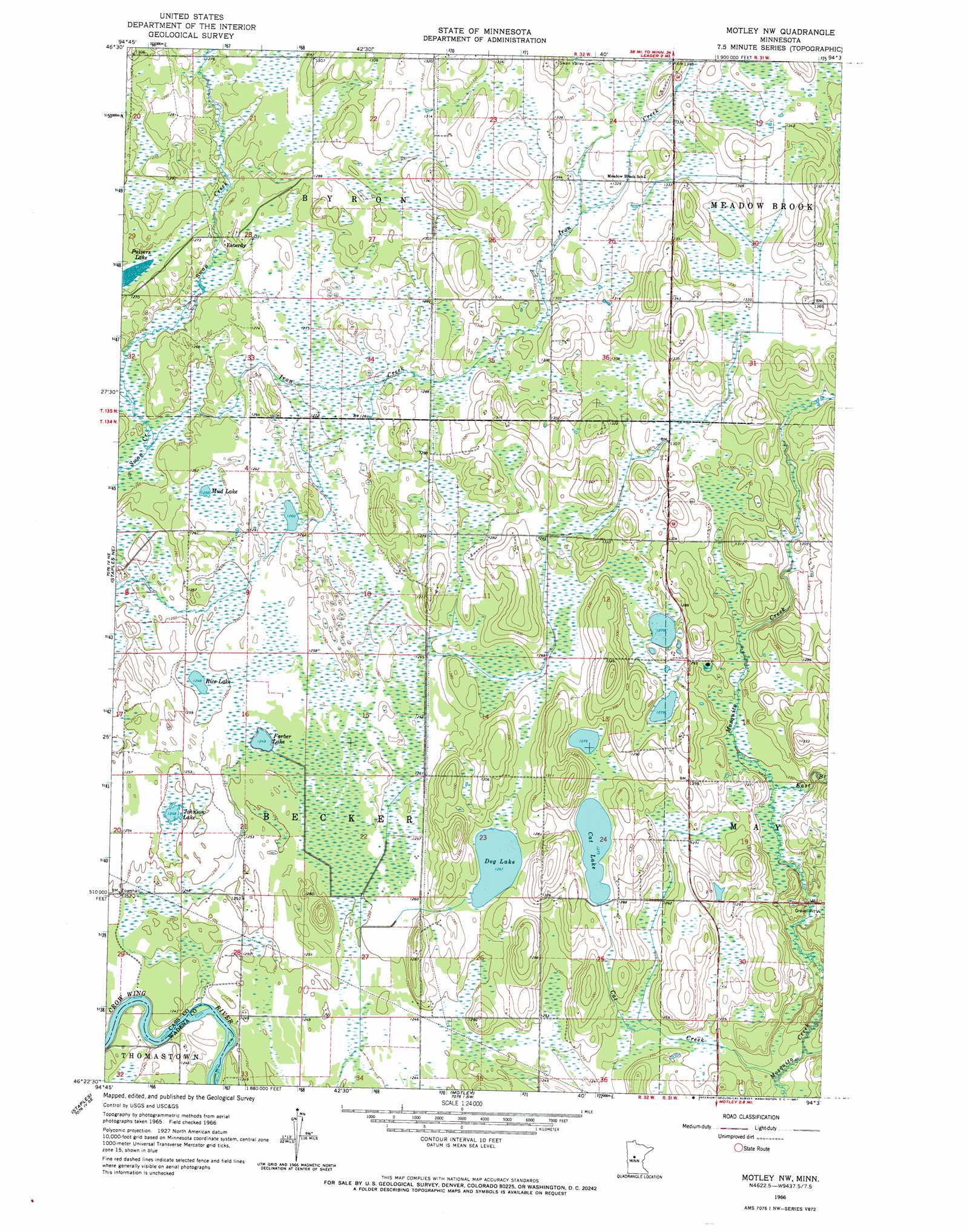
USGS Topo Quad 46094d6 - 1:24,000 scale
| Topo Map Name: | Motley Nw |
| USGS Topo Quad ID: | 46094d6 |
| Print Size: | ca. 21 1/4" wide x 27" high |
| Southeast Coordinates: | 46.375° N latitude / 94.625° W longitude |
| Map Center Coordinates: | 46.4375° N latitude / 94.6875° W longitude |
| U.S. State: | MN |
| Filename: | o46094d6.jpg |
| Download Map JPG Image: | Motley Nw topo map 1:24,000 scale |
| Map Type: | Topographic |
| Topo Series: | 7.5´ |
| Map Scale: | 1:24,000 |
| Source of Map Images: | United States Geological Survey (USGS) |
| Alternate Map Versions: |
Motley NW MN 1966, updated 1967 Download PDF Buy paper map Motley NW MN 2010 Download PDF Buy paper map Motley NW MN 2013 Download PDF Buy paper map Motley NW MN 2016 Download PDF Buy paper map |
1:24,000 Topo Quads surrounding Motley Nw
Nimrod |
Burgen Lake |
Spider Lake |
Bungo Creek |
Pine River |
Nimrod Sw |
Oylen |
Leader |
Graff |
Pine River Sw |
Aldrich North |
Staples Ne |
Motley Nw |
Casino |
Wilson Bay |
Aldrich South |
Staples |
Motley |
Motley Se |
Pillager |
Clarissa |
Browerville Ne |
Lincoln |
Cushing |
Belle Prairie Nw |
> Back to 46094a1 at 1:100,000 scale
> Back to 46094a1 at 1:250,000 scale
> Back to U.S. Topo Maps home
Motley Nw topo map: Gazetteer
Motley Nw: Lakes
Cat Lake elevation 389m 1276′Dog Lake elevation 386m 1266′
Farber Lake elevation 381m 1250′
Johnson Lake elevation 381m 1250′
Mud Lake elevation 384m 1259′
Pulvers Lake elevation 385m 1263′
Rice Lake elevation 381m 1250′
Motley Nw: Populated Places
Esterdy elevation 387m 1269′Motley Nw: Post Offices
Esterdy Post Office (historical) elevation 388m 1272′Gladiola Post Office (historical) elevation 404m 1325′
Motley Nw: Streams
Cat Creek elevation 375m 1230′East Branch Mosquito Creek elevation 381m 1250′
Iron Creek elevation 379m 1243′
Motley Nw digital topo map on disk
Buy this Motley Nw topo map showing relief, roads, GPS coordinates and other geographical features, as a high-resolution digital map file on DVD: