Sulphur Bar Creek Topo Map Montana
To zoom in, hover over the map of Sulphur Bar Creek
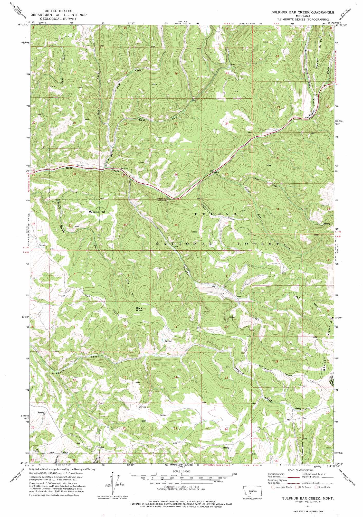
USGS Topo Quad 46111c2 - 1:24,000 scale
| Topo Map Name: | Sulphur Bar Creek |
| USGS Topo Quad ID: | 46111c2 |
| Print Size: | ca. 21 1/4" wide x 27" high |
| Southeast Coordinates: | 46.25° N latitude / 111.125° W longitude |
| Map Center Coordinates: | 46.3125° N latitude / 111.1875° W longitude |
| U.S. State: | MT |
| Filename: | o46111c2.jpg |
| Download Map JPG Image: | Sulphur Bar Creek topo map 1:24,000 scale |
| Map Type: | Topographic |
| Topo Series: | 7.5´ |
| Map Scale: | 1:24,000 |
| Source of Map Images: | United States Geological Survey (USGS) |
| Alternate Map Versions: |
Sulphur Bar Creek MT 1971, updated 1975 Download PDF Buy paper map Sulphur Bar Creek MT 2001, updated 2004 Download PDF Buy paper map Sulphur Bar Creek MT 2011 Download PDF Buy paper map Sulphur Bar Creek MT 2014 Download PDF Buy paper map |
| FStopo: | US Forest Service topo Sulphur Bar Creek is available: Download FStopo PDF Download FStopo TIF |
1:24,000 Topo Quads surrounding Sulphur Bar Creek
Diamond City |
Boulder Baldy |
Gipsy Lake |
Hanson Reservoir |
White Sulphur Springs |
Gurnett Creek West |
Gurnett Creek East |
Mount Edith |
Alkali Lake |
Catlin Spring |
Holker |
Lippert Gulch |
Sulphur Bar Creek |
Battle Mountain |
Black Butte Mountain |
Toston |
Deer Park |
Sixmile Mountain |
Francis |
Sixteen |
Lombard |
Roy Gulch |
Maudlow |
Blacktail Mountain |
Hatfield Mountain |
> Back to 46111a1 at 1:100,000 scale
> Back to 46110a1 at 1:250,000 scale
> Back to U.S. Topo Maps home
Sulphur Bar Creek topo map: Gazetteer
Sulphur Bar Creek: Dams
Higgins Brothers Number 2 Dam elevation 1678m 5505′Sulphur Bar Creek: Flats
Munding Flat elevation 1694m 5557′Sulphur Bar Creek: Mines
Bigler Mine elevation 1831m 6007′Snowbank Mine elevation 1818m 5964′
Sulphur Bar Creek: Streams
Blacktail Creek elevation 1505m 4937′Castle Fork elevation 1613m 5291′
Cedar Bar Creek elevation 1518m 4980′
Russell Fork Deep Creek elevation 1579m 5180′
Sulphur Bar Creek elevation 1458m 4783′
Sulphur Bar Creek: Summits
Black Butte elevation 2013m 6604′Sulphur Bar Creek: Trails
Flathead Indian Trail elevation 1968m 6456′Sulphur Bar Creek: Valleys
Cabin Gulch elevation 1445m 4740′East Fork Cabin Gulch elevation 1473m 4832′
Middle Fork Cabin Gulch elevation 1507m 4944′
West Fork Cabin Gulch elevation 1471m 4826′
Sulphur Bar Creek digital topo map on disk
Buy this Sulphur Bar Creek topo map showing relief, roads, GPS coordinates and other geographical features, as a high-resolution digital map file on DVD: