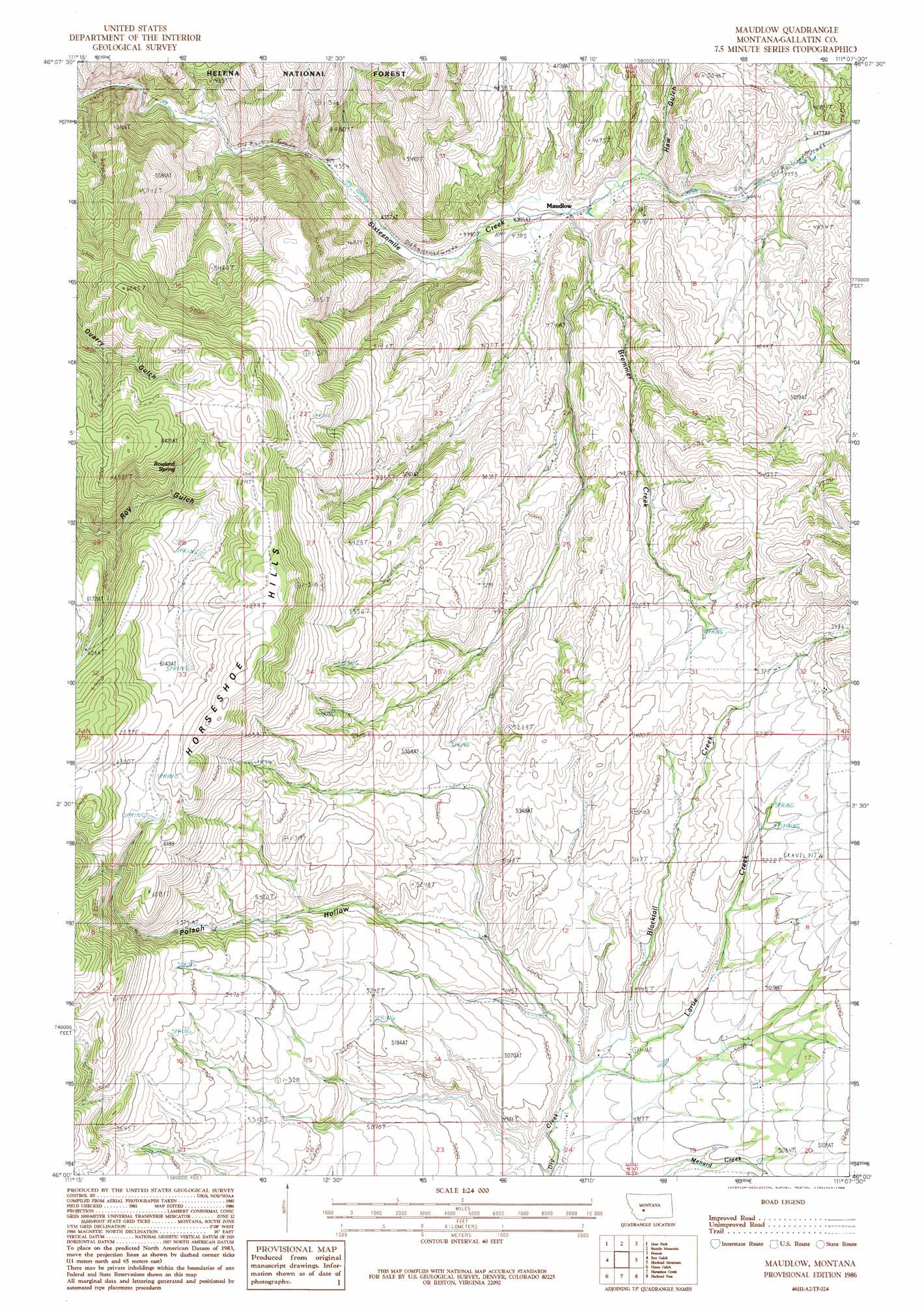
Maudlow Topo Map Montana
To zoom in, hover over the map of Maudlow
USGS Topo Quad 46111a2 - 1:24,000 scale
| Topo Map Name: | Maudlow |
| USGS Topo Quad ID: | 46111a2 |
| Print Size: | ca. 21 1/4" wide x 27" high |
| Southeast Coordinates: | 46° N latitude / 111.125° W longitude |
| Map Center Coordinates: | 46.0625° N latitude / 111.1875° W longitude |
| U.S. State: | MT |
| Filename: | o46111a2.jpg |
| Download Map JPG Image: | Maudlow topo map 1:24,000 scale |
| Map Type: | Topographic |
| Topo Series: | 7.5´ |
| Map Scale: | 1:24,000 |
| Source of Map Images: | United States Geological Survey (USGS) |
| Alternate Map Versions: |
Maudlow MT 1986, updated 1986 Download PDF Buy paper map Maudlow MT 2011 Download PDF Buy paper map Maudlow MT 2014 Download PDF Buy paper map |
| FStopo: | US Forest Service topo Maudlow is available: Download FStopo PDF Download FStopo TIF |
1:24,000 Topo Quads surrounding Maudlow
Holker |
Lippert Gulch |
Sulphur Bar Creek |
Battle Mountain |
Black Butte Mountain |
Toston |
Deer Park |
Sixmile Mountain |
Francis |
Sixteen |
Lombard |
Roy Gulch |
Maudlow |
Blacktail Mountain |
Hatfield Mountain |
Logan |
Nixon Gulch |
Horseshoe Creek |
Flathead Pass |
Sacagawea Peak |
Manhattan Sw |
Manhattan |
Belgrade |
Miser Creek |
Saddle Peak |
> Back to 46111a1 at 1:100,000 scale
> Back to 46110a1 at 1:250,000 scale
> Back to U.S. Topo Maps home
Maudlow topo map: Gazetteer
Maudlow: Populated Places
Maudlow elevation 1344m 4409′Maudlow: Post Offices
Maudlow Post Office (historical) elevation 1344m 4409′Maudlow: Springs
03N05E17CC__01 Spring elevation 1550m 5085′Rowland Spring elevation 1858m 6095′
Maudlow: Streams
Blacktail Creek elevation 1479m 4852′Bremmer Creek elevation 1346m 4416′
Larue Creek elevation 1478m 4849′
Maudlow: Valleys
Haw Gulch elevation 1361m 4465′Little Rocky Canyon elevation 1530m 5019′
Poison Hollow elevation 1497m 4911′
Maudlow: Wells
03N04E11BCC_03 Well elevation 1564m 5131′03N04E24BDAA01 Well elevation 1468m 4816′
Maudlow digital topo map on disk
Buy this Maudlow topo map showing relief, roads, GPS coordinates and other geographical features, as a high-resolution digital map file on DVD: