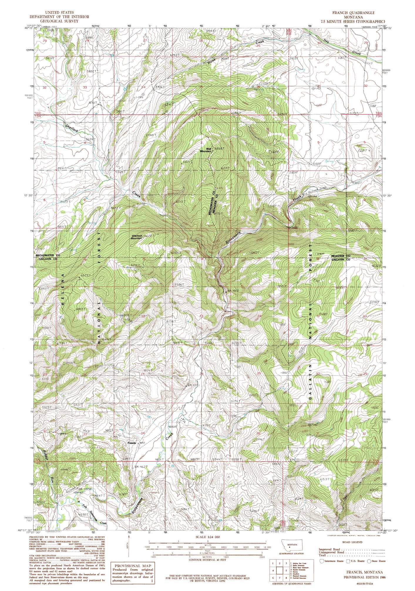
Francis Topo Map Montana
To zoom in, hover over the map of Francis
USGS Topo Quad 46111b1 - 1:24,000 scale
| Topo Map Name: | Francis |
| USGS Topo Quad ID: | 46111b1 |
| Print Size: | ca. 21 1/4" wide x 27" high |
| Southeast Coordinates: | 46.125° N latitude / 111° W longitude |
| Map Center Coordinates: | 46.1875° N latitude / 111.0625° W longitude |
| U.S. State: | MT |
| Filename: | o46111b1.jpg |
| Download Map JPG Image: | Francis topo map 1:24,000 scale |
| Map Type: | Topographic |
| Topo Series: | 7.5´ |
| Map Scale: | 1:24,000 |
| Source of Map Images: | United States Geological Survey (USGS) |
| Alternate Map Versions: |
Francis MT 1986, updated 1986 Download PDF Buy paper map Francis MT 2011 Download PDF Buy paper map Francis MT 2014 Download PDF Buy paper map |
| FStopo: | US Forest Service topo Francis is available: Download FStopo PDF Download FStopo TIF |
1:24,000 Topo Quads surrounding Francis
Gurnett Creek East |
Mount Edith |
Alkali Lake |
Catlin Spring |
Manger Park |
Lippert Gulch |
Sulphur Bar Creek |
Battle Mountain |
Black Butte Mountain |
Ringling |
Deer Park |
Sixmile Mountain |
Francis |
Sixteen |
Sixteen Ne |
Roy Gulch |
Maudlow |
Blacktail Mountain |
Hatfield Mountain |
Wallrock |
Nixon Gulch |
Horseshoe Creek |
Flathead Pass |
Sacagawea Peak |
Sedan |
> Back to 46111a1 at 1:100,000 scale
> Back to 46110a1 at 1:250,000 scale
> Back to U.S. Topo Maps home
Francis topo map: Gazetteer
Francis: Populated Places
Francis elevation 1422m 4665′Francis: Post Offices
Francis Post Office (historical) elevation 1422m 4665′Francis: Streams
Horse Creek elevation 1596m 5236′Middle Fork Sixteenmile Creek elevation 1373m 4504′
Paddys Run elevation 1370m 4494′
Sherlock Creek elevation 1653m 5423′
Francis: Summits
Sherlock Mountain elevation 2013m 6604′Wall Mountain elevation 2084m 6837′
Francis: Valleys
Middle Fork Canyon elevation 1372m 4501′Spring Gulch elevation 1489m 4885′
Francis digital topo map on disk
Buy this Francis topo map showing relief, roads, GPS coordinates and other geographical features, as a high-resolution digital map file on DVD: