Orofino East Topo Map Idaho
To zoom in, hover over the map of Orofino East
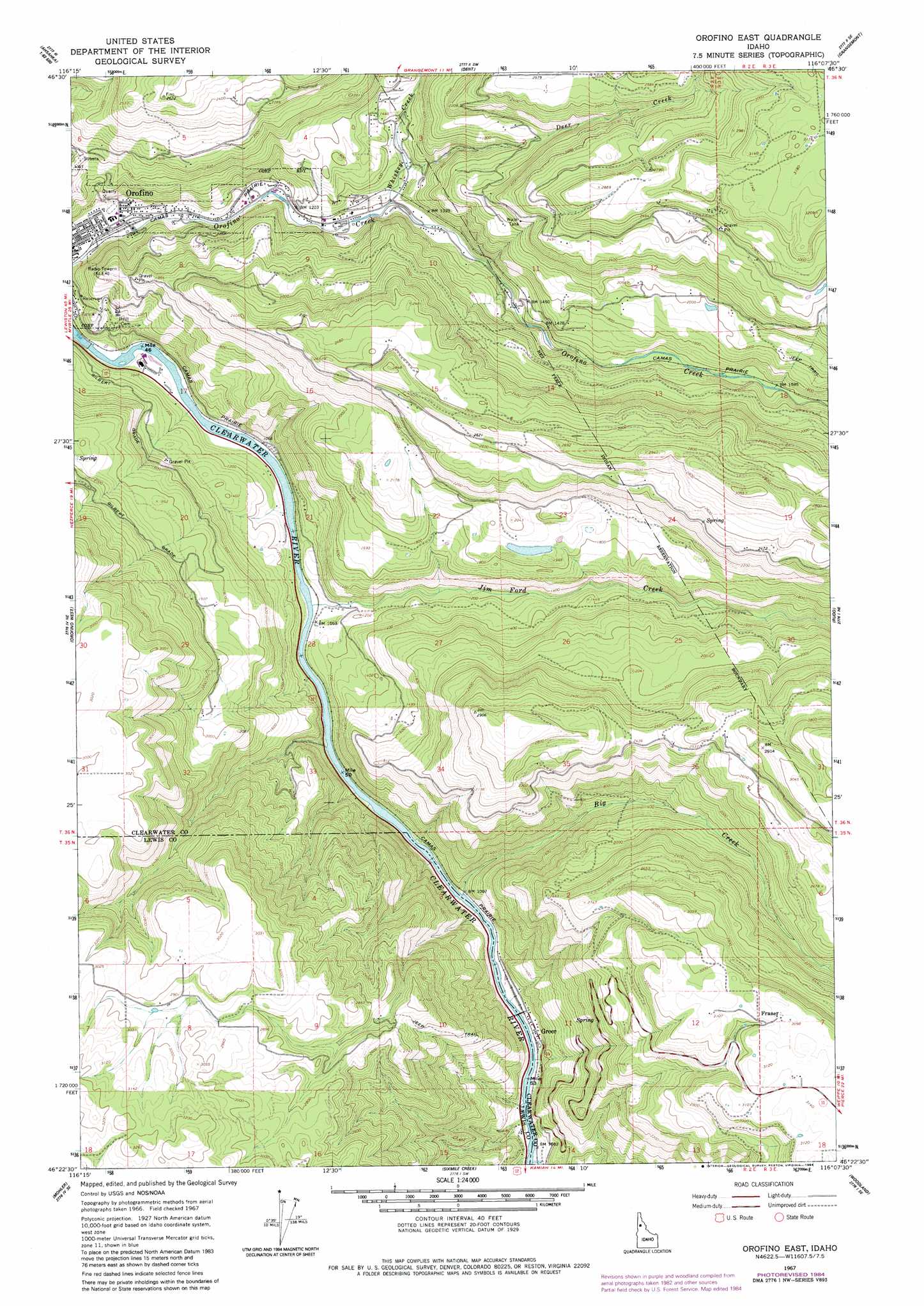
USGS Topo Quad 46116d2 - 1:24,000 scale
| Topo Map Name: | Orofino East |
| USGS Topo Quad ID: | 46116d2 |
| Print Size: | ca. 21 1/4" wide x 27" high |
| Southeast Coordinates: | 46.375° N latitude / 116.125° W longitude |
| Map Center Coordinates: | 46.4375° N latitude / 116.1875° W longitude |
| U.S. State: | ID |
| Filename: | o46116d2.jpg |
| Download Map JPG Image: | Orofino East topo map 1:24,000 scale |
| Map Type: | Topographic |
| Topo Series: | 7.5´ |
| Map Scale: | 1:24,000 |
| Source of Map Images: | United States Geological Survey (USGS) |
| Alternate Map Versions: |
Orofino East ID 1967, updated 1971 Download PDF Buy paper map Orofino East ID 1967, updated 1984 Download PDF Buy paper map Orofino East ID 1994, updated 1997 Download PDF Buy paper map Orofino East ID 2010 Download PDF Buy paper map Orofino East ID 2013 Download PDF Buy paper map |
| FStopo: | US Forest Service topo Orofino East is available: Download FStopo PDF Download FStopo TIF |
1:24,000 Topo Quads surrounding Orofino East
Park |
Alderman Ridge |
Elk Creek Falls |
Little Green Mountain |
John Lewis Mountain |
Southwick |
Ahsahka |
Dent |
Grangemont |
Whiskey Butte |
Peck |
Orofino West |
Orofino East |
Rudo |
Weippe North |
Fletcher |
Mohler |
Sixmile Creek |
Woodland |
Weippe South |
Craigmont |
Cottonwood Ne |
Nezperce |
Kamiah |
Kooskia |
> Back to 46116a1 at 1:100,000 scale
> Back to 46116a1 at 1:250,000 scale
> Back to U.S. Topo Maps home
Orofino East topo map: Gazetteer
Orofino East: Populated Places
Blake elevation 408m 1338′Brunning elevation 886m 2906′
Fraser elevation 919m 3015′
Greer elevation 336m 1102′
Konkolville elevation 439m 1440′
Orofino East: Streams
Big Creek elevation 317m 1040′Deer Creek elevation 384m 1259′
Jim Ford Creek elevation 308m 1010′
Whiskey Creek elevation 366m 1200′
Orofino East digital topo map on disk
Buy this Orofino East topo map showing relief, roads, GPS coordinates and other geographical features, as a high-resolution digital map file on DVD: