Little Bear Ridge Topo Map Idaho
To zoom in, hover over the map of Little Bear Ridge
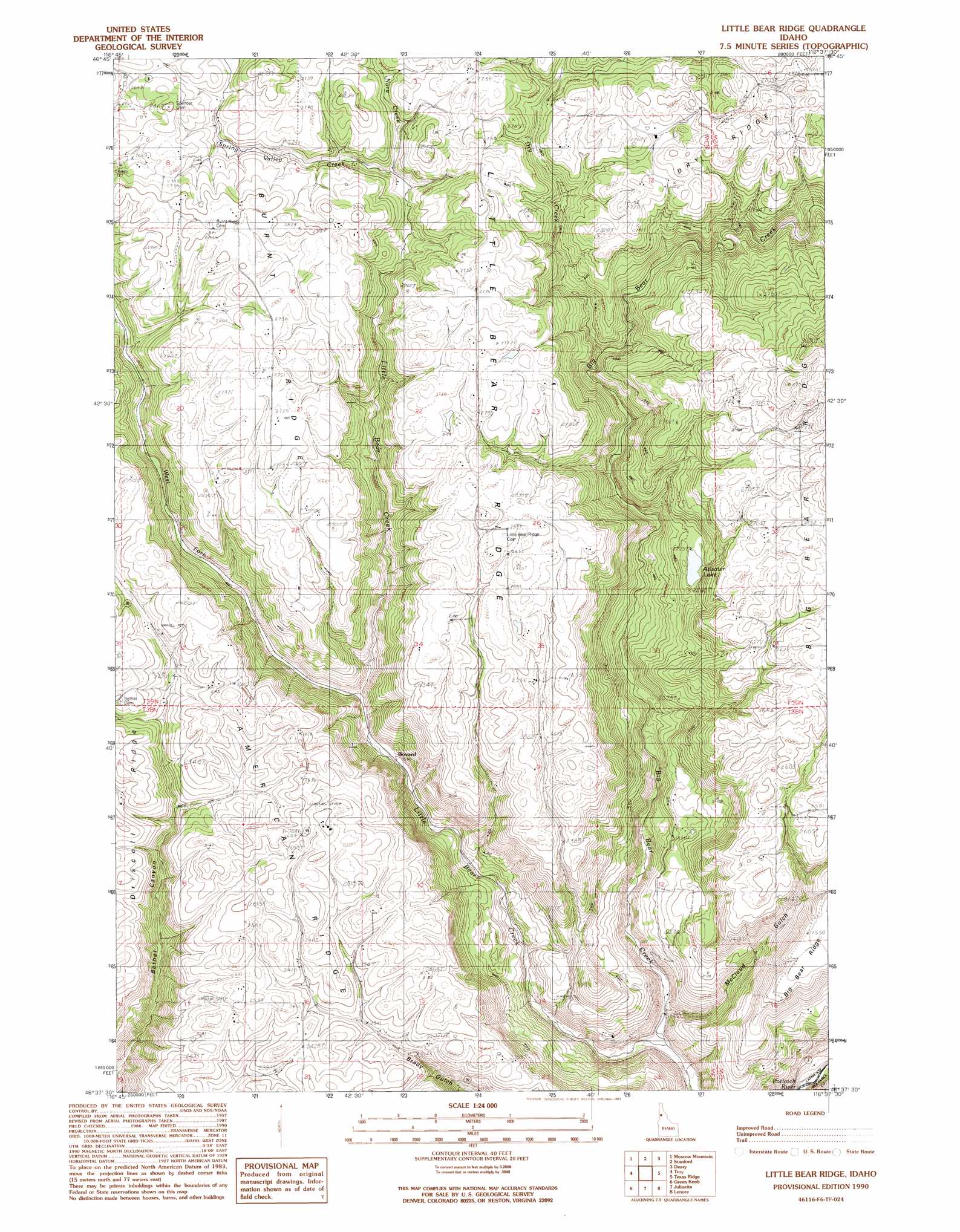
USGS Topo Quad 46116f6 - 1:24,000 scale
| Topo Map Name: | Little Bear Ridge |
| USGS Topo Quad ID: | 46116f6 |
| Print Size: | ca. 21 1/4" wide x 27" high |
| Southeast Coordinates: | 46.625° N latitude / 116.625° W longitude |
| Map Center Coordinates: | 46.6875° N latitude / 116.6875° W longitude |
| U.S. State: | ID |
| Filename: | o46116f6.jpg |
| Download Map JPG Image: | Little Bear Ridge topo map 1:24,000 scale |
| Map Type: | Topographic |
| Topo Series: | 7.5´ |
| Map Scale: | 1:24,000 |
| Source of Map Images: | United States Geological Survey (USGS) |
| Alternate Map Versions: |
Little Bear Ridge ID 1990, updated 1991 Download PDF Buy paper map Little Bear Ridge ID 1990, updated 1991 Download PDF Buy paper map Little Bear Ridge ID 2010 Download PDF Buy paper map Little Bear Ridge ID 2013 Download PDF Buy paper map |
1:24,000 Topo Quads surrounding Little Bear Ridge
Potlatch |
Princeton |
Harvard |
Sand Mountain |
Abes Knob |
Robinson Lake |
Moscow Mountain |
Stanford |
Deary |
Bovill |
Moscow East |
Troy |
Little Bear Ridge |
Texas Ridge |
Park |
Genesee |
Green Knob |
Juliaetta |
Lenore |
Southwick |
Lewiston Orchards North |
Lapwai |
Culdesac North |
Gifford |
Peck |
> Back to 46116e1 at 1:100,000 scale
> Back to 46116a1 at 1:250,000 scale
> Back to U.S. Topo Maps home
Little Bear Ridge topo map: Gazetteer
Little Bear Ridge: Lakes
Atwater Lake elevation 678m 2224′Little Bear Ridge: Populated Places
Bovard (historical) elevation 550m 1804′Little Bear Ridge: Ridges
American Ridge elevation 805m 2641′Burnt Ridge elevation 845m 2772′
Dry Ridge elevation 860m 2821′
Little Bear Ridge elevation 831m 2726′
Little Bear Ridge: Streams
Dry Creek elevation 631m 2070′Little Bear Creek elevation 397m 1302′
Nora Creek elevation 755m 2477′
Spring Valley Creek elevation 757m 2483′
West Fork Little Bear Creek elevation 567m 1860′
Little Bear Ridge: Valleys
McCloud Gulch elevation 425m 1394′Little Bear Ridge digital topo map on disk
Buy this Little Bear Ridge topo map showing relief, roads, GPS coordinates and other geographical features, as a high-resolution digital map file on DVD: