Wolf Point Topo Map Washington
To zoom in, hover over the map of Wolf Point
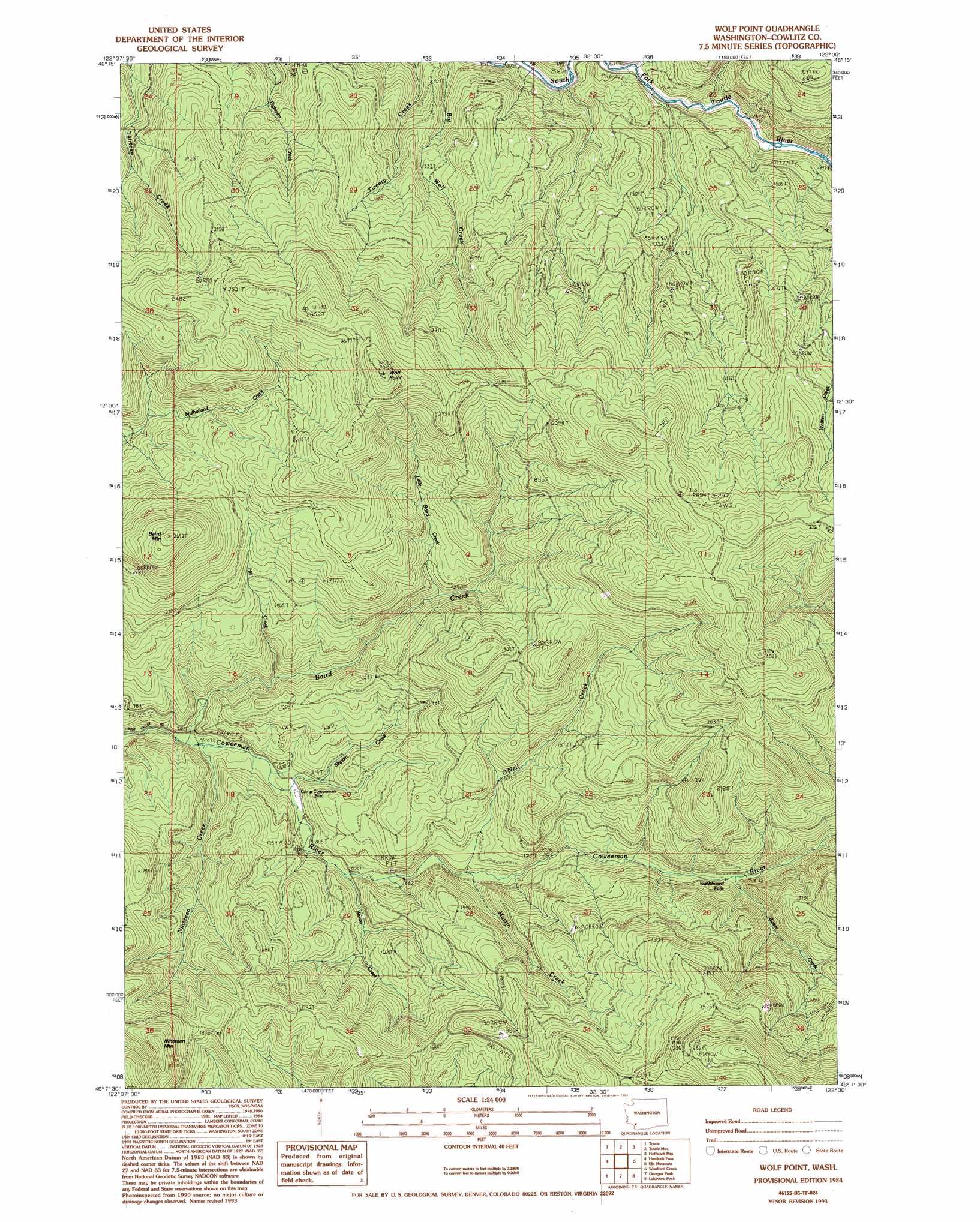
USGS Topo Quad 46122b5 - 1:24,000 scale
| Topo Map Name: | Wolf Point |
| USGS Topo Quad ID: | 46122b5 |
| Print Size: | ca. 21 1/4" wide x 27" high |
| Southeast Coordinates: | 46.125° N latitude / 122.5° W longitude |
| Map Center Coordinates: | 46.1875° N latitude / 122.5625° W longitude |
| U.S. State: | WA |
| Filename: | o46122b5.jpg |
| Download Map JPG Image: | Wolf Point topo map 1:24,000 scale |
| Map Type: | Topographic |
| Topo Series: | 7.5´ |
| Map Scale: | 1:24,000 |
| Source of Map Images: | United States Geological Survey (USGS) |
| Alternate Map Versions: |
Wolf Point WA 1984, updated 1984 Download PDF Buy paper map Wolf Point WA 1984, updated 1994 Download PDF Buy paper map Wolf Point WA 2011 Download PDF Buy paper map Wolf Point WA 2013 Download PDF Buy paper map |
1:24,000 Topo Quads surrounding Wolf Point
Toledo |
Eden Valley |
Hatchet Mountain |
Coyote Mountain |
Winters Mountain |
Silver Lake |
Toutle |
Toutle Mountain |
Huffstadt Mountain |
Elk Rock |
Mount Brynion |
Hemlock Pass |
Wolf Point |
Elk Mountain |
Goat Mountain |
Kalama |
Woolford Creek |
Georges Peak |
Lakeview Peak |
Cougar |
Deer Island |
Woodland |
Ariel |
Amboy |
Yale Dam |
> Back to 46122a1 at 1:100,000 scale
> Back to 46122a1 at 1:250,000 scale
> Back to U.S. Topo Maps home
Wolf Point topo map: Gazetteer
Wolf Point: Capes
Wolf Point elevation 903m 2962′Wolf Point: Falls
Washboard Falls elevation 352m 1154′Wolf Point: Streams
Baird Creek elevation 212m 695′Brown Creek elevation 255m 836′
Butler Creek elevation 357m 1171′
Hill Creek elevation 270m 885′
Little Baird Creek elevation 378m 1240′
Martin Creek elevation 279m 915′
Nineteen Creek elevation 212m 695′
O'Neil Creek elevation 306m 1003′
Skipper Creek elevation 228m 748′
Wolf Point: Summits
Baird Mountain elevation 811m 2660′Nineteen Mountain elevation 766m 2513′
O'Neil Peak elevation 926m 3038′
Wolf Point digital topo map on disk
Buy this Wolf Point topo map showing relief, roads, GPS coordinates and other geographical features, as a high-resolution digital map file on DVD: