Allen Topo Map Minnesota
To zoom in, hover over the map of Allen
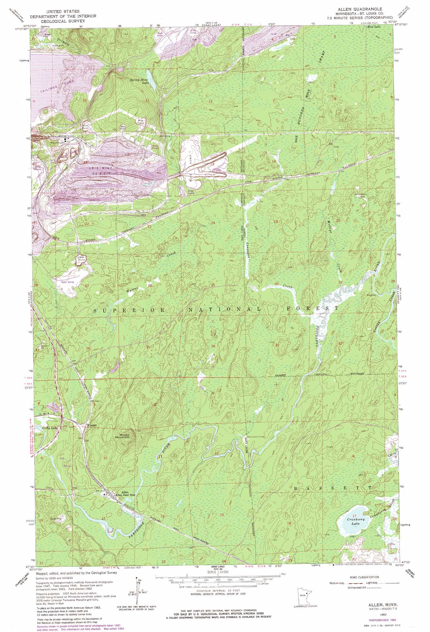
USGS Topo Quad 47092e1 - 1:24,000 scale
| Topo Map Name: | Allen |
| USGS Topo Quad ID: | 47092e1 |
| Print Size: | ca. 21 1/4" wide x 27" high |
| Southeast Coordinates: | 47.5° N latitude / 92° W longitude |
| Map Center Coordinates: | 47.5625° N latitude / 92.0625° W longitude |
| U.S. State: | MN |
| Filename: | o47092e1.jpg |
| Download Map JPG Image: | Allen topo map 1:24,000 scale |
| Map Type: | Topographic |
| Topo Series: | 7.5´ |
| Map Scale: | 1:24,000 |
| Source of Map Images: | United States Geological Survey (USGS) |
| Alternate Map Versions: |
Allen MN 1949, updated 1958 Download PDF Buy paper map Allen MN 1950 Download PDF Buy paper map Allen MN 1962, updated 1964 Download PDF Buy paper map Allen MN 1962, updated 1971 Download PDF Buy paper map Allen MN 1962, updated 1983 Download PDF Buy paper map Allen MN 1962, updated 1985 Download PDF Buy paper map Allen MN 2011 Download PDF Buy paper map Allen MN 2013 Download PDF Buy paper map Allen MN 2016 Download PDF Buy paper map |
| FStopo: | US Forest Service topo Allen is available: Download FStopo PDF Download FStopo TIF |
1:24,000 Topo Quads surrounding Allen
Tower |
Soudan |
Eagles Nest |
Bear Island |
Kangas Bay |
Biwabik Ne |
Embarrass |
Isaac Lake |
Babbitt |
Babbitt Ne |
Biwabik |
Aurora |
Allen |
Babbitt Sw |
Babbitt Se |
Palo |
Turpela Lake |
Bird Lake |
Skibo |
Toimi |
Makinen |
Whiteface Reservoir |
Harris Lake |
Fairbanks |
Brimson |
> Back to 47092e1 at 1:100,000 scale
> Back to 47092a1 at 1:250,000 scale
> Back to U.S. Topo Maps home
Allen topo map: Gazetteer
Allen: Lakes
Cranberry Lake elevation 471m 1545′Spring Mine Lake elevation 511m 1676′
Allen: Mines
Erie Mine Number Two Pit elevation 496m 1627′Allen: Populated Places
Allen elevation 460m 1509′Ridge elevation 497m 1630′
Wyman elevation 452m 1482′
Allen: Post Offices
Allen Post Office (historical) elevation 460m 1509′Holter Post Office (historical) elevation 524m 1719′
Allen: Streams
Colvin Creek elevation 463m 1519′Longnose Creek elevation 463m 1519′
Wetlegs Creek elevation 464m 1522′
Wyman Creek elevation 439m 1440′
Allen: Summits
Moose Mountain elevation 508m 1666′Allen: Swamps
One Hundred Mile Swamp elevation 490m 1607′Allen digital topo map on disk
Buy this Allen topo map showing relief, roads, GPS coordinates and other geographical features, as a high-resolution digital map file on DVD: