Stray Gulch Topo Map Washington
To zoom in, hover over the map of Stray Gulch
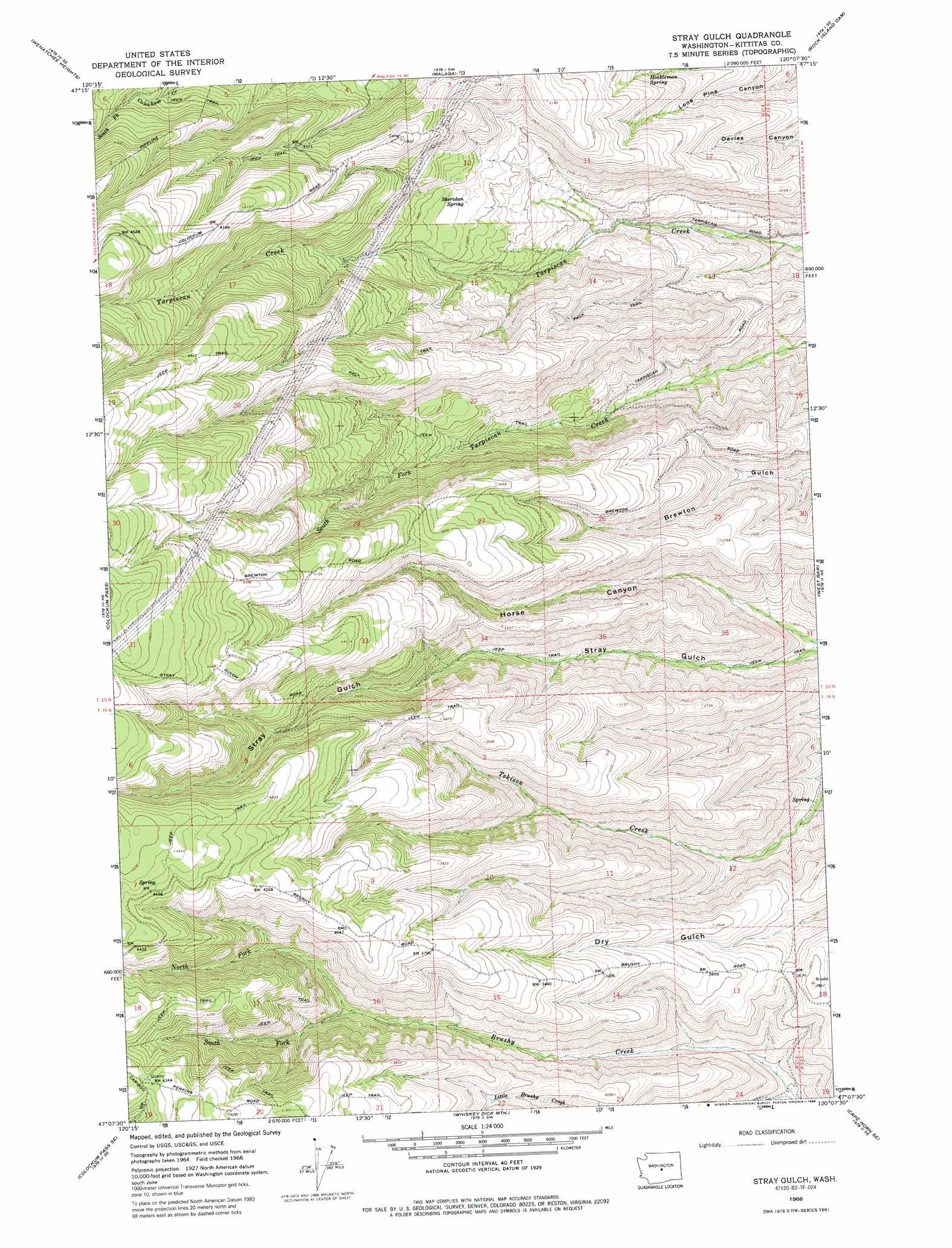
USGS Topo Quad 47120b2 - 1:24,000 scale
| Topo Map Name: | Stray Gulch |
| USGS Topo Quad ID: | 47120b2 |
| Print Size: | ca. 21 1/4" wide x 27" high |
| Southeast Coordinates: | 47.125° N latitude / 120.125° W longitude |
| Map Center Coordinates: | 47.1875° N latitude / 120.1875° W longitude |
| U.S. State: | WA |
| Filename: | o47120b2.jpg |
| Download Map JPG Image: | Stray Gulch topo map 1:24,000 scale |
| Map Type: | Topographic |
| Topo Series: | 7.5´ |
| Map Scale: | 1:24,000 |
| Source of Map Images: | United States Geological Survey (USGS) |
| Alternate Map Versions: |
Stray Gulch WA 1966, updated 1968 Download PDF Buy paper map Stray Gulch WA 1966, updated 1986 Download PDF Buy paper map Stray Gulch WA 2011 Download PDF Buy paper map Stray Gulch WA 2014 Download PDF Buy paper map |
1:24,000 Topo Quads surrounding Stray Gulch
Monitor |
Wenatchee |
Rock Island |
Malaga Ne |
Palisades |
Mission Peak |
Wenatchee Heights |
Malaga |
Rock Island Dam |
Appledale |
Naneum Canyon |
Colockum Pass |
Stray Gulch |
West Bar |
Babcock Ridge |
Colockum Pass Sw |
Colockum Pass Se |
Whiskey Dick Mountain |
Cape Horn Se |
Evergreen Ridge |
Kittitas |
East Kittitas |
Boylston |
Ginkgo |
Vantage |
> Back to 47120a1 at 1:100,000 scale
> Back to 47120a1 at 1:250,000 scale
> Back to U.S. Topo Maps home
Stray Gulch topo map: Gazetteer
Stray Gulch: Springs
Hinkleman Spring elevation 746m 2447′Sheridan Spring elevation 811m 2660′
Stray Gulch: Streams
Little Brushy Creek elevation 570m 1870′North Fork Brushy Creek elevation 936m 3070′
South Fork Brushy Creek elevation 936m 3070′
Stray Gulch: Valleys
Horse Canyon elevation 508m 1666′Stray Gulch digital topo map on disk
Buy this Stray Gulch topo map showing relief, roads, GPS coordinates and other geographical features, as a high-resolution digital map file on DVD: