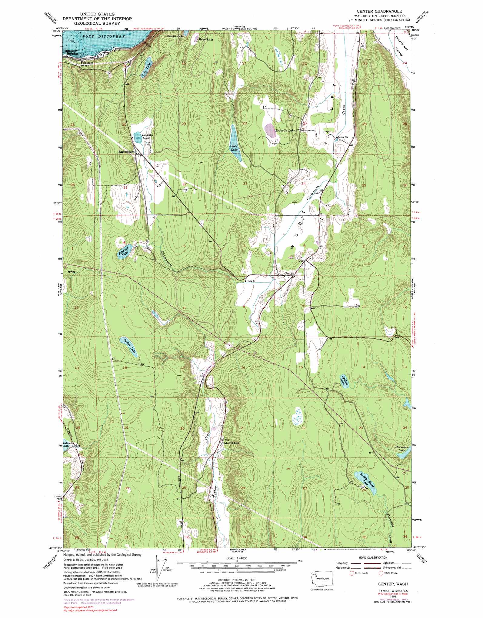
Center Topo Map Washington
To zoom in, hover over the map of Center
USGS Topo Quad 47122h7 - 1:24,000 scale
| Topo Map Name: | Center |
| USGS Topo Quad ID: | 47122h7 |
| Print Size: | ca. 21 1/4" wide x 27" high |
| Southeast Coordinates: | 47.875° N latitude / 122.75° W longitude |
| Map Center Coordinates: | 47.9375° N latitude / 122.8125° W longitude |
| U.S. State: | WA |
| Filename: | o47122h7.jpg |
| Download Map JPG Image: | Center topo map 1:24,000 scale |
| Map Type: | Topographic |
| Topo Series: | 7.5´ |
| Map Scale: | 1:24,000 |
| Source of Map Images: | United States Geological Survey (USGS) |
| Alternate Map Versions: |
Center WA 1953, updated 1955 Download PDF Buy paper map Center WA 1953, updated 1973 Download PDF Buy paper map Center WA 1953, updated 1976 Download PDF Buy paper map Center WA 1997, updated 2003 Download PDF Buy paper map Center WA 2011 Download PDF Buy paper map Center WA 2014 Download PDF Buy paper map |
1:24,000 Topo Quads surrounding Center
Dungeness |
Port Townsend North |
Coupeville |
Camano |
|
Sequim |
Gardiner |
Port Townsend South |
Nordland |
Freeland |
Mount Zion |
Uncas |
Center |
Port Ludlow |
Hansville |
Mount Townsend |
Mount Walker |
Quilcene |
Lofall |
Port Gamble |
Mount Jupiter |
Brinnon |
Seabeck |
Poulsbo |
Suquamish |
> Back to 47122e1 at 1:100,000 scale
> Back to 47122a1 at 1:250,000 scale
> Back to U.S. Topo Maps home
Center topo map: Gazetteer
Center: Airports
Timberline Quarter Horse Farm Airport elevation 111m 364′Center: Dams
City Lakes Dam elevation 199m 652′Center: Lakes
Beausite Lake elevation 129m 423′Browns Lake elevation 146m 479′
Delanty Lake elevation 155m 508′
Gibbs Lake elevation 104m 341′
Horseshoe Lake elevation 107m 351′
Larson Lake elevation 117m 383′
Ludlow Lake elevation 138m 452′
Moon Lake elevation 195m 639′
Peterson Lake elevation 151m 495′
Sandy Shore Lake elevation 145m 475′
Sunset Lake elevation 155m 508′
Tarboo Lake elevation 191m 626′
Center: Populated Places
Discovery Junction elevation 3m 9′Eaglemount elevation 163m 534′
Fairmont elevation 8m 26′
Center digital topo map on disk
Buy this Center topo map showing relief, roads, GPS coordinates and other geographical features, as a high-resolution digital map file on DVD: