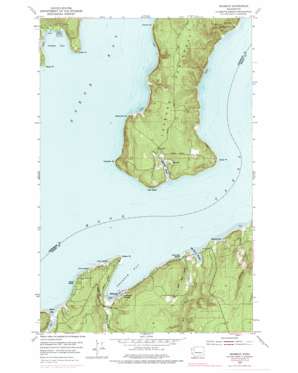
Seabeck Topo Map Washington
To zoom in, hover over the map of Seabeck
USGS Topo Quad 47122f7 - 1:24,000 scale
| Topo Map Name: | Seabeck |
| USGS Topo Quad ID: | 47122f7 |
| Print Size: | ca. 21 1/4" wide x 27" high |
| Southeast Coordinates: | 47.625° N latitude / 122.75° W longitude |
| Map Center Coordinates: | 47.6875° N latitude / 122.8125° W longitude |
| U.S. State: | WA |
| Filename: | o47122f7.jpg |
| Download Map JPG Image: | Seabeck topo map 1:24,000 scale |
| Map Type: | Topographic |
| Topo Series: | 7.5´ |
| Map Scale: | 1:24,000 |
| Source of Map Images: | United States Geological Survey (USGS) |
| Alternate Map Versions: |
Seabeck WA 1953, updated 1954 Download PDF Buy paper map Seabeck WA 1953, updated 1965 Download PDF Buy paper map Seabeck WA 1953, updated 1969 Download PDF Buy paper map Seabeck WA 1953, updated 1978 Download PDF Buy paper map Seabeck WA 1997, updated 2003 Download PDF Buy paper map Seabeck WA 2011 Download PDF Buy paper map Seabeck WA 2014 Download PDF Buy paper map |
1:24,000 Topo Quads surrounding Seabeck
> Back to 47122e1 at 1:100,000 scale
> Back to 47122a1 at 1:250,000 scale
> Back to U.S. Topo Maps home
Seabeck topo map: Gazetteer
Seabeck: Bays
Big Beef Harbor elevation 1m 3′Fisherman Harbor elevation 2m 6′
Jackson Cove elevation 1m 3′
Little Beef Harbor elevation 0m 0′
Seabeck Bay elevation 0m 0′
Stavis Bay elevation 2m 6′
Seabeck: Beaches
Maple Beach elevation 2m 6′Miami Beach elevation 4m 13′
Scenic Beach elevation 1m 3′
Seabeck: Capes
Hazel Point elevation 1m 3′Misery Point elevation 9m 29′
Pulali Point elevation 14m 45′
Tabook Point elevation 19m 62′
Tskutsko Point elevation 2m 6′
Wawa Point elevation 3m 9′
Zelatched Point elevation 3m 9′
Seabeck: Cliffs
Oak Head elevation 63m 206′Seabeck: Parks
Scenic Beach State Park elevation 11m 36′Seabeck: Pillars
Lone Rock elevation 61m 200′Seabeck: Populated Places
Coyle elevation 43m 141′Lawters Beach elevation 5m 16′
Seabeck elevation 7m 22′
Warrenville elevation 19m 62′
Seabeck: Streams
Anderson Creek elevation 3m 9′Big Beef Creek elevation 3m 9′
Little Beef Creek elevation 2m 6′
Seabeck Creek elevation 2m 6′
Seabeck digital topo map on disk
Buy this Seabeck topo map showing relief, roads, GPS coordinates and other geographical features, as a high-resolution digital map file on DVD:


