Nordland Topo Map Washington
To zoom in, hover over the map of Nordland
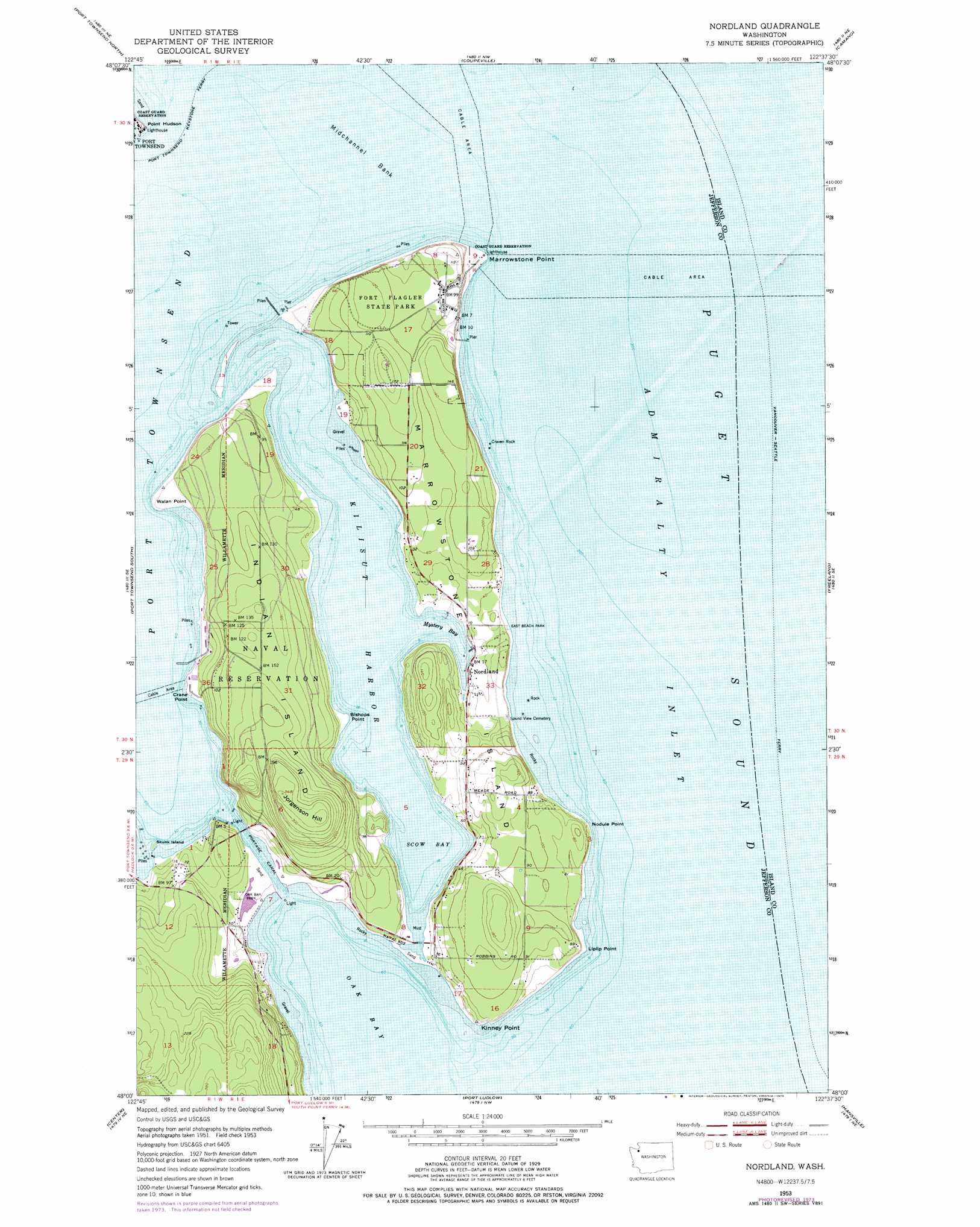
USGS Topo Quad 48122a6 - 1:24,000 scale
| Topo Map Name: | Nordland |
| USGS Topo Quad ID: | 48122a6 |
| Print Size: | ca. 21 1/4" wide x 27" high |
| Southeast Coordinates: | 48° N latitude / 122.625° W longitude |
| Map Center Coordinates: | 48.0625° N latitude / 122.6875° W longitude |
| U.S. State: | WA |
| Filename: | o48122a6.jpg |
| Download Map JPG Image: | Nordland topo map 1:24,000 scale |
| Map Type: | Topographic |
| Topo Series: | 7.5´ |
| Map Scale: | 1:24,000 |
| Source of Map Images: | United States Geological Survey (USGS) |
| Alternate Map Versions: |
Nordland WA 1953, updated 1955 Download PDF Buy paper map Nordland WA 1953, updated 1971 Download PDF Buy paper map Nordland WA 1953, updated 1975 Download PDF Buy paper map Nordland WA 1953, updated 1975 Download PDF Buy paper map Nordland WA 1998, updated 2003 Download PDF Buy paper map Nordland WA 2011 Download PDF Buy paper map Nordland WA 2014 Download PDF Buy paper map |
1:24,000 Topo Quads surrounding Nordland
Smith Island |
Oak Harbor |
Crescent Harbor |
Utsalady |
|
Port Townsend North |
Coupeville |
Camano |
Juniper Beach |
|
Gardiner |
Port Townsend South |
Nordland |
Freeland |
Langley |
Uncas |
Center |
Port Ludlow |
Hansville |
Maxwelton |
Mount Walker |
Quilcene |
Lofall |
Port Gamble |
Edmonds West |
> Back to 48122a1 at 1:100,000 scale
> Back to 48122a1 at 1:250,000 scale
> Back to U.S. Topo Maps home
Nordland topo map: Gazetteer
Nordland: Bars
Midchannel Bank elevation 0m 0′Nordland: Bays
Kilisut Harbor elevation 0m 0′Mystery Bay elevation 1m 3′
Scow Bay elevation 2m 6′
Nordland: Canals
Portage Canal elevation 1m 3′Nordland: Capes
Bishops Point elevation 2m 6′Crane Point elevation 3m 9′
Kinney Point elevation 12m 39′
Liplip Point elevation 4m 13′
Marrowstone Point elevation 2m 6′
Nodule Point elevation 2m 6′
Point Hudson elevation 2m 6′
Walan Point elevation 2m 6′
Nordland: Islands
Craven Penninsula (historical) elevation 2m 6′Indian Island elevation 46m 150′
Marrowstone Island elevation 10m 32′
Skunk Island elevation 0m 0′
Nordland: Parks
East Beach Park elevation 1m 3′Fort Flagler State Park elevation 31m 101′
Mystery Bay State Park elevation 5m 16′
Oak Bay Park elevation 9m 29′
Nordland: Populated Places
Fort Flagler elevation 31m 101′Marrowstone elevation 7m 22′
Nordland elevation 5m 16′
Nordland: Summits
Craven Rock elevation -10m -33′Jorgenson Hill elevation 106m 347′
Nordland digital topo map on disk
Buy this Nordland topo map showing relief, roads, GPS coordinates and other geographical features, as a high-resolution digital map file on DVD: