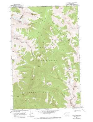
Castle Peak Topo Map Washington
To zoom in, hover over the map of Castle Peak
USGS Topo Quad 48120h7 - 1:24,000 scale
| Topo Map Name: | Castle Peak |
| USGS Topo Quad ID: | 48120h7 |
| Print Size: | ca. 21 1/4" wide x 27" high |
| Southeast Coordinates: | 48.875° N latitude / 120.75° W longitude |
| Map Center Coordinates: | 48.9375° N latitude / 120.8125° W longitude |
| U.S. State: | WA |
| Filename: | o48120h7.jpg |
| Download Map JPG Image: | Castle Peak topo map 1:24,000 scale |
| Map Type: | Topographic |
| Topo Series: | 7.5´ |
| Map Scale: | 1:24,000 |
| Source of Map Images: | United States Geological Survey (USGS) |
| Alternate Map Versions: |
Castle Peak WA 2002, updated 2006 Download PDF Buy paper map Castle Peak WA 2011 Download PDF Buy paper map Castle Peak WA 2014 Download PDF Buy paper map |
| FStopo: | US Forest Service topo Castle Peak is available: Download FStopo PDF Download FStopo TIF |
1:24,000 Topo Quads surrounding Castle Peak
> Back to 48120e1 at 1:100,000 scale
> Back to 48120a1 at 1:250,000 scale
> Back to U.S. Topo Maps home
Castle Peak topo map: Gazetteer
Castle Peak: Basins
Coney Basin elevation 1877m 6158′Castle Peak: Cliffs
Devils Stairway elevation 2128m 6981′Castle Peak: Gaps
Castle Pass elevation 1667m 5469′Frosty Pass elevation 1977m 6486′
Hopkins Pass elevation 1866m 6122′
Woody Pass elevation 2025m 6643′
Castle Peak: Lakes
Hopkins Lake elevation 1886m 6187′Castle Peak: Parks
North Cascade Primitive Area (historical) elevation 979m 3211′Castle Peak: Ridges
Lakeview Ridge elevation 2128m 6981′Castle Peak: Streams
Big Face Creek elevation 1095m 3592′Castle Fork elevation 947m 3106′
Crow Creek elevation 1325m 4347′
King Creek elevation 1334m 4376′
Princess Creek elevation 1294m 4245′
Queen Creek elevation 1362m 4468′
Rock Creek elevation 1795m 5889′
Route Creek elevation 1295m 4248′
Rustle Creek elevation 1289m 4229′
Shull Creek elevation 898m 2946′
Trouble Creek elevation 1238m 4061′
Two Buttes Creek elevation 1378m 4520′
Castle Peak: Summits
Blizzard Peak elevation 2317m 7601′Castle Peak elevation 2511m 8238′
Mount Winthrop elevation 2395m 7857′
Powder Mountain elevation 2330m 7644′
Three Fools Peak elevation 2420m 7939′
Castle Peak digital topo map on disk
Buy this Castle Peak topo map showing relief, roads, GPS coordinates and other geographical features, as a high-resolution digital map file on DVD:


