Glacier Peak East Topo Map Washington
To zoom in, hover over the map of Glacier Peak East
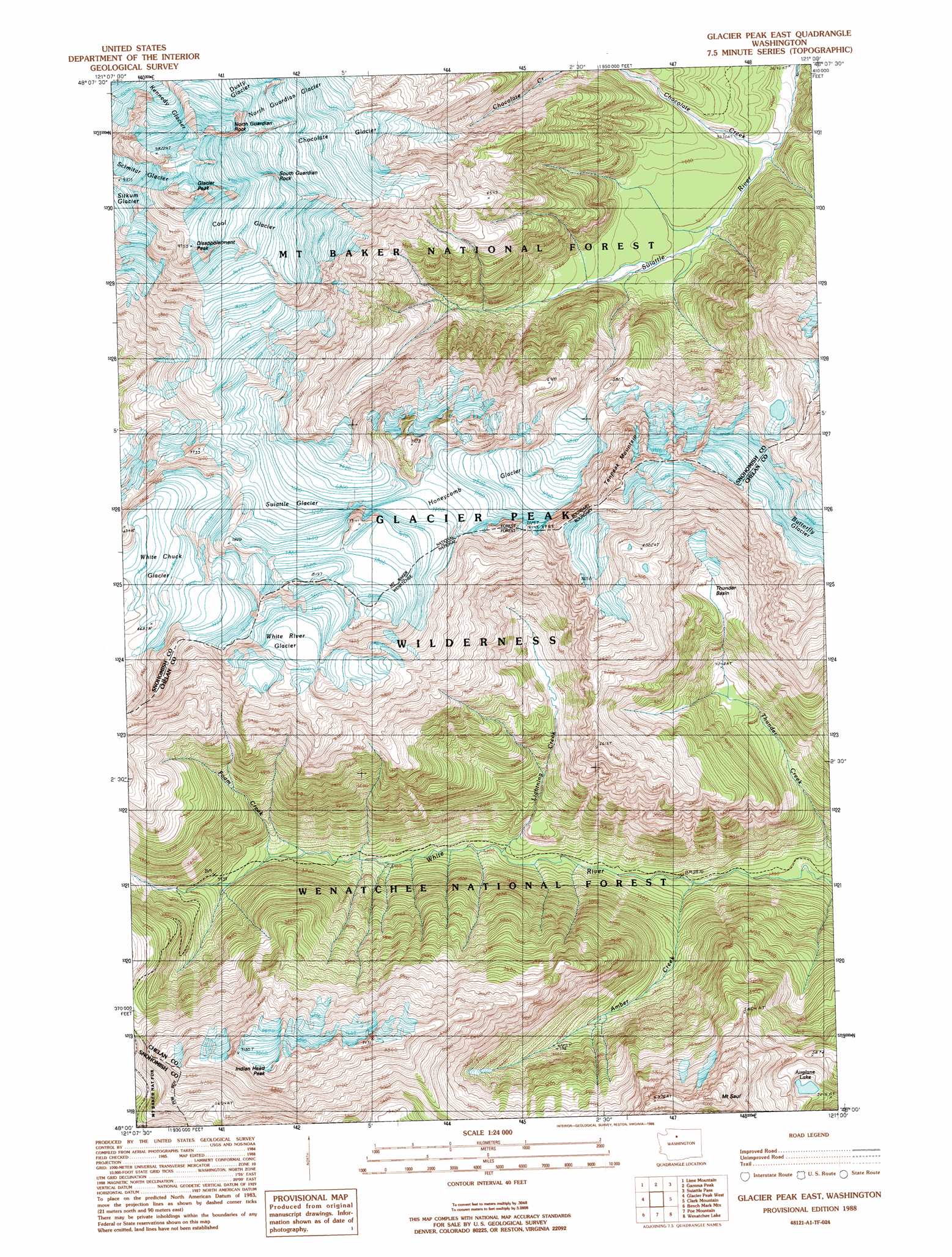
USGS Topo Quad 48121a1 - 1:24,000 scale
| Topo Map Name: | Glacier Peak East |
| USGS Topo Quad ID: | 48121a1 |
| Print Size: | ca. 21 1/4" wide x 27" high |
| Southeast Coordinates: | 48° N latitude / 121° W longitude |
| Map Center Coordinates: | 48.0625° N latitude / 121.0625° W longitude |
| U.S. State: | WA |
| Filename: | o48121a1.jpg |
| Download Map JPG Image: | Glacier Peak East topo map 1:24,000 scale |
| Map Type: | Topographic |
| Topo Series: | 7.5´ |
| Map Scale: | 1:24,000 |
| Source of Map Images: | United States Geological Survey (USGS) |
| Alternate Map Versions: |
Glacier Peak East WA 1988, updated 1988 Download PDF Buy paper map Glacier Peak East WA 1999, updated 2002 Download PDF Buy paper map Glacier Peak East WA 2011 Download PDF Buy paper map Glacier Peak East WA 2014 Download PDF Buy paper map |
| FStopo: | US Forest Service topo Glacier Peak East is available: Download FStopo PDF Download FStopo TIF |
1:24,000 Topo Quads surrounding Glacier Peak East
Huckleberry Mountain |
Downey Mountain |
Dome Peak |
Agnes Mountain |
Mount Lyall |
Pugh Mountain |
Lime Mountain |
Gamma Peak |
Suiattle Pass |
Holden |
Sloan Peak |
Glacier Peak West |
Glacier Peak East |
Clark Mountain |
Trinity |
Blanca Lake |
Benchmark Mountain |
Poe Mountain |
Mount David |
Schaefer Lake |
Evergreen Mountain |
Captain Point |
Labyrinth Mountain |
Mount Howard |
Lake Wenatchee |
> Back to 48121a1 at 1:100,000 scale
> Back to 48120a1 at 1:250,000 scale
> Back to U.S. Topo Maps home
Glacier Peak East topo map: Gazetteer
Glacier Peak East: Basins
Thunder Basin elevation 1582m 5190′Glacier Peak East: Glaciers
Chocolate Glacier elevation 2197m 7208′Cool Glacier elevation 2740m 8989′
Honeycomb Glacier elevation 2111m 6925′
North Guardian Glacier elevation 2292m 7519′
Suiattle Glacier elevation 2230m 7316′
White Chuck Glacier elevation 2123m 6965′
White River Glacier elevation 2226m 7303′
Glacier Peak East: Lakes
Airplane Lake elevation 1617m 5305′Glacier Peak East: Pillars
North Guardian Rock elevation 2842m 9324′South Guardian Rock elevation 2565m 8415′
Glacier Peak East: Streams
Amber Creek elevation 876m 2874′Foam Creek elevation 1117m 3664′
Lightning Creek elevation 968m 3175′
Thunder Creek elevation 824m 2703′
Glacier Peak East: Summits
Disappointment Peak elevation 2970m 9744′Glacier Peak elevation 3180m 10433′
Indian Head Peak elevation 2215m 7267′
Mount Saul elevation 2211m 7253′
Tenpeak Mountain elevation 2505m 8218′
Glacier Peak East digital topo map on disk
Buy this Glacier Peak East topo map showing relief, roads, GPS coordinates and other geographical features, as a high-resolution digital map file on DVD: