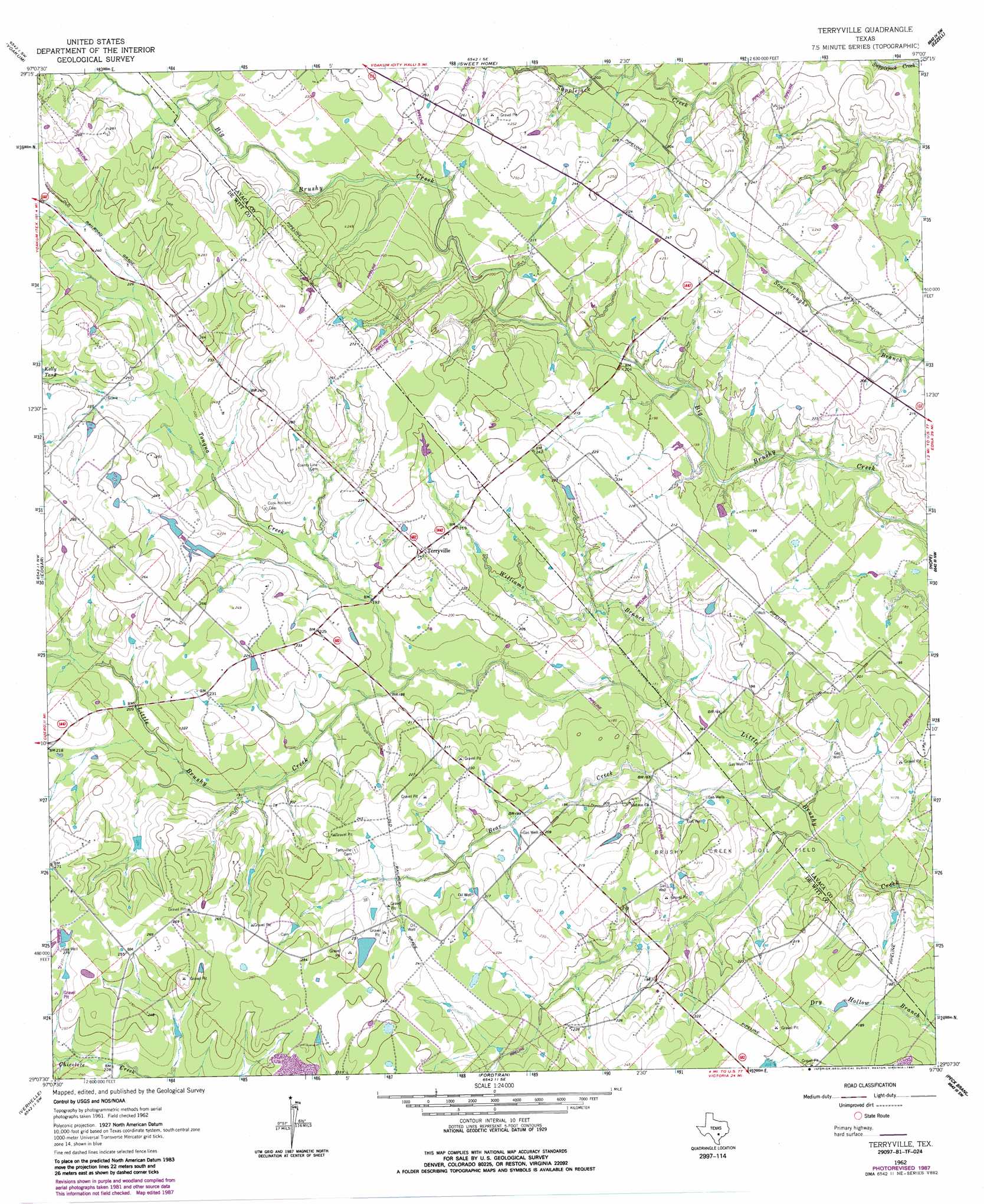
Terryville Topo Map Texas
To zoom in, hover over the map of Terryville
USGS Topo Quad 29097b1 - 1:24,000 scale
| Topo Map Name: | Terryville |
| USGS Topo Quad ID: | 29097b1 |
| Print Size: | ca. 21 1/4" wide x 27" high |
| Southeast Coordinates: | 29.125° N latitude / 97° W longitude |
| Map Center Coordinates: | 29.1875° N latitude / 97.0625° W longitude |
| U.S. State: | TX |
| Filename: | o29097b1.jpg |
| Download Map JPG Image: | Terryville topo map 1:24,000 scale |
| Map Type: | Topographic |
| Topo Series: | 7.5´ |
| Map Scale: | 1:24,000 |
| Source of Map Images: | United States Geological Survey (USGS) |
| Alternate Map Versions: |
Terryville TX 1962, updated 1964 Download PDF Buy paper map Terryville TX 1962, updated 1987 Download PDF Buy paper map Terryville TX 2010 Download PDF Buy paper map Terryville TX 2013 Download PDF Buy paper map Terryville TX 2016 Download PDF Buy paper map |
1:24,000 Topo Quads surrounding Terryville
Hamon |
Shiner |
Wied |
Hallettsville |
Sublime |
Hochheim |
Yoakum |
Sweet Home |
Ezzell |
Hallettsville Se |
Concrete |
Edgar |
Terryville |
Hope |
Morales |
Cuero |
Verhelle |
Fordtran |
Peck Branch |
Navidad |
Meyersville |
Mission Valley |
Nursery |
Inez Nw |
Inez |
> Back to 29097a1 at 1:100,000 scale
> Back to 29096a1 at 1:250,000 scale
> Back to U.S. Topo Maps home
Terryville topo map: Gazetteer
Terryville: Dams
Carroll Dam elevation 62m 203′Terryville: Oilfields
Brushy Creek Oil Field elevation 50m 164′Terryville: Populated Places
Terryville elevation 73m 239′Terryville: Reservoirs
Carroll Lake elevation 62m 203′Terryville: Streams
Bear Creek elevation 46m 150′Tonqua Creek elevation 55m 180′
Williams Branch elevation 48m 157′
Terryville digital topo map on disk
Buy this Terryville topo map showing relief, roads, GPS coordinates and other geographical features, as a high-resolution digital map file on DVD: