Spuds Topo Map Florida
To zoom in, hover over the map of Spuds
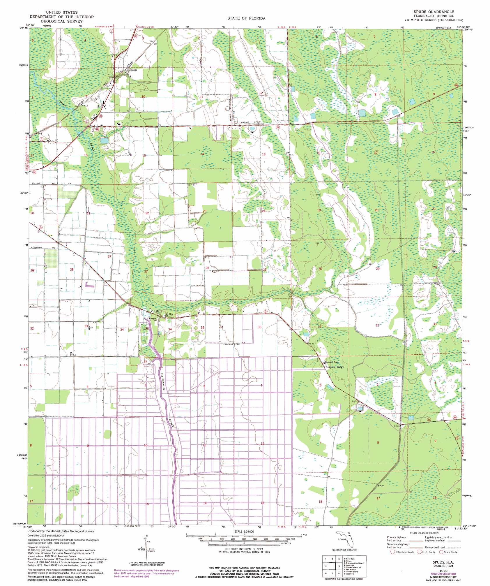
USGS Topo Quad 29081f4 - 1:24,000 scale
| Topo Map Name: | Spuds |
| USGS Topo Quad ID: | 29081f4 |
| Print Size: | ca. 21 1/4" wide x 27" high |
| Southeast Coordinates: | 29.625° N latitude / 81.375° W longitude |
| Map Center Coordinates: | 29.6875° N latitude / 81.4375° W longitude |
| U.S. State: | FL |
| Filename: | O29081F4.jpg |
| Download Map JPG Image: | Spuds topo map 1:24,000 scale |
| Map Type: | Topographic |
| Topo Series: | 7.5´ |
| Map Scale: | 1:24,000 |
| Source of Map Images: | United States Geological Survey (USGS) |
| Alternate Map Versions: |
Spuds FL 1970, updated 1973 Download PDF Buy paper map Spuds FL 1970, updated 1990 Download PDF Buy paper map Spuds FL 1970, updated 1992 Download PDF Buy paper map Spuds FL 2012 Download PDF Buy paper map Spuds FL 2015 Download PDF Buy paper map |
1:24,000 Topo Quads surrounding Spuds
Green Cove Springs |
Picolata |
Bakersville |
Saint Augustine |
|
Bostwick |
Riverdale |
Elkton |
Saint Augustine Beach |
|
Palatka |
Hastings |
Spuds |
Dinner Island Ne |
Matanzas Inlet |
Satsuma |
San Mateo |
Dinner Island |
Espanola |
Beverly Beach |
Welaka |
Crescent City |
Saint Johns Park |
Bunnell |
Flagler Beach West |
> Back to 29081e1 at 1:100,000 scale
> Back to 29080a1 at 1:250,000 scale
> Back to U.S. Topo Maps home
Spuds topo map: Gazetteer
Spuds: Airports
Hutson Airfield elevation 15m 49′Tater Farms Strip elevation 5m 16′
Spuds: Populated Places
Byrd elevation 5m 16′Gopher Ridge elevation 10m 32′
San Buenaventura (historical) elevation 3m 9′
Spuds elevation 6m 19′
Spuds: Streams
Sixteenmile Creek elevation 1m 3′Spuds: Swamps
Big Fish Tail Swamp elevation 9m 29′Spuds digital topo map on disk
Buy this Spuds topo map showing relief, roads, GPS coordinates and other geographical features, as a high-resolution digital map file on DVD: