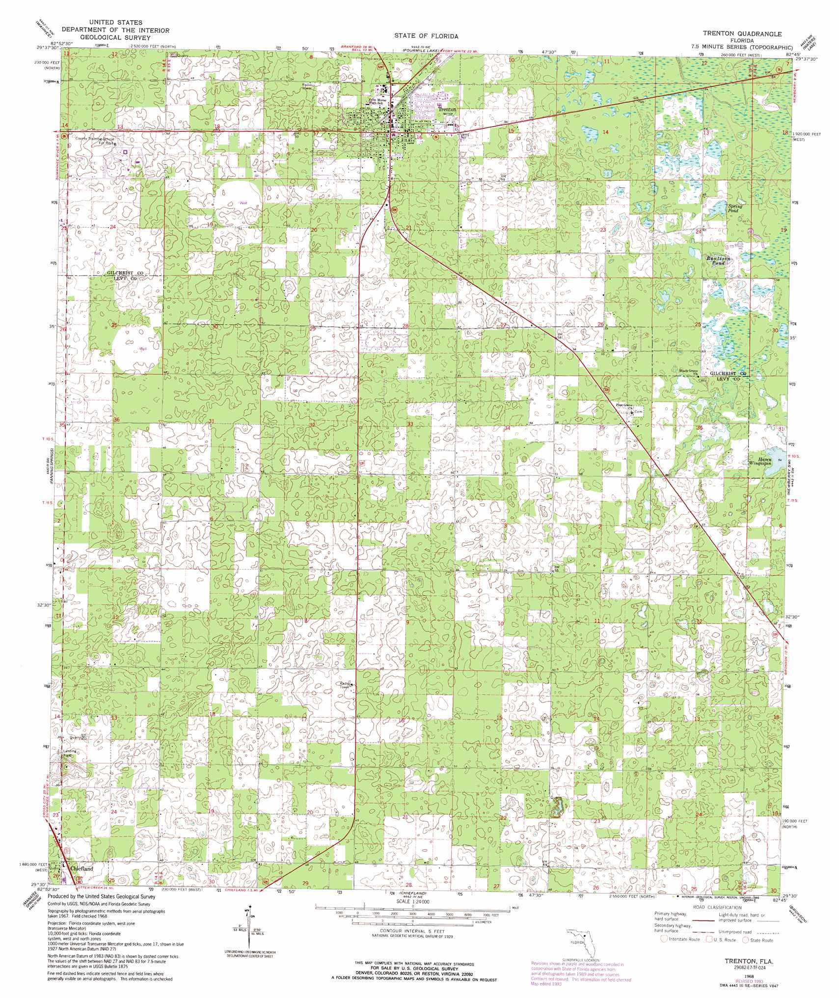
Trenton Topo Map Florida
To zoom in, hover over the map of Trenton
USGS Topo Quad 29082e7 - 1:24,000 scale
| Topo Map Name: | Trenton |
| USGS Topo Quad ID: | 29082e7 |
| Print Size: | ca. 21 1/4" wide x 27" high |
| Southeast Coordinates: | 29.5° N latitude / 82.75° W longitude |
| Map Center Coordinates: | 29.5625° N latitude / 82.8125° W longitude |
| U.S. State: | FL |
| Filename: | O29082E7.jpg |
| Download Map JPG Image: | Trenton topo map 1:24,000 scale |
| Map Type: | Topographic |
| Topo Series: | 7.5´ |
| Map Scale: | 1:24,000 |
| Source of Map Images: | United States Geological Survey (USGS) |
| Alternate Map Versions: |
Trenton FL 1968, updated 1971 Download PDF Buy paper map Trenton FL 1968, updated 1990 Download PDF Buy paper map Trenton FL 1968, updated 1993 Download PDF Buy paper map Trenton FL 2012 Download PDF Buy paper map Trenton FL 2015 Download PDF Buy paper map |
1:24,000 Topo Quads surrounding Trenton
Mallory Swamp Se |
Hatchbend |
Bell |
High Springs Sw |
High Springs |
Cross City East |
Wannee |
Fourmile Lake |
Waters Lake |
Newberry |
Eugene |
Suwannee River |
Trenton |
Newberry Sw |
Archer |
Vista |
Manatee Springs |
Chiefland |
Bronson |
Bronson Ne |
East Pass |
Chiefland Sw |
Otter Creek |
Bronson Sw |
Bronson Se |
> Back to 29082e1 at 1:100,000 scale
> Back to 29082a1 at 1:250,000 scale
> Back to U.S. Topo Maps home
Trenton topo map: Gazetteer
Trenton: Airports
Ames Field elevation 13m 42′Brookins Air Strip elevation 13m 42′
Neal Field elevation 15m 49′
White Farms Airport (historical) elevation 11m 36′
Windy Acres Airport elevation 13m 42′
Trenton: Lakes
Haven Winquipin elevation 16m 52′Trenton: Parks
Trenton High School Football Stadium elevation 17m 55′Trenton State Park elevation 17m 55′
Trenton: Populated Places
Trenton elevation 16m 52′Trenton: Post Offices
Trenton Post Office elevation 17m 55′Trenton: Reservoirs
Raulison Pond elevation 16m 52′Spring Pond elevation 18m 59′
Trenton digital topo map on disk
Buy this Trenton topo map showing relief, roads, GPS coordinates and other geographical features, as a high-resolution digital map file on DVD: