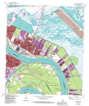
Chalmette Topo Map Louisiana
To zoom in, hover over the map of Chalmette
USGS Topo Quad 29089h8 - 1:24,000 scale
| Topo Map Name: | Chalmette |
| USGS Topo Quad ID: | 29089h8 |
| Print Size: | ca. 21 1/4" wide x 27" high |
| Southeast Coordinates: | 29.875° N latitude / 89.875° W longitude |
| Map Center Coordinates: | 29.9375° N latitude / 89.9375° W longitude |
| U.S. State: | LA |
| Filename: | o29089h8.jpg |
| Download Map JPG Image: | Chalmette topo map 1:24,000 scale |
| Map Type: | Topographic |
| Topo Series: | 7.5´ |
| Map Scale: | 1:24,000 |
| Source of Map Images: | United States Geological Survey (USGS) |
| Alternate Map Versions: |
Chalmette LA 1951, updated 1953 Download PDF Buy paper map Chalmette LA 1951, updated 1958 Download PDF Buy paper map Chalmette LA 1967, updated 1968 Download PDF Buy paper map Chalmette LA 1967, updated 1972 Download PDF Buy paper map Chalmette LA 1967, updated 1973 Download PDF Buy paper map Chalmette LA 1967, updated 1980 Download PDF Buy paper map Chalmette LA 1967, updated 1984 Download PDF Buy paper map Chalmette LA 1967, updated 1989 Download PDF Buy paper map Chalmette LA 1967, updated 1994 Download PDF Buy paper map Chalmette LA 1998, updated 2001 Download PDF Buy paper map Chalmette LA 2012 Download PDF Buy paper map Chalmette LA 2015 Download PDF Buy paper map |
1:24,000 Topo Quads surrounding Chalmette
> Back to 29089e1 at 1:100,000 scale
> Back to 29088a1 at 1:250,000 scale
> Back to U.S. Topo Maps home
Chalmette topo map: Gazetteer
Chalmette: Airports
Fishers Field elevation 1m 3′Sun Drilling Products Heliport elevation 2m 6′
Chalmette: Bends
English Turn Bend elevation 3m 9′Chalmette: Canals
Chalmette Vista Canal elevation 0m 0′Corinne Canal elevation -2m -7′
De La Ronde Canal elevation 1m 3′
Docville Canal elevation 0m 0′
Donner Canal elevation -2m -7′
Dubouchel Canal elevation -1m -4′
Eickes Canal elevation 0m 0′
Florida Walk Canal elevation -2m -7′
Forty Arpent Canal elevation -1m -4′
Guerengeh Canal elevation 0m 0′
Guichard Canal elevation 1m 3′
Meraux Canal elevation -1m -4′
Norman Canal elevation 0m 0′
Norman Canal elevation -3m -10′
Planters Canal elevation -2m -7′
Rodriguez Canal (historical) elevation 1m 3′
Twenty Arpent Canal elevation 0m 0′
Violet Canal elevation 0m 0′
Chalmette: Capes
Shingle Point elevation 3m 9′Chalmette: Channels
Intracoastal Waterway elevation 0m 0′Chalmette: Dams
Algiers Lock elevation 4m 13′Chalmette: Guts
Bayou Chaperon elevation 0m 0′Bayou Ducros elevation 0m 0′
Bayou Villere elevation 0m 0′
Bayou Villere elevation 1m 3′
Chalmette: Levees
Back Protection Levee elevation 1m 3′Cutoff Revetment elevation 4m 13′
Old Jackson Protection Levee elevation 0m 0′
Chalmette: Parks
Borgnemouth Park elevation 1m 3′Chalmette Monument elevation 3m 9′
Norman Playground elevation 0m 0′
Pakenham Oaks elevation 2m 6′
Spotts Monument elevation 3m 9′
Sydney D Torres Memorial Park elevation 0m 0′
Valreiss Park elevation 0m 0′
Chalmette: Populated Places
Angelique Estates elevation 1m 3′Aurora Gardens elevation 0m 0′
Campbell elevation 3m 9′
Chalmette elevation 1m 3′
Chalmette Vista elevation 0m 0′
Cutoff elevation 1m 3′
Cypress Gardens elevation 1m 3′
Daniel Park elevation 0m 0′
Dauterive Trailer Park elevation 3m 9′
Dazet Estates elevation 1m 3′
English Turn elevation 3m 9′
Fazende (historical) elevation 2m 6′
Forest Isle elevation -1m -4′
Frances Place elevation 1m 3′
Hi-Land elevation 2m 6′
Lexington Place elevation 0m 0′
Little Rock (historical) elevation 2m 6′
Meraux elevation 2m 6′
Mohawk City elevation 2m 6′
Myrtle Grove elevation 1m 3′
Oak Ridge Park elevation 0m 0′
Packenham Mobile Home Park elevation 2m 6′
River Bend elevation 2m 6′
Saint Bernard Grove elevation 1m 3′
Saint Claude Heights elevation 0m 0′
Saxonholm elevation 2m 6′
Stanton elevation 2m 6′
Story elevation 1m 3′
Story Park elevation 0m 0′
Tall Timbers elevation -2m -7′
Timber Grove elevation -2m -7′
Versailles elevation 1m 3′
Violet elevation 1m 3′
Chalmette: Post Offices
Chalmette Post Office elevation 2m 6′Meraux Post Office elevation 2m 6′
Violet Post Office elevation 2m 6′
Chalmette digital topo map on disk
Buy this Chalmette topo map showing relief, roads, GPS coordinates and other geographical features, as a high-resolution digital map file on DVD:
Gulf Coast (LA, MS, AL, FL) & Southwestern Georgia
Buy digital topo maps: Gulf Coast (LA, MS, AL, FL) & Southwestern Georgia


