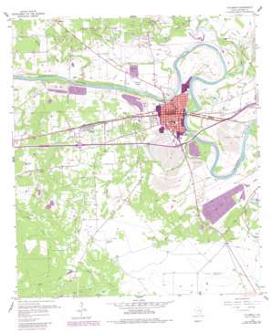
Columbus Topo Map Texas
To zoom in, hover over the map of Columbus
USGS Topo Quad 29096f5 - 1:24,000 scale
| Topo Map Name: | Columbus |
| USGS Topo Quad ID: | 29096f5 |
| Print Size: | ca. 21 1/4" wide x 27" high |
| Southeast Coordinates: | 29.625° N latitude / 96.5° W longitude |
| Map Center Coordinates: | 29.6875° N latitude / 96.5625° W longitude |
| U.S. State: | TX |
| Filename: | o29096f5.jpg |
| Download Map JPG Image: | Columbus topo map 1:24,000 scale |
| Map Type: | Topographic |
| Topo Series: | 7.5´ |
| Map Scale: | 1:24,000 |
| Source of Map Images: | United States Geological Survey (USGS) |
| Alternate Map Versions: |
Columbus TX 1957, updated 1958 Download PDF Buy paper map Columbus TX 1957, updated 1983 Download PDF Buy paper map Columbus TX 2010 Download PDF Buy paper map Columbus TX 2013 Download PDF Buy paper map Columbus TX 2016 Download PDF Buy paper map |
1:24,000 Topo Quads surrounding Columbus
> Back to 29096e1 at 1:100,000 scale
> Back to 29096a1 at 1:250,000 scale
> Back to U.S. Topo Maps home
Columbus topo map: Gazetteer
Columbus: Airports
2 G Ranch Airport elevation 79m 259′Columbus Hospital Heliport elevation 60m 196′
Robert R Wells Junior Airport elevation 72m 236′
Columbus: Bridges
State Highway 3 Bridge elevation 51m 167′Columbus: Oilfields
Columbus Oil Field elevation 78m 255′Columbus: Parks
City Park elevation 67m 219′Columbus: Populated Places
Columbus elevation 62m 203′Glidden elevation 72m 236′
Helms elevation 67m 219′
Hillcrest elevation 79m 259′
Columbus: Streams
Brune Creek elevation 55m 180′Cummins Creek elevation 53m 173′
Dry Creek elevation 57m 187′
Miller Creek elevation 70m 229′
Piney Creek elevation 53m 173′
Ratliff Creek elevation 49m 160′
Rocky Creek elevation 57m 187′
Wolfpen Creek elevation 55m 180′
Yupon Creek elevation 62m 203′
Columbus digital topo map on disk
Buy this Columbus topo map showing relief, roads, GPS coordinates and other geographical features, as a high-resolution digital map file on DVD:


