Lake Creek Topo Map Texas
To zoom in, hover over the map of Lake Creek
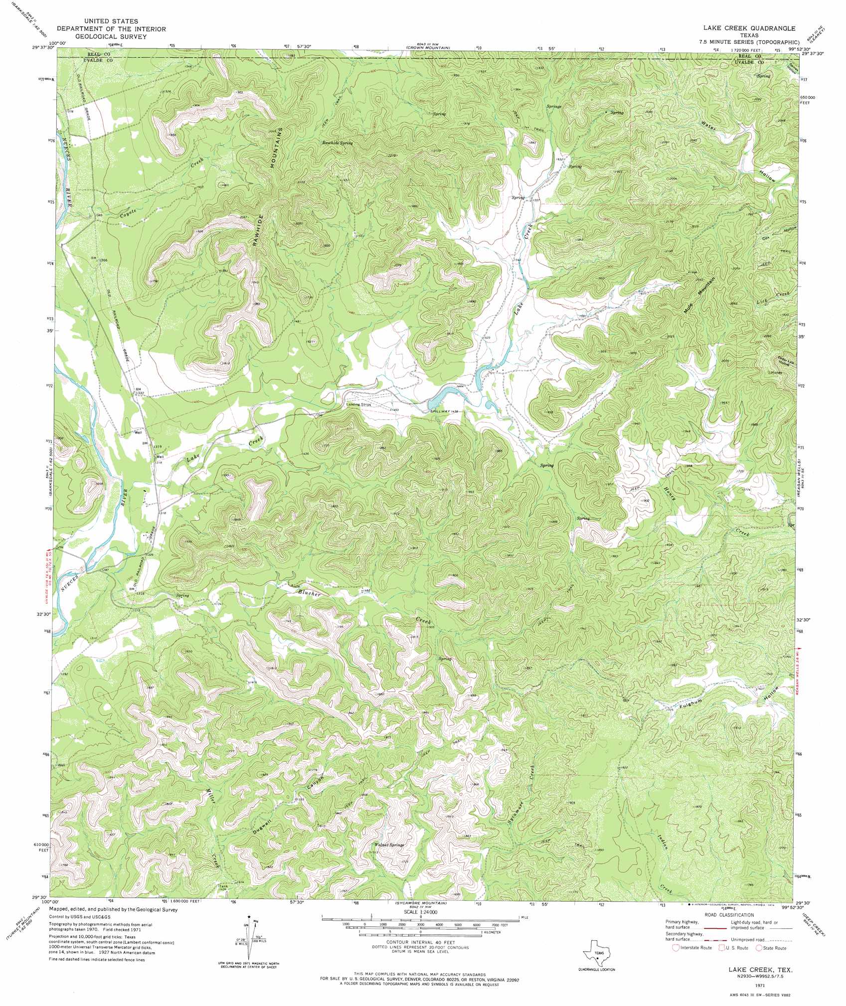
USGS Topo Quad 29099e8 - 1:24,000 scale
| Topo Map Name: | Lake Creek |
| USGS Topo Quad ID: | 29099e8 |
| Print Size: | ca. 21 1/4" wide x 27" high |
| Southeast Coordinates: | 29.5° N latitude / 99.875° W longitude |
| Map Center Coordinates: | 29.5625° N latitude / 99.9375° W longitude |
| U.S. State: | TX |
| Filename: | o29099e8.jpg |
| Download Map JPG Image: | Lake Creek topo map 1:24,000 scale |
| Map Type: | Topographic |
| Topo Series: | 7.5´ |
| Map Scale: | 1:24,000 |
| Source of Map Images: | United States Geological Survey (USGS) |
| Alternate Map Versions: |
Lake Creek TX 1971, updated 1974 Download PDF Buy paper map Lake Creek TX 2010 Download PDF Buy paper map Lake Creek TX 2012 Download PDF Buy paper map Lake Creek TX 2016 Download PDF Buy paper map |
1:24,000 Topo Quads surrounding Lake Creek
Half Moon Prairie |
Vance |
Jo Jan Van Camp |
Owl Hollow |
Circle Bluff |
Kelley Peak |
Camp Wood |
Crown Mountain |
Leakey |
Rio Frio |
Bull Waterhole |
Montell |
Lake Creek |
Reagan Wells |
Magers Crossing |
Salmon Peak |
Laguna |
Sycamore Mountain |
Deep Creek |
Concan |
Turkey Mountain |
Mustang Waterhole |
Chalk Bluff |
Sevenmile Hill |
Knippa |
> Back to 29099e1 at 1:100,000 scale
> Back to 29098a1 at 1:250,000 scale
> Back to U.S. Topo Maps home
Lake Creek topo map: Gazetteer
Lake Creek: Dams
Williams Lake Number 1 Dam elevation 430m 1410′Williams Lake Number 2 Dam elevation 433m 1420′
Williams Lake Number 3 Dam elevation 446m 1463′
Lake Creek: Reservoirs
Williams Lake Number 1 elevation 430m 1410′Williams Lake Number 2 elevation 433m 1420′
Williams Lake Number 3 elevation 446m 1463′
Lake Creek: Springs
Rawhide Spring elevation 512m 1679′Spring Creek Spring elevation 467m 1532′
Walnut Springs elevation 459m 1505′
Lake Creek: Streams
Blucher Creek elevation 395m 1295′Cedar Creek elevation 391m 1282′
Coyote Creek elevation 408m 1338′
Lake Creek elevation 391m 1282′
Lake Creek: Summits
Mule Mountain elevation 602m 1975′Rawhide Mountains elevation 527m 1729′
Lake Creek: Valleys
Dugwell Canyon elevation 444m 1456′Lake Creek digital topo map on disk
Buy this Lake Creek topo map showing relief, roads, GPS coordinates and other geographical features, as a high-resolution digital map file on DVD: