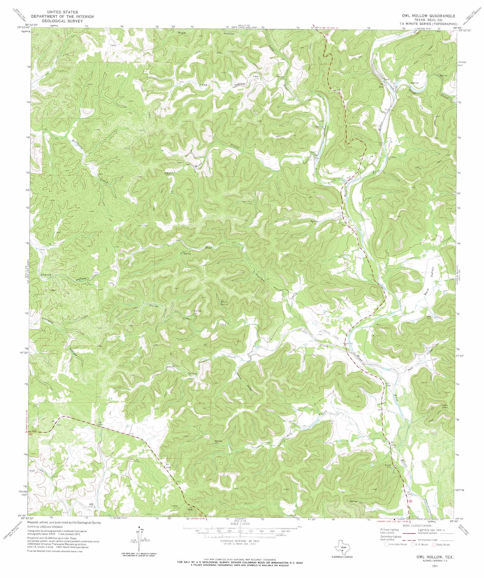
Owl Hollow Topo Map Texas
To zoom in, hover over the map of Owl Hollow
USGS Topo Quad 29099g7 - 1:24,000 scale
| Topo Map Name: | Owl Hollow |
| USGS Topo Quad ID: | 29099g7 |
| Print Size: | ca. 21 1/4" wide x 27" high |
| Southeast Coordinates: | 29.75° N latitude / 99.75° W longitude |
| Map Center Coordinates: | 29.8125° N latitude / 99.8125° W longitude |
| U.S. State: | TX |
| Filename: | o29099g7.jpg |
| Download Map JPG Image: | Owl Hollow topo map 1:24,000 scale |
| Map Type: | Topographic |
| Topo Series: | 7.5´ |
| Map Scale: | 1:24,000 |
| Source of Map Images: | United States Geological Survey (USGS) |
| Alternate Map Versions: |
Owl Hollow TX 1971, updated 1974 Download PDF Buy paper map Owl Hollow TX 2010 Download PDF Buy paper map Owl Hollow TX 2013 Download PDF Buy paper map Owl Hollow TX 2016 Download PDF Buy paper map |
1:24,000 Topo Quads surrounding Owl Hollow
Devils Sinkhole |
Earwood Creek Sw |
Earwood Creek |
Garven Store |
Boneyard Draw |
Hackberry |
Joy Hollow |
Bee Cave Hollow |
Hillcrest Ranch |
Well Hollow |
Vance |
Jo Jan Van Camp |
Owl Hollow |
Circle Bluff |
Sabinal Canyon |
Camp Wood |
Crown Mountain |
Leakey |
Rio Frio |
Vanderpool |
Montell |
Lake Creek |
Reagan Wells |
Magers Crossing |
Utopia |
> Back to 29099e1 at 1:100,000 scale
> Back to 29098a1 at 1:250,000 scale
> Back to U.S. Topo Maps home
Owl Hollow topo map: Gazetteer
Owl Hollow: Airports
Lewis Ranch Airport elevation 579m 1899′Owl Hollow: Springs
White Spring elevation 607m 1991′Owl Hollow: Streams
Ash Creek elevation 499m 1637′Bluff Creek elevation 547m 1794′
Cedar Creek elevation 512m 1679′
Kent Creek elevation 536m 1758′
Long Kent Creek elevation 546m 1791′
North Cedar Creek elevation 541m 1774′
Riemer Creek elevation 583m 1912′
Short Kent Creek elevation 546m 1791′
South Cedar Creek elevation 541m 1774′
Owl Hollow: Valleys
Buckalue Hollow elevation 561m 1840′Lawson Hollow elevation 551m 1807′
Long Hollow elevation 582m 1909′
Owl Hollow elevation 524m 1719′
Perry Hollow elevation 508m 1666′
Rain Valley elevation 522m 1712′
Owl Hollow digital topo map on disk
Buy this Owl Hollow topo map showing relief, roads, GPS coordinates and other geographical features, as a high-resolution digital map file on DVD: