Bristol Topo Map Florida
To zoom in, hover over the map of Bristol
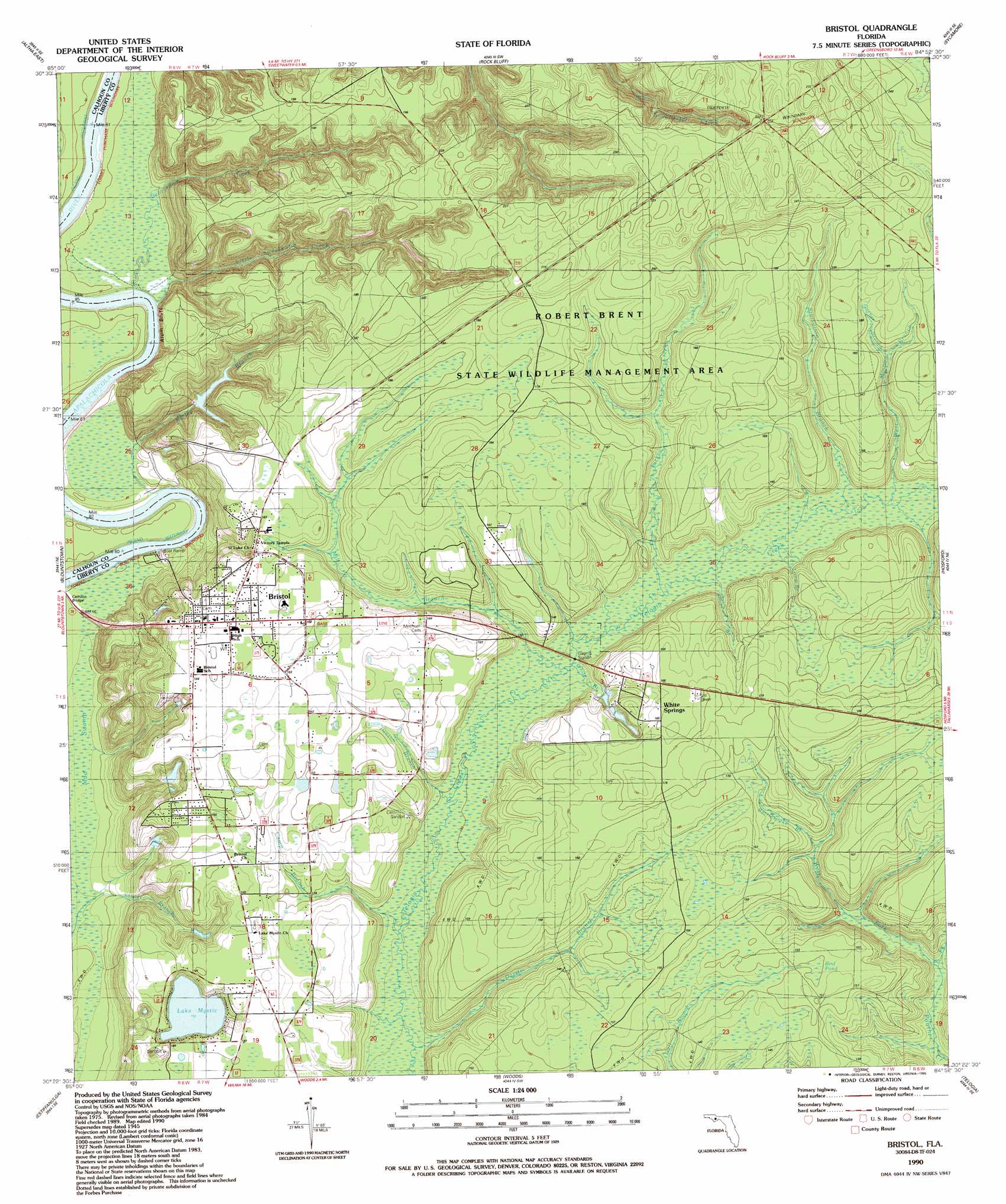
USGS Topo Quad 30084d8 - 1:24,000 scale
| Topo Map Name: | Bristol |
| USGS Topo Quad ID: | 30084d8 |
| Print Size: | ca. 21 1/4" wide x 27" high |
| Southeast Coordinates: | 30.375° N latitude / 84.875° W longitude |
| Map Center Coordinates: | 30.4375° N latitude / 84.9375° W longitude |
| U.S. State: | FL |
| Filename: | O30084D8.jpg |
| Download Map JPG Image: | Bristol topo map 1:24,000 scale |
| Map Type: | Topographic |
| Topo Series: | 7.5´ |
| Map Scale: | 1:24,000 |
| Source of Map Images: | United States Geological Survey (USGS) |
| Alternate Map Versions: |
Bristol FL 1945, updated 1960 Download PDF Buy paper map Bristol FL 1990, updated 1990 Download PDF Buy paper map Bristol FL 2012 Download PDF Buy paper map Bristol FL 2015 Download PDF Buy paper map |
1:24,000 Topo Quads surrounding Bristol
Oakdale |
Cypress |
Sneads |
Chattahoochee |
Mount Pleasant |
Altha West |
Altha East |
Rock Bluff |
Sycamore |
Gretna |
Clarksville |
Blountstown |
Bristol |
Hosford |
Bloxham |
Frink |
Estiffanulga |
Woods |
Telogia |
Ward |
Dead Lake |
Orange |
Wilma |
Queens Bay |
Smith Creek |
> Back to 30084a1 at 1:100,000 scale
> Back to 30084a1 at 1:250,000 scale
> Back to U.S. Topo Maps home
Bristol topo map: Gazetteer
Bristol: Cliffs
Alum Bluff elevation 14m 45′Bristol: Lakes
Lake Mystic elevation 34m 111′Bristol: Populated Places
Bristol elevation 53m 173′Ochisi (historical) elevation 71m 232′
White Springs elevation 49m 160′
Bristol: Springs
White Springs elevation 45m 147′Bristol: Streams
Beaverdam Creek elevation 17m 55′Camp Branch elevation 46m 150′
Deason Branch elevation 44m 144′
Devils Branch elevation 41m 134′
East Fork Panther Creek elevation 38m 124′
East Minnow Branch elevation 48m 157′
Garner Branch elevation 57m 187′
Kelley Branch elevation 12m 39′
Little Sweetwater Creek elevation 9m 29′
Long Branch elevation 49m 160′
Mill Branch elevation 46m 150′
Rattlesnake Branch elevation 47m 154′
Short Branch elevation 45m 147′
Shuler Branch elevation 28m 91′
Starvation Branch elevation 52m 170′
Turkey Creek elevation 52m 170′
West Fork Panther Creek elevation 38m 124′
White Branch elevation 42m 137′
Bristol: Swamps
Bird Pond elevation 60m 196′Mud Swamp elevation 25m 82′
Bristol digital topo map on disk
Buy this Bristol topo map showing relief, roads, GPS coordinates and other geographical features, as a high-resolution digital map file on DVD:
Gulf Coast (LA, MS, AL, FL) & Southwestern Georgia
Buy digital topo maps: Gulf Coast (LA, MS, AL, FL) & Southwestern Georgia
 & Southwestern Georgia map DVD")