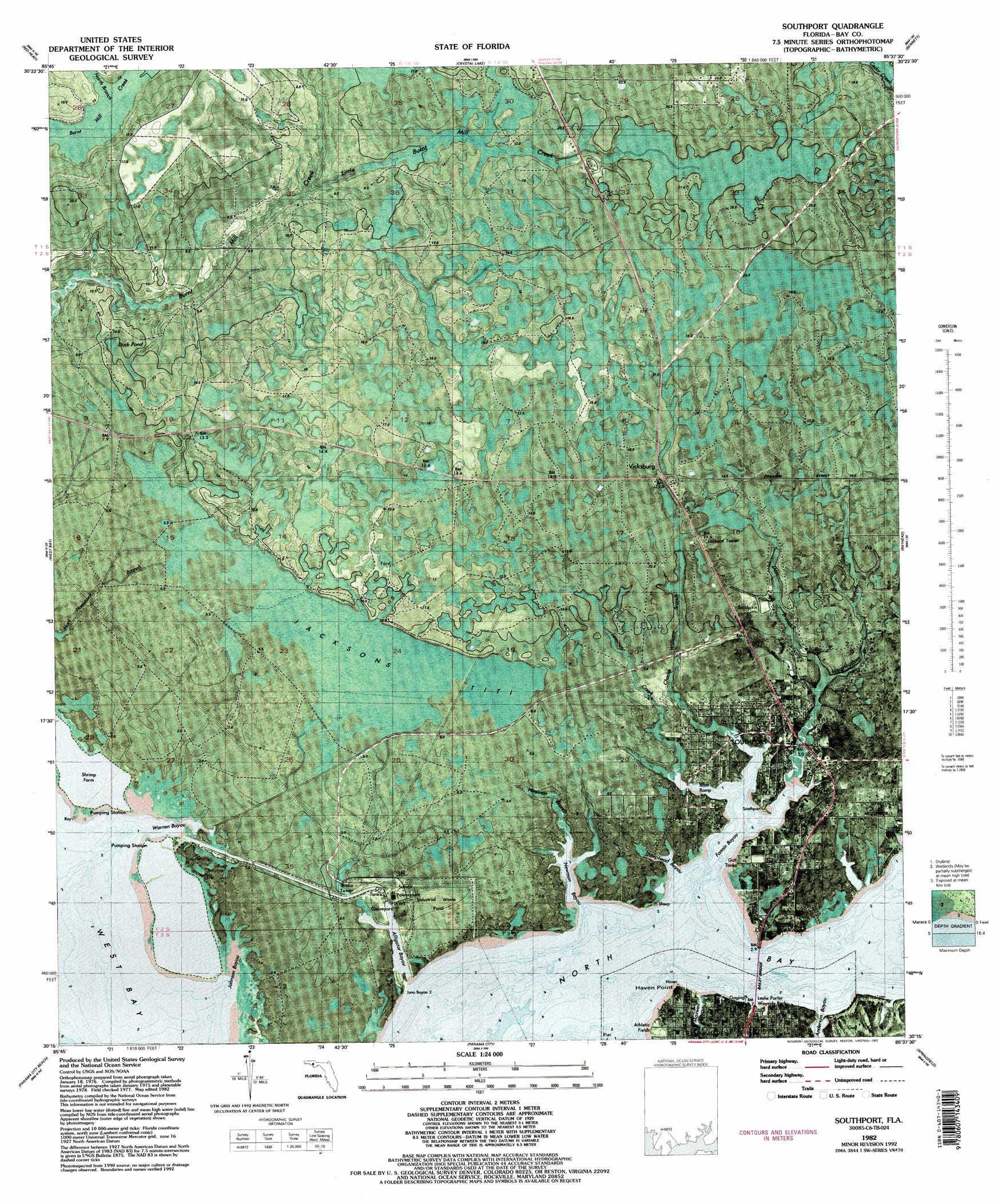
Southport Topo Map Florida
To zoom in, hover over the map of Southport
USGS Topo Quad 30085c6 - 1:24,000 scale
| Topo Map Name: | Southport |
| USGS Topo Quad ID: | 30085c6 |
| Print Size: | ca. 21 1/4" wide x 27" high |
| Southeast Coordinates: | 30.25° N latitude / 85.625° W longitude |
| Map Center Coordinates: | 30.3125° N latitude / 85.6875° W longitude |
| U.S. State: | FL |
| Filename: | P30085c6.jpg |
| Download Map JPG Image: | Southport topo map 1:24,000 scale |
| Map Type: | Orthophoto |
| Topo Series: | 7.5´ |
| Map Scale: | 1:24,000 |
| Source of Map Images: | United States Geological Survey (USGS) |
| Alternate Map Versions: |
Southport FL 1943, updated 1973 Download PDF Buy paper map Southport FL 1944 Download PDF Buy paper map Southport FL 1944, updated 1960 Download PDF Buy paper map Southport FL 1982, updated 1984 Download PDF Buy paper map Southport FL 1982, updated 1992 Download PDF Buy paper map Southport FL 1982, updated 1992 Download PDF Buy paper map Southport FL 2012 Download PDF Buy paper map Southport FL 2015 Download PDF Buy paper map |
1:24,000 Topo Quads surrounding Southport
Redbay |
Millers Ferry |
Vernon |
Gap Lake |
Compass Lake |
Bruce |
Red Head |
Crystal Lake |
Bennett |
Fountain |
Seminole Hills |
West Bay |
Southport |
Bayhead |
Youngstown |
Laguna Beach |
Panama City Beach |
Panama City |
Springfield |
North Of Allanton |
Beacon Beach |
Long Point |
Allanton |
> Back to 30085a1 at 1:100,000 scale
> Back to 30084a1 at 1:250,000 scale
> Back to U.S. Topo Maps home
Southport topo map: Gazetteer
Southport: Bays
Fannin Bayou elevation 0m 0′Johnson Bayou elevation 1m 3′
Newman Bayou elevation 0m 0′
North Bay elevation 0m 0′
Sheephead Bayou elevation 0m 0′
Warren Bayou elevation 0m 0′
Southport: Bridges
North Bridge elevation 0m 0′Southport: Capes
Cedar Hammock elevation 1m 3′Haven Point elevation 1m 3′
Mill Point elevation 1m 3′
Southport: Islands
Cedar Hammock elevation 0m 0′Southport: Populated Places
San Carlos Chacatos (historical) elevation 18m 59′Southport elevation 2m 6′
Vicksburg elevation 16m 52′
Southport: Streams
Alligator Bayou elevation 0m 0′North Branch Burnt Mill Creek elevation 11m 36′
Southport digital topo map on disk
Buy this Southport topo map showing relief, roads, GPS coordinates and other geographical features, as a high-resolution digital map file on DVD:
Gulf Coast (LA, MS, AL, FL) & Southwestern Georgia
Buy digital topo maps: Gulf Coast (LA, MS, AL, FL) & Southwestern Georgia
 & Southwestern Georgia map DVD")