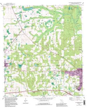
Cottondale East Topo Map Florida
To zoom in, hover over the map of Cottondale East
USGS Topo Quad 30085g3 - 1:24,000 scale
| Topo Map Name: | Cottondale East |
| USGS Topo Quad ID: | 30085g3 |
| Print Size: | ca. 21 1/4" wide x 27" high |
| Southeast Coordinates: | 30.75° N latitude / 85.25° W longitude |
| Map Center Coordinates: | 30.8125° N latitude / 85.3125° W longitude |
| U.S. State: | FL |
| Filename: | O30085G3.jpg |
| Download Map JPG Image: | Cottondale East topo map 1:24,000 scale |
| Map Type: | Topographic |
| Topo Series: | 7.5´ |
| Map Scale: | 1:24,000 |
| Source of Map Images: | United States Geological Survey (USGS) |
| Alternate Map Versions: |
Cottondale East FL 1952, updated 1953 Download PDF Buy paper map Cottondale East FL 1952, updated 1971 Download PDF Buy paper map Cottondale East FL 1982, updated 1982 Download PDF Buy paper map Cottondale East FL 1994, updated 1995 Download PDF Buy paper map Cottondale East FL 2012 Download PDF Buy paper map Cottondale East FL 2015 Download PDF Buy paper map |
1:24,000 Topo Quads surrounding Cottondale East
> Back to 30085e1 at 1:100,000 scale
> Back to 30084a1 at 1:250,000 scale
> Back to U.S. Topo Maps home
Cottondale East topo map: Gazetteer
Cottondale East: Airports
Aero-Custom Airport elevation 27m 88′Cottondale East: Bridges
Bellamy Bridge elevation 22m 72′Cottondale East: Lakes
Caraway Mill Pond elevation 51m 167′Finger Pond elevation 29m 95′
Jenkins Pond elevation 28m 91′
Mary Pond elevation 42m 137′
Maybet Pond elevation 32m 104′
Middle Pond elevation 27m 88′
Open Pond elevation 41m 134′
Red Pond elevation 43m 141′
Roulac Pond elevation 28m 91′
Swain Pond elevation 25m 82′
White Pond elevation 25m 82′
Williams Mill Pond elevation 46m 150′
Cottondale East: Populated Places
Waddells Mill elevation 29m 95′Cottondale East: Reservoirs
Waddells Mill Pond elevation 25m 82′Cottondale East: Springs
Tanner Springs elevation 27m 88′Webbville Spring elevation 27m 88′
Cottondale East: Streams
Baker Creek elevation 22m 72′Russ Mill Creek elevation 23m 75′
Waddells Mill Creek elevation 22m 72′
Cottondale East: Swamps
Bell Pond elevation 49m 160′Bonnet Pond elevation 34m 111′
Caney Pond elevation 35m 114′
Cold Pond elevation 39m 127′
Frank Pond elevation 36m 118′
Gnat Hole Pond elevation 34m 111′
Guy Pond elevation 38m 124′
Jenkins Pond elevation 56m 183′
Lockey Pond elevation 36m 118′
Mary Ann Pond elevation 42m 137′
McNealy Pond elevation 37m 121′
Roulhac Pond elevation 28m 91′
Snelling Pond elevation 29m 95′
Cottondale East digital topo map on disk
Buy this Cottondale East topo map showing relief, roads, GPS coordinates and other geographical features, as a high-resolution digital map file on DVD:
Gulf Coast (LA, MS, AL, FL) & Southwestern Georgia
Buy digital topo maps: Gulf Coast (LA, MS, AL, FL) & Southwestern Georgia


