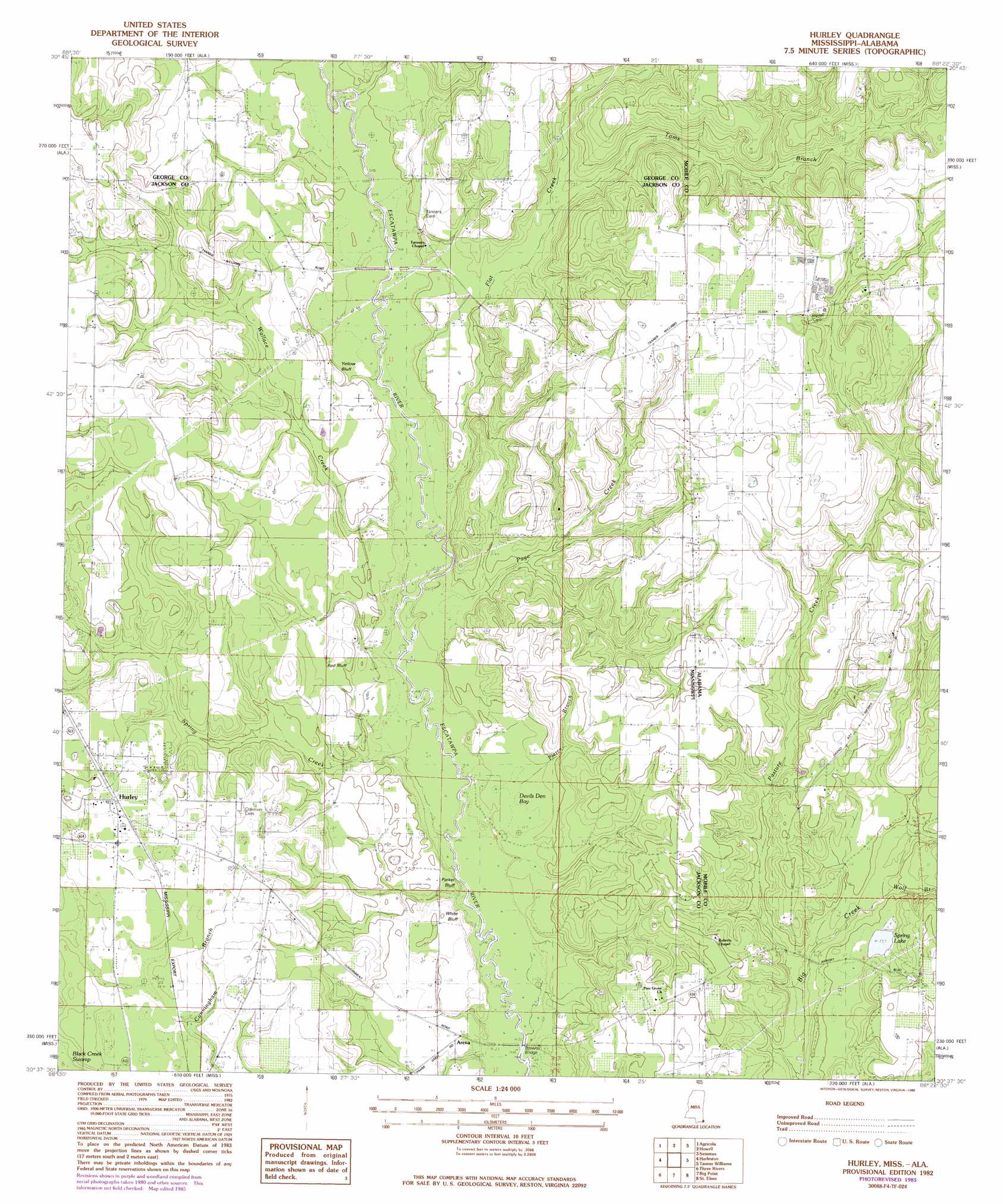
Hurley Topo Map Mississippi
To zoom in, hover over the map of Hurley
USGS Topo Quad 30088f4 - 1:24,000 scale
| Topo Map Name: | Hurley |
| USGS Topo Quad ID: | 30088f4 |
| Print Size: | ca. 21 1/4" wide x 27" high |
| Southeast Coordinates: | 30.625° N latitude / 88.375° W longitude |
| Map Center Coordinates: | 30.6875° N latitude / 88.4375° W longitude |
| U.S. States: | MS, AL |
| Filename: | o30088f4.jpg |
| Download Map JPG Image: | Hurley topo map 1:24,000 scale |
| Map Type: | Topographic |
| Topo Series: | 7.5´ |
| Map Scale: | 1:24,000 |
| Source of Map Images: | United States Geological Survey (USGS) |
| Alternate Map Versions: |
Hurley MS 1982, updated 1982 Download PDF Buy paper map Hurley MS 1982, updated 1986 Download PDF Buy paper map Hurley MS 2012 Download PDF Buy paper map Hurley MS 2015 Download PDF Buy paper map |
1:24,000 Topo Quads surrounding Hurley
Merrill |
Lucedale |
Earlville |
Georgetown |
Chunchula |
Basin |
Agricola |
Howell |
Semmes |
Kushla |
Easen Hill |
Harleston |
Hurley |
Tanner Williams |
Spring Hill |
Vancleave |
Three Rivers |
Big Point |
Saint Elmo |
Theodore |
Gautier North |
Pascagoula North |
Kreole |
Grand Bay |
Coden |
> Back to 30088e1 at 1:100,000 scale
> Back to 30088a1 at 1:250,000 scale
> Back to U.S. Topo Maps home
Hurley topo map: Gazetteer
Hurley: Bridges
Browns Bridge elevation 9m 29′Hurley: Cliffs
Red Bluff elevation 18m 59′White Bluff elevation 14m 45′
Yellow Bluff elevation 21m 68′
Hurley: Crossings
Dickens Ferry (historical) elevation 8m 26′Tanners Ferry (historical) elevation 11m 36′
Hurley: Lakes
Spring Lake elevation 16m 52′Hurley: Populated Places
Hurley elevation 30m 98′Hurley: Streams
Flat Creek elevation 10m 32′Flat Creek elevation 10m 32′
Page Creek elevation 10m 32′
Page Creek elevation 9m 29′
Pasture Creek elevation 16m 52′
Pierce Branch elevation 8m 26′
Spring Creek elevation 8m 26′
Toms Branch elevation 23m 75′
Toms Branch elevation 18m 59′
Wallace Creek elevation 12m 39′
Wolf Branch elevation 11m 36′
Hurley: Swamps
Devils Den Bay elevation 11m 36′Hurley digital topo map on disk
Buy this Hurley topo map showing relief, roads, GPS coordinates and other geographical features, as a high-resolution digital map file on DVD:
Gulf Coast (LA, MS, AL, FL) & Southwestern Georgia
Buy digital topo maps: Gulf Coast (LA, MS, AL, FL) & Southwestern Georgia
 & Southwestern Georgia map DVD")