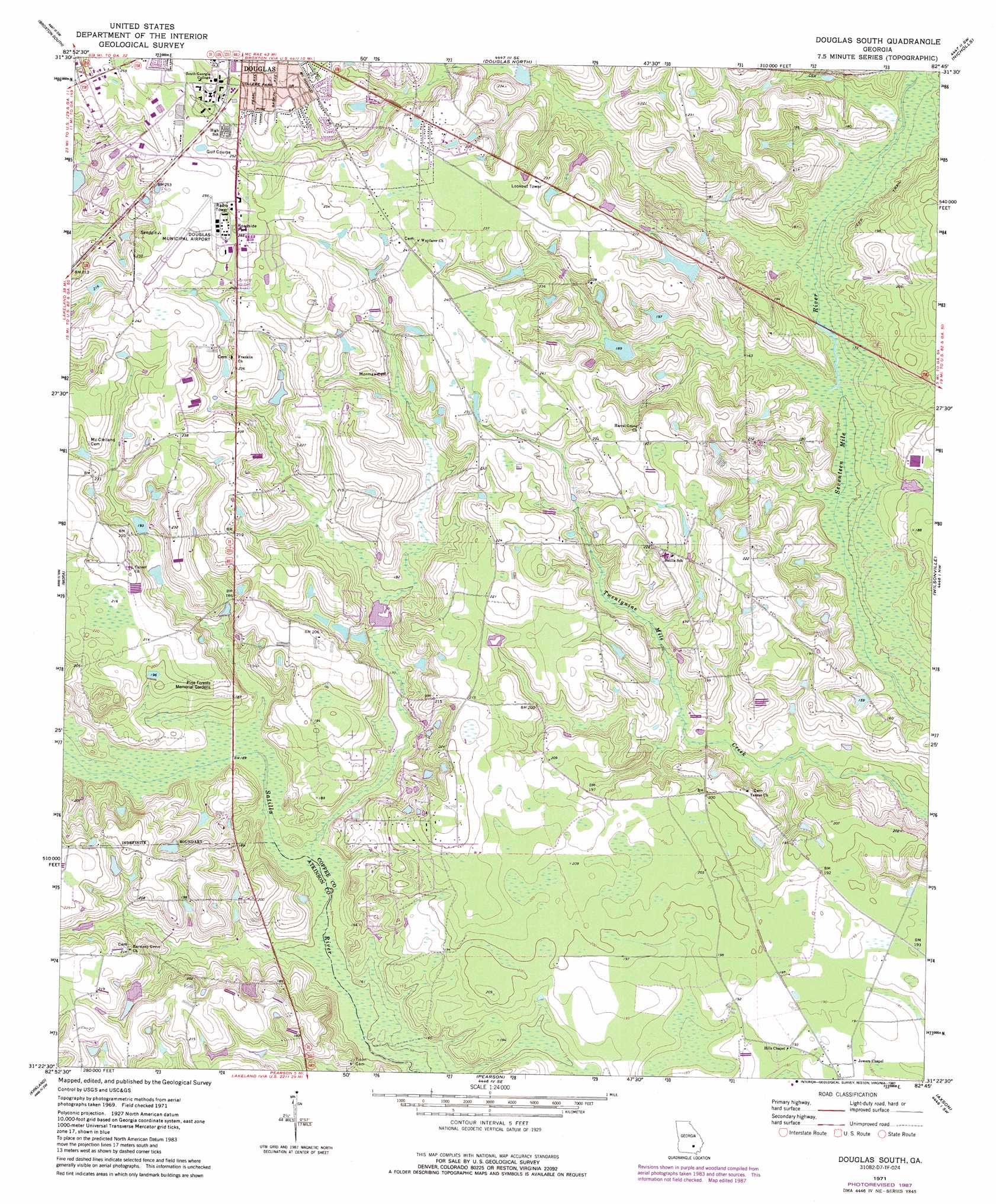
Douglas South Topo Map Georgia
To zoom in, hover over the map of Douglas South
USGS Topo Quad 31082d7 - 1:24,000 scale
| Topo Map Name: | Douglas South |
| USGS Topo Quad ID: | 31082d7 |
| Print Size: | ca. 21 1/4" wide x 27" high |
| Southeast Coordinates: | 31.375° N latitude / 82.75° W longitude |
| Map Center Coordinates: | 31.4375° N latitude / 82.8125° W longitude |
| U.S. State: | GA |
| Filename: | o31082d7.jpg |
| Download Map JPG Image: | Douglas South topo map 1:24,000 scale |
| Map Type: | Topographic |
| Topo Series: | 7.5´ |
| Map Scale: | 1:24,000 |
| Source of Map Images: | United States Geological Survey (USGS) |
| Alternate Map Versions: |
Douglas South GA 1971, updated 1974 Download PDF Buy paper map Douglas South GA 1971, updated 1987 Download PDF Buy paper map Douglas South GA 2011 Download PDF Buy paper map Douglas South GA 2014 Download PDF Buy paper map |
1:24,000 Topo Quads surrounding Douglas South
Osierfield |
Broxton North |
Broxton Ne |
Denton |
Nicholls Ne |
Ambrose |
Broxton South |
Douglas North |
Nicholls |
Sessoms |
Lax |
Mora |
Douglas South |
Wilsonville |
Beach |
Willacoochee |
Kirkland |
Pearson |
Axson |
Talmo |
Hastings Fish Pond |
Henderson Still |
Sandy Bottom |
Cogdell |
Pine Valley |
> Back to 31082a1 at 1:100,000 scale
> Back to 31082a1 at 1:250,000 scale
> Back to U.S. Topo Maps home
Douglas South topo map: Gazetteer
Douglas South: Airports
Douglas Municipal Airport elevation 77m 252′Douglas South: Dams
Haskin Lake Dam elevation 64m 209′Johnson Lake Dam elevation 56m 183′
Johnson Lake Dam North elevation 59m 193′
Douglas South: Parks
Bell Lake Park elevation 72m 236′Pine Street Park elevation 76m 249′
Roundtree Center Park elevation 76m 249′
Douglas South: Reservoirs
Haskin Lake elevation 64m 209′Johnson Lake elevation 56m 183′
Johnson Lake North elevation 59m 193′
Douglas South digital topo map on disk
Buy this Douglas South topo map showing relief, roads, GPS coordinates and other geographical features, as a high-resolution digital map file on DVD: