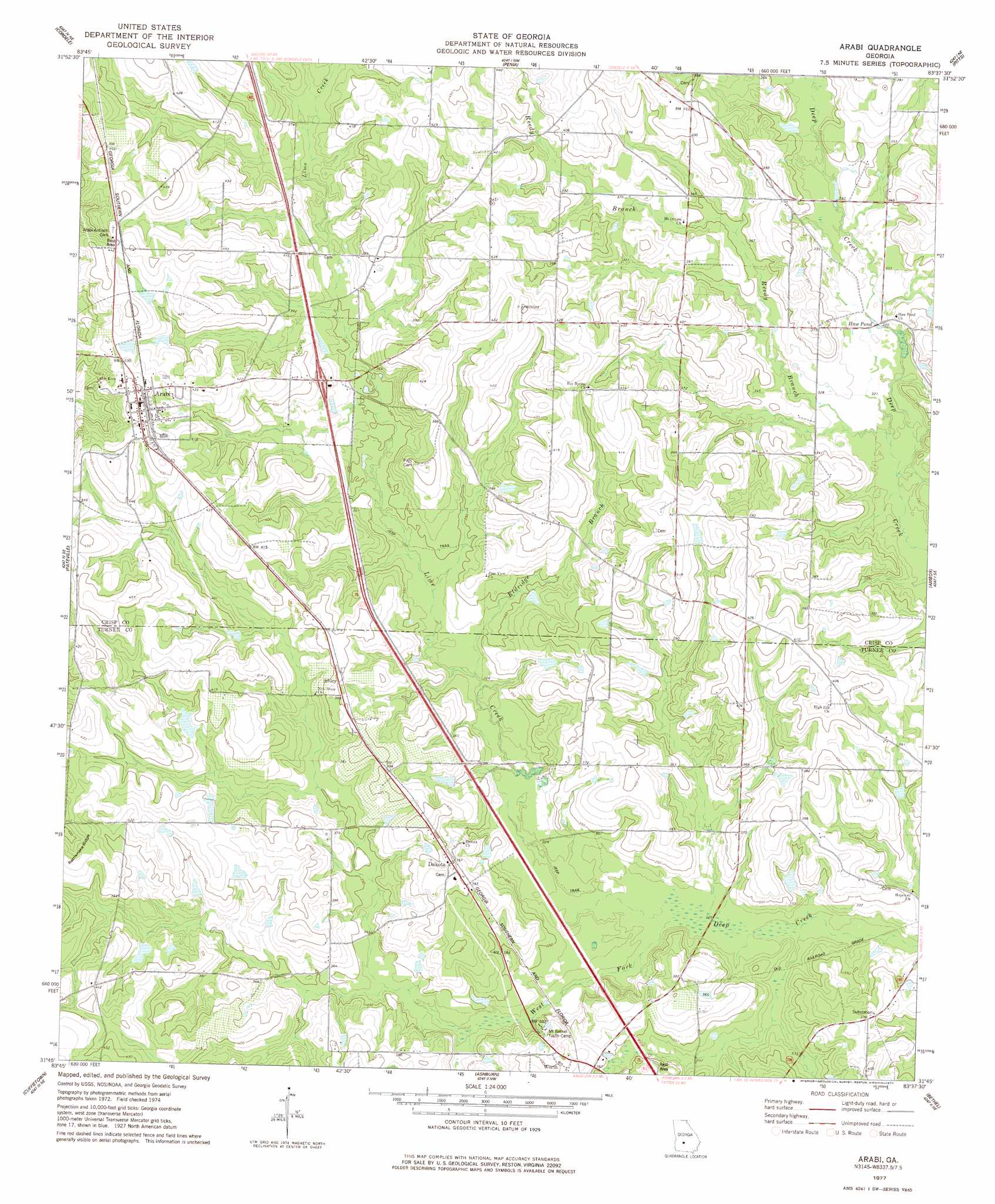
Arabi Topo Map Georgia
To zoom in, hover over the map of Arabi
USGS Topo Quad 31083g6 - 1:24,000 scale
| Topo Map Name: | Arabi |
| USGS Topo Quad ID: | 31083g6 |
| Print Size: | ca. 21 1/4" wide x 27" high |
| Southeast Coordinates: | 31.75° N latitude / 83.625° W longitude |
| Map Center Coordinates: | 31.8125° N latitude / 83.6875° W longitude |
| U.S. State: | GA |
| Filename: | o31083g6.jpg |
| Download Map JPG Image: | Arabi topo map 1:24,000 scale |
| Map Type: | Topographic |
| Topo Series: | 7.5´ |
| Map Scale: | 1:24,000 |
| Source of Map Images: | United States Geological Survey (USGS) |
| Alternate Map Versions: |
Arabi GA 1977, updated 1977 Download PDF Buy paper map Arabi GA 2011 Download PDF Buy paper map Arabi GA 2014 Download PDF Buy paper map |
1:24,000 Topo Quads surrounding Arabi
Drayton |
Vienna |
Pineview Sw |
Pineview West |
Pineview East |
Cobb |
Cordele |
Penia |
Pitts |
Rochelle |
Warwick |
Pateville |
Arabi |
Amboy |
Rebecca |
Doles |
Cuffietown |
Ashburn |
Bethel |
Irwinville |
Acree |
Sylvester |
Sumner |
Chula |
Waterloo |
> Back to 31083e1 at 1:100,000 scale
> Back to 31082a1 at 1:250,000 scale
> Back to U.S. Topo Maps home
Arabi topo map: Gazetteer
Arabi: Crossings
Exit 30 elevation 117m 383′Arabi: Dams
Youngblood Lake Dam elevation 122m 400′Arabi: Lakes
Haw Pond elevation 97m 318′Arabi: Populated Places
Arabi elevation 134m 439′Bedgood elevation 123m 403′
Dakota elevation 123m 403′
Sibley elevation 121m 396′
Worth elevation 119m 390′
Arabi: Post Offices
Arabi Post Office elevation 140m 459′Arabi: Reservoirs
Youngblood Lake elevation 122m 400′Arabi: Ridges
Rattlesnake Ridge elevation 132m 433′Arabi: Streams
Eldridge Branch elevation 99m 324′Lime Creek elevation 97m 318′
Reedy Branch elevation 97m 318′
Arabi: Swamps
Sink of the Creek elevation 97m 318′Arabi digital topo map on disk
Buy this Arabi topo map showing relief, roads, GPS coordinates and other geographical features, as a high-resolution digital map file on DVD: