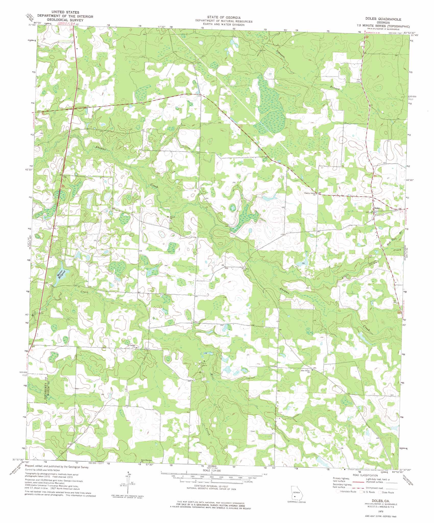
Doles Topo Map Georgia
To zoom in, hover over the map of Doles
USGS Topo Quad 31083f8 - 1:24,000 scale
| Topo Map Name: | Doles |
| USGS Topo Quad ID: | 31083f8 |
| Print Size: | ca. 21 1/4" wide x 27" high |
| Southeast Coordinates: | 31.625° N latitude / 83.875° W longitude |
| Map Center Coordinates: | 31.6875° N latitude / 83.9375° W longitude |
| U.S. State: | GA |
| Filename: | o31083f8.jpg |
| Download Map JPG Image: | Doles topo map 1:24,000 scale |
| Map Type: | Topographic |
| Topo Series: | 7.5´ |
| Map Scale: | 1:24,000 |
| Source of Map Images: | United States Geological Survey (USGS) |
| Alternate Map Versions: |
Doles GA 1973, updated 1975 Download PDF Buy paper map Doles GA 2011 Download PDF Buy paper map Doles GA 2014 Download PDF Buy paper map |
1:24,000 Topo Quads surrounding Doles
Smithville East |
Leslie |
Cobb |
Cordele |
Penia |
Neyami |
Leslie Se |
Warwick |
Pateville |
Arabi |
Leesburg |
Albany Ne |
Doles |
Cuffietown |
Ashburn |
Albany West |
Albany East |
Acree |
Sylvester |
Sumner |
Baconton North |
Putney |
Bridgeboro |
Tempy |
Ty Ty |
> Back to 31083e1 at 1:100,000 scale
> Back to 31082a1 at 1:250,000 scale
> Back to U.S. Topo Maps home
Doles topo map: Gazetteer
Doles: Dams
Mercer Millpond Dam elevation 62m 203′Tison Lake Dam elevation 80m 262′
Doles: Populated Places
Aultmans (historical) elevation 73m 239′Blue Spring (historical) elevation 73m 239′
Doles elevation 83m 272′
Doles: Reservoirs
Mercer Millpond elevation 63m 206′Tison Lake elevation 80m 262′
Doles: Springs
Blue Spring elevation 72m 236′Doles: Streams
Johnson Branch elevation 73m 239′Little Abrams Creek elevation 72m 236′
Red Oak Branch elevation 79m 259′
Doles digital topo map on disk
Buy this Doles topo map showing relief, roads, GPS coordinates and other geographical features, as a high-resolution digital map file on DVD: