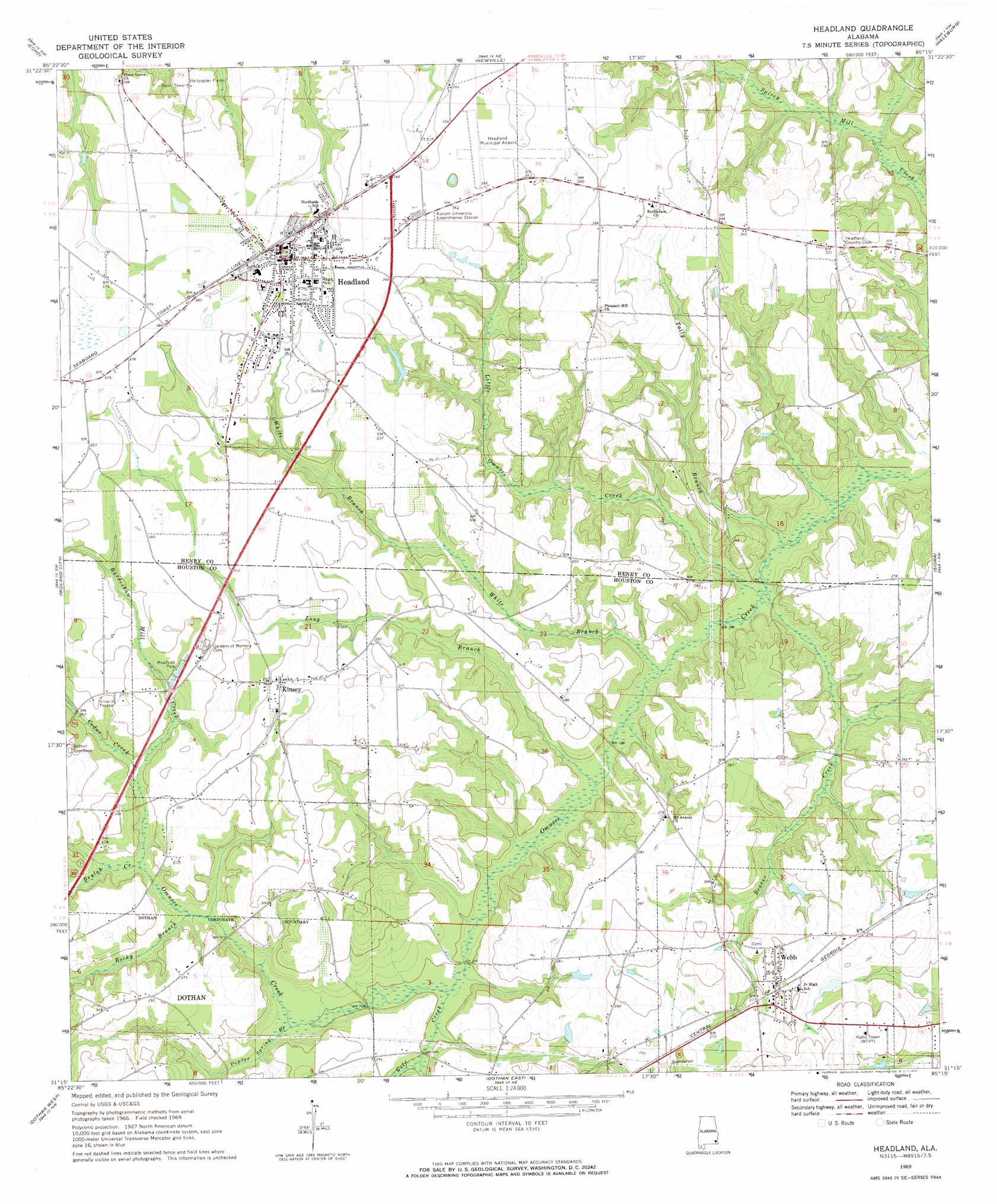
Headland Topo Map Alabama
To zoom in, hover over the map of Headland
USGS Topo Quad 31085c3 - 1:24,000 scale
| Topo Map Name: | Headland |
| USGS Topo Quad ID: | 31085c3 |
| Print Size: | ca. 21 1/4" wide x 27" high |
| Southeast Coordinates: | 31.25° N latitude / 85.25° W longitude |
| Map Center Coordinates: | 31.3125° N latitude / 85.3125° W longitude |
| U.S. State: | AL |
| Filename: | o31085c3.jpg |
| Download Map JPG Image: | Headland topo map 1:24,000 scale |
| Map Type: | Topographic |
| Topo Series: | 7.5´ |
| Map Scale: | 1:24,000 |
| Source of Map Images: | United States Geological Survey (USGS) |
| Alternate Map Versions: |
Headland AL 1969, updated 1971 Download PDF Buy paper map Headland AL 2011 Download PDF Buy paper map Headland AL 2014 Download PDF Buy paper map |
1:24,000 Topo Quads surrounding Headland
Skipperville |
Clopton |
Abbeville West |
Abbeville East |
Fort Gaines |
Ewell |
Echo |
Newville |
Haleburg |
Columbia Ne |
Pinckard |
Midland City |
Headland |
Sigma |
Columbia |
Malvern |
Dothan West |
Dothan East |
Ashford |
Gordon |
Slocomb |
Madrid |
Cottonwood |
Grangeburg |
Saffold |
> Back to 31085a1 at 1:100,000 scale
> Back to 31084a1 at 1:250,000 scale
> Back to U.S. Topo Maps home
Headland topo map: Gazetteer
Headland: Airports
Headland Municipal Airport elevation 107m 351′Headland: Populated Places
Headland elevation 116m 380′Kinsey elevation 92m 301′
Southgate elevation 116m 380′
Walden Pond Estates elevation 106m 347′
Webb elevation 85m 278′
Headland: Post Offices
Webb Post Office elevation 88m 288′Headland: Streams
Beaver Creek elevation 53m 173′Beulah Creek elevation 68m 223′
Burdeshaw Mill Creek elevation 73m 239′
Cedar Creek elevation 71m 232′
Crawford Creek elevation 59m 193′
Golf Creek elevation 60m 196′
Little Omusee Creek elevation 53m 173′
Long Branch elevation 56m 183′
Poplar Spring Branch elevation 62m 203′
Rocky Branch elevation 66m 216′
Tally Branch elevation 52m 170′
White Branch elevation 54m 177′
Headland digital topo map on disk
Buy this Headland topo map showing relief, roads, GPS coordinates and other geographical features, as a high-resolution digital map file on DVD:
Gulf Coast (LA, MS, AL, FL) & Southwestern Georgia
Buy digital topo maps: Gulf Coast (LA, MS, AL, FL) & Southwestern Georgia
 & Southwestern Georgia map DVD")