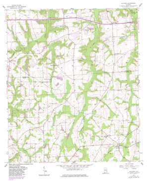
Malvern Topo Map Alabama
To zoom in, hover over the map of Malvern
USGS Topo Quad 31085b5 - 1:24,000 scale
| Topo Map Name: | Malvern |
| USGS Topo Quad ID: | 31085b5 |
| Print Size: | ca. 21 1/4" wide x 27" high |
| Southeast Coordinates: | 31.125° N latitude / 85.5° W longitude |
| Map Center Coordinates: | 31.1875° N latitude / 85.5625° W longitude |
| U.S. State: | AL |
| Filename: | o31085b5.jpg |
| Download Map JPG Image: | Malvern topo map 1:24,000 scale |
| Map Type: | Topographic |
| Topo Series: | 7.5´ |
| Map Scale: | 1:24,000 |
| Source of Map Images: | United States Geological Survey (USGS) |
| Alternate Map Versions: |
Malvern AL 1957 Download PDF Buy paper map Malvern AL 1957, updated 1959 Download PDF Buy paper map Malvern AL 1957, updated 1981 Download PDF Buy paper map Malvern AL 2011 Download PDF Buy paper map Malvern AL 2014 Download PDF Buy paper map |
1:24,000 Topo Quads surrounding Malvern
> Back to 31085a1 at 1:100,000 scale
> Back to 31084a1 at 1:250,000 scale
> Back to U.S. Topo Maps home
Malvern topo map: Gazetteer
Malvern: Dams
Emmett Sellers Dam elevation 81m 265′Hosea Mathis Dam elevation 84m 275′
Pasco Davis Dam elevation 83m 272′
Malvern: Populated Places
Bailey Crossroads elevation 94m 308′Malvern elevation 86m 282′
Wicksburg elevation 93m 305′
Malvern: Post Offices
Malvern Post Office elevation 89m 291′Malvern: Reservoirs
Emmett Sellers Lake elevation 81m 265′Hosea Mathis Lake elevation 84m 275′
Malvern: Streams
Buzzard Bay Branch elevation 70m 229′Gilley Mill Creek elevation 61m 200′
Goodwater Branch elevation 67m 219′
Hatband Creek elevation 63m 206′
Jack Ward Branch elevation 70m 229′
Newton Creek elevation 60m 196′
Sasser Branch elevation 67m 219′
Malvern digital topo map on disk
Buy this Malvern topo map showing relief, roads, GPS coordinates and other geographical features, as a high-resolution digital map file on DVD:
Gulf Coast (LA, MS, AL, FL) & Southwestern Georgia
Buy digital topo maps: Gulf Coast (LA, MS, AL, FL) & Southwestern Georgia


