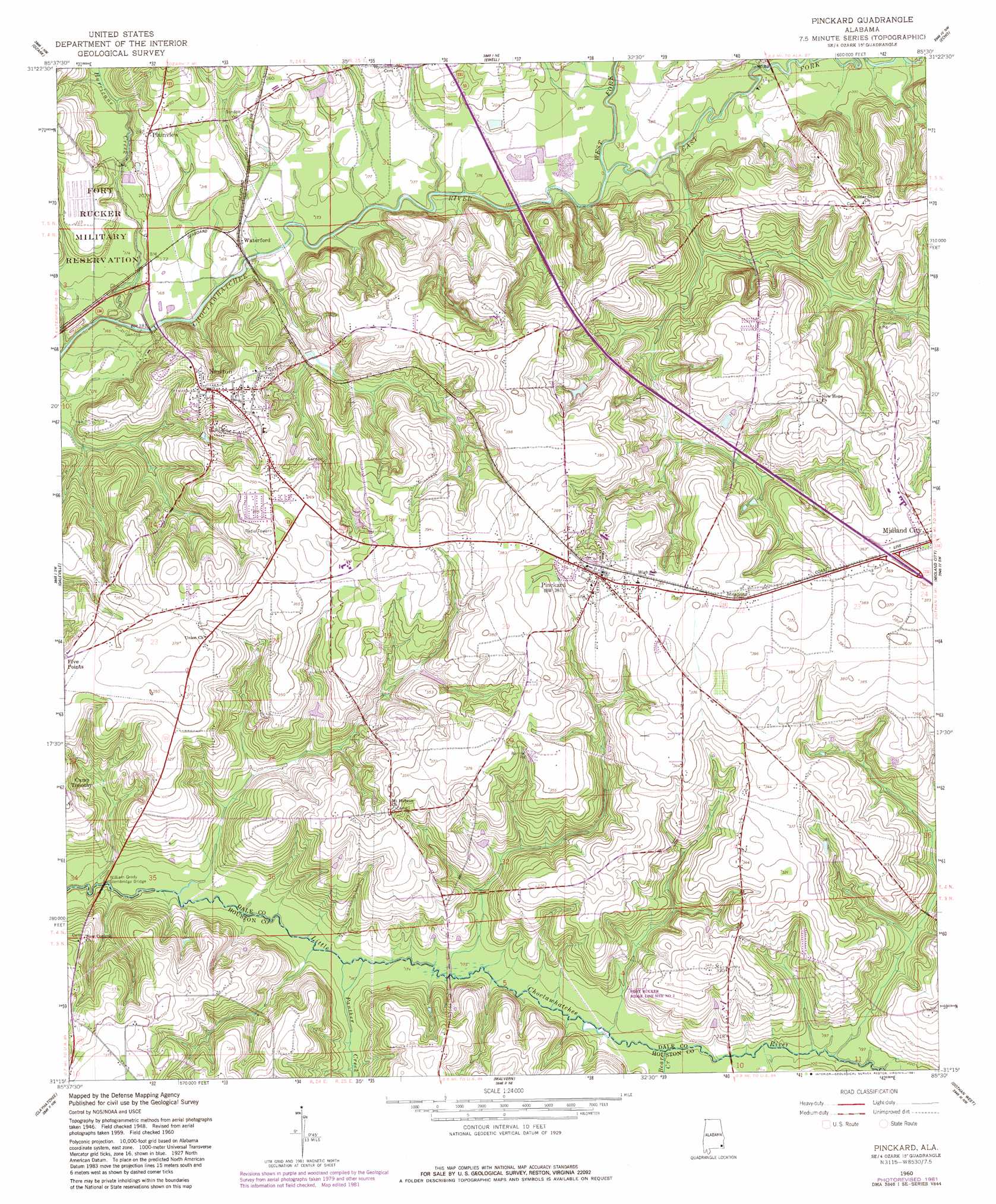
Pinckard Topo Map Alabama
To zoom in, hover over the map of Pinckard
USGS Topo Quad 31085c5 - 1:24,000 scale
| Topo Map Name: | Pinckard |
| USGS Topo Quad ID: | 31085c5 |
| Print Size: | ca. 21 1/4" wide x 27" high |
| Southeast Coordinates: | 31.25° N latitude / 85.5° W longitude |
| Map Center Coordinates: | 31.3125° N latitude / 85.5625° W longitude |
| U.S. State: | AL |
| Filename: | o31085c5.jpg |
| Download Map JPG Image: | Pinckard topo map 1:24,000 scale |
| Map Type: | Topographic |
| Topo Series: | 7.5´ |
| Map Scale: | 1:24,000 |
| Source of Map Images: | United States Geological Survey (USGS) |
| Alternate Map Versions: |
Pinckard AL 1960, updated 1963 Download PDF Buy paper map Pinckard AL 1960, updated 1979 Download PDF Buy paper map Pinckard AL 1960, updated 1981 Download PDF Buy paper map Pinckard AL 2011 Download PDF Buy paper map Pinckard AL 2014 Download PDF Buy paper map |
1:24,000 Topo Quads surrounding Pinckard
Brundidge Se |
Ariton |
Skipperville |
Clopton |
Abbeville West |
Enterprise Ne |
Ozark |
Ewell |
Echo |
Newville |
Enterprise |
Daleville |
Pinckard |
Midland City |
Headland |
Bellwood |
Clayhatchee |
Malvern |
Dothan West |
Dothan East |
Geneva East |
Hartford |
Slocomb |
Madrid |
Cottonwood |
> Back to 31085a1 at 1:100,000 scale
> Back to 31084a1 at 1:250,000 scale
> Back to U.S. Topo Maps home
Pinckard topo map: Gazetteer
Pinckard: Bridges
William Grady Stembridge Bridge elevation 45m 147′Woodham Bridge elevation 49m 160′
Pinckard: Populated Places
Newton elevation 97m 318′Pinckard elevation 106m 347′
Plainview elevation 71m 232′
Waterford elevation 52m 170′
Pinckard: Post Offices
Pinckard Post Office (historical) elevation 114m 374′Pinckard: Streams
Alexander Creek elevation 54m 177′Bear Creek elevation 54m 177′
Camp Creek elevation 57m 187′
East Fork Choctawhatchee River elevation 50m 164′
Gin Branch elevation 44m 144′
Harrison Mill Creek elevation 58m 190′
Hurricane Creek elevation 45m 147′
Kelly Creek elevation 51m 167′
Killebrew Factory Creek elevation 45m 147′
Mossy Camp Branch elevation 48m 157′
Panther Creek elevation 51m 167′
Poley Branch elevation 43m 141′
Prestons Mill Branch elevation 48m 157′
Soapstone Branch elevation 54m 177′
West Fork Choctawhatchee River elevation 50m 164′
Pinckard digital topo map on disk
Buy this Pinckard topo map showing relief, roads, GPS coordinates and other geographical features, as a high-resolution digital map file on DVD:
Gulf Coast (LA, MS, AL, FL) & Southwestern Georgia
Buy digital topo maps: Gulf Coast (LA, MS, AL, FL) & Southwestern Georgia
 & Southwestern Georgia map DVD")