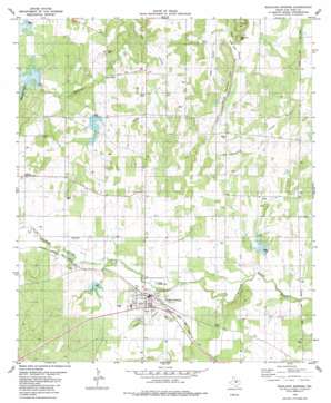
Richland Springs Topo Map Texas
To zoom in, hover over the map of Richland Springs
USGS Topo Quad 31098c8 - 1:24,000 scale
| Topo Map Name: | Richland Springs |
| USGS Topo Quad ID: | 31098c8 |
| Print Size: | ca. 21 1/4" wide x 27" high |
| Southeast Coordinates: | 31.25° N latitude / 98.875° W longitude |
| Map Center Coordinates: | 31.3125° N latitude / 98.9375° W longitude |
| U.S. State: | TX |
| Filename: | o31098c8.jpg |
| Download Map JPG Image: | Richland Springs topo map 1:24,000 scale |
| Map Type: | Topographic |
| Topo Series: | 7.5´ |
| Map Scale: | 1:24,000 |
| Source of Map Images: | United States Geological Survey (USGS) |
| Alternate Map Versions: |
Richland Springs TX 1979, updated 1980 Download PDF Buy paper map Richland Springs TX 2010 Download PDF Buy paper map Richland Springs TX 2012 Download PDF Buy paper map Richland Springs TX 2016 Download PDF Buy paper map |
1:24,000 Topo Quads surrounding Richland Springs
> Back to 31098a1 at 1:100,000 scale
> Back to 31098a1 at 1:250,000 scale
> Back to U.S. Topo Maps home
Richland Springs topo map: Gazetteer
Richland Springs: Dams
Soil Conservation Service Site 7 Dam elevation 420m 1377′Soil Conservation Service Site 8 Dam elevation 435m 1427′
Soil Conservation Service Site 8a-1 Dam elevation 414m 1358′
Soil Conservation Service Site 9 Dam elevation 414m 1358′
Soil Conservation Service Site 9 Dam elevation 405m 1328′
Richland Springs: Gaps
Hog Pass elevation 402m 1318′Richland Springs: Populated Places
Richland Springs elevation 429m 1407′Skeeterville elevation 411m 1348′
Richland Springs: Reservoirs
Lower San Saba Watershed Reservoir elevation 410m 1345′Lower San Saba Watershed Reservoir elevation 434m 1423′
Soil Conservation Service Site 7 Reservoir elevation 420m 1377′
Soil Conservation Service Site 8 Reservoir elevation 435m 1427′
Soil Conservation Service Site 8a-1 Reservoir elevation 414m 1358′
Soil Conservation Service Site 9 Reservoir elevation 405m 1328′
Soil Conservation Service Site 9 Reservoir elevation 414m 1358′
Southeast Laterals Watershed Reservoir Number 7 elevation 424m 1391′
Southeast Laterals Watershed Reservoir Number 8 elevation 418m 1371′
Southeast Laterals Watershed Reservoir Number 9 elevation 414m 1358′
Richland Springs: Ridges
Shiloh Mountain Chain elevation 440m 1443′Richland Springs: Springs
Richland Springs elevation 420m 1377′Richland Springs: Streams
Mountain Creek elevation 420m 1377′Richland Springs: Summits
Barnett Hill elevation 428m 1404′Locker Hill elevation 437m 1433′
Richland Springs: Valleys
Hogg Hollow elevation 399m 1309′Hooten Hollow elevation 416m 1364′
Richland Springs digital topo map on disk
Buy this Richland Springs topo map showing relief, roads, GPS coordinates and other geographical features, as a high-resolution digital map file on DVD:


