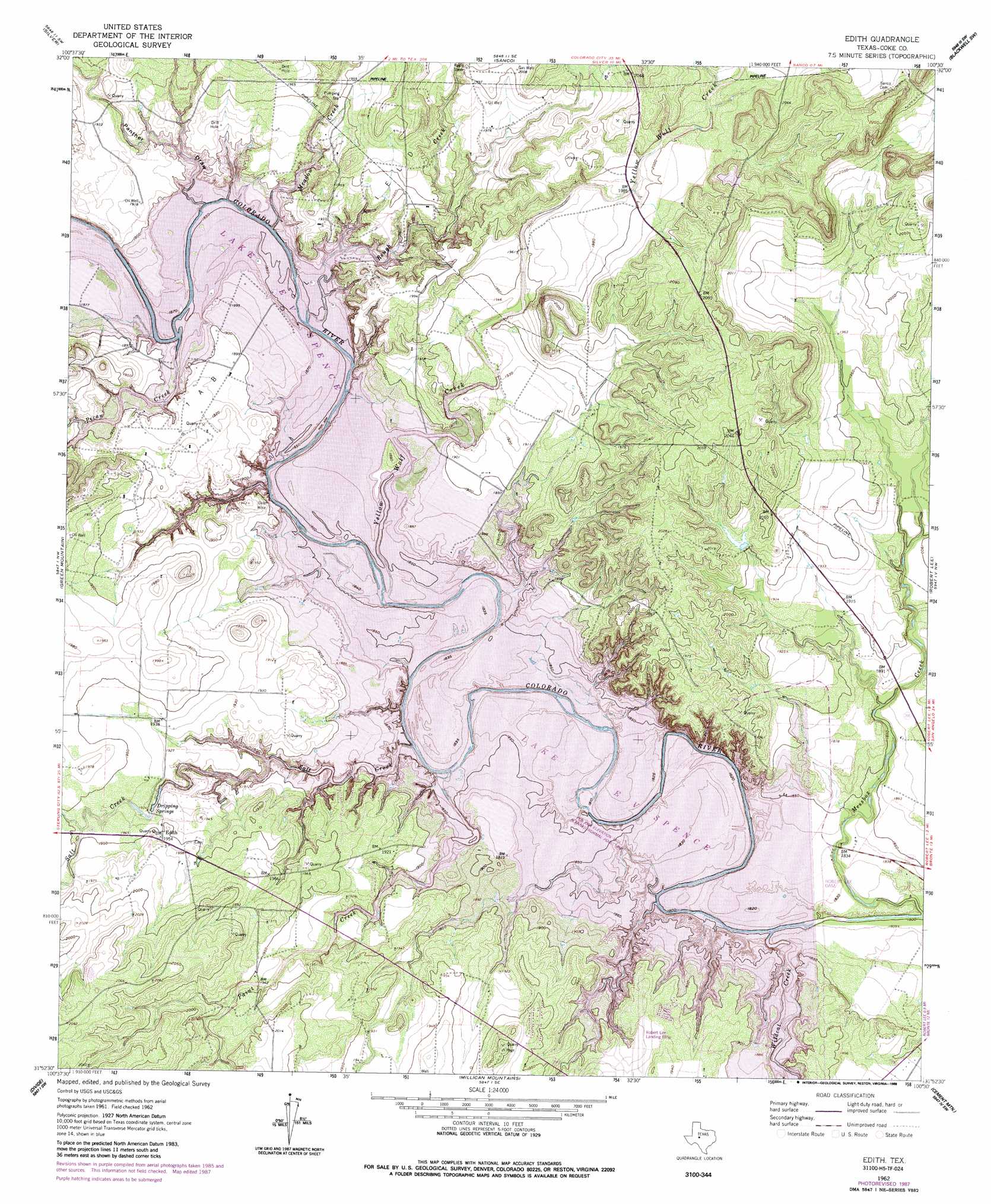
Edith Topo Map Texas
To zoom in, hover over the map of Edith
USGS Topo Quad 31100h5 - 1:24,000 scale
| Topo Map Name: | Edith |
| USGS Topo Quad ID: | 31100h5 |
| Print Size: | ca. 21 1/4" wide x 27" high |
| Southeast Coordinates: | 31.875° N latitude / 100.5° W longitude |
| Map Center Coordinates: | 31.9375° N latitude / 100.5625° W longitude |
| U.S. State: | TX |
| Filename: | o31100h5.jpg |
| Download Map JPG Image: | Edith topo map 1:24,000 scale |
| Map Type: | Topographic |
| Topo Series: | 7.5´ |
| Map Scale: | 1:24,000 |
| Source of Map Images: | United States Geological Survey (USGS) |
| Alternate Map Versions: |
Edith TX 1962, updated 1964 Download PDF Buy paper map Edith TX 1962, updated 1988 Download PDF Buy paper map Edith TX 2010 Download PDF Buy paper map Edith TX 2013 Download PDF Buy paper map Edith TX 2016 Download PDF Buy paper map |
1:24,000 Topo Quads surrounding Edith
Pecan Crossing |
Dam Draw |
Dew Drop Creek |
Maryneal |
Blackwell Ne |
Dead Indian Mountain |
Silver |
Sanco |
Blackwell Sw |
Blackwell |
Crawford Slide |
Green Mountain |
Edith |
Robert Lee |
Bronte |
Broome |
Divide |
Millican Mountains |
Cement Mountain |
Shawville |
Dog Creek Ne |
Water Valley |
Murph Draw |
Pecan Mott |
Tennyson |
> Back to 31100e1 at 1:100,000 scale
> Back to 31100a1 at 1:250,000 scale
> Back to U.S. Topo Maps home
Edith topo map: Gazetteer
Edith: Airports
Robert Lee Airport elevation 583m 1912′Edith: Bends
Elm Bend elevation 579m 1899′Edith: Dams
Robert Lee Dam elevation 560m 1837′Edith: Oilfields
I A B Oil Field elevation 579m 1899′Edith: Parks
Lake View Park elevation 593m 1945′Paint Creek Park elevation 589m 1932′
Rough Creek Park elevation 595m 1952′
Wildcat Creek Park elevation 588m 1929′
Edith: Populated Places
Edith elevation 597m 1958′Edith: Reservoirs
E V Spence Reservoir elevation 549m 1801′Lake E V Spence elevation 560m 1837′
Edith: Springs
Dripping Springs elevation 582m 1909′Edith: Streams
Meadow Creek elevation 579m 1899′Paint Creek elevation 580m 1902′
Rough Creek elevation 579m 1899′
Salt Creek elevation 581m 1906′
Wildcat Creek elevation 579m 1899′
Yellow Wolf Creek elevation 579m 1899′
Edith: Valleys
Panther Draw elevation 581m 1906′Edith digital topo map on disk
Buy this Edith topo map showing relief, roads, GPS coordinates and other geographical features, as a high-resolution digital map file on DVD: