Mcrae Nw Topo Map Georgia
To zoom in, hover over the map of Mcrae Nw
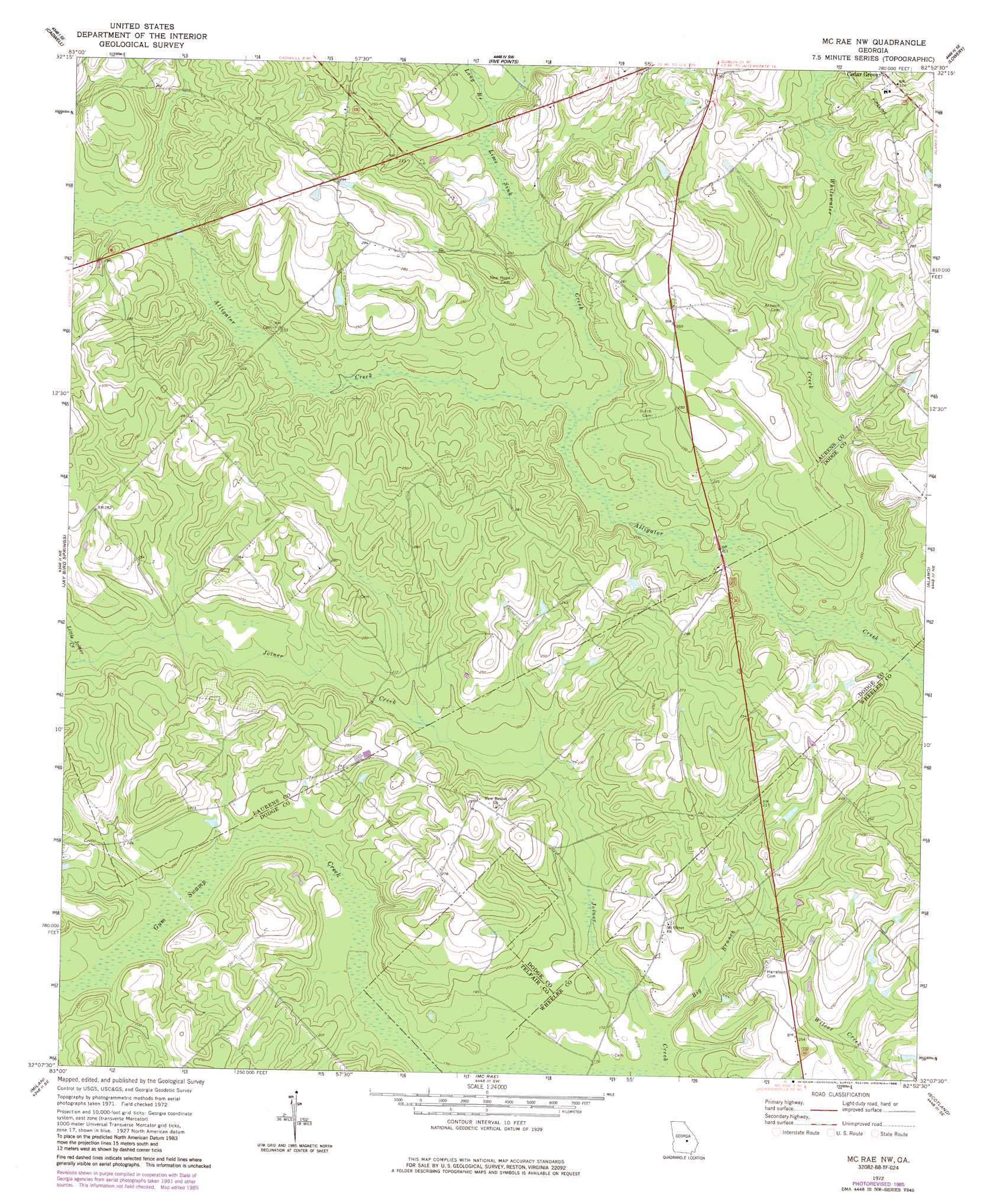
USGS Topo Quad 32082b8 - 1:24,000 scale
| Topo Map Name: | Mcrae Nw |
| USGS Topo Quad ID: | 32082b8 |
| Print Size: | ca. 21 1/4" wide x 27" high |
| Southeast Coordinates: | 32.125° N latitude / 82.875° W longitude |
| Map Center Coordinates: | 32.1875° N latitude / 82.9375° W longitude |
| U.S. State: | GA |
| Filename: | o32082b8.jpg |
| Download Map JPG Image: | Mcrae Nw topo map 1:24,000 scale |
| Map Type: | Topographic |
| Topo Series: | 7.5´ |
| Map Scale: | 1:24,000 |
| Source of Map Images: | United States Geological Survey (USGS) |
| Alternate Map Versions: |
Mc Rae NW GA 1972, updated 1975 Download PDF Buy paper map Mc Rae NW GA 1972, updated 1986 Download PDF Buy paper map McRae NW GA 2011 Download PDF Buy paper map McRae NW GA 2014 Download PDF Buy paper map |
1:24,000 Topo Quads surrounding Mcrae Nw
Chester |
Dexter |
Rentz |
Minter |
Rockledge |
Yonkers |
Cadwell |
Five Points |
Lowery |
Lothair |
Eastman |
Jay Bird Springs |
Mcrae Nw |
Alamo |
Glenwood |
Lake Cypress |
Milan |
Mcrae |
Scotland |
Jordan |
Rhine |
Cooks Still |
Workmore |
Jacksonville Ne |
Lumber City |
> Back to 32082a1 at 1:100,000 scale
> Back to 32082a1 at 1:250,000 scale
> Back to U.S. Topo Maps home
Mcrae Nw topo map: Gazetteer
Mcrae Nw: Bridges
Doctor Alfred Tennyson Coleman Memorial Bridge elevation 57m 187′Mcrae Nw: Populated Places
Sigurd (historical) elevation 59m 193′Mcrae Nw: Streams
Big Branch elevation 51m 167′Lime Sink Creek elevation 59m 193′
Little Joiner Creek elevation 67m 219′
Long Branch elevation 66m 216′
Whitewater Creek elevation 55m 180′
Mcrae Nw digital topo map on disk
Buy this Mcrae Nw topo map showing relief, roads, GPS coordinates and other geographical features, as a high-resolution digital map file on DVD:
South Carolina, Western North Carolina & Northeastern Georgia
Buy digital topo maps: South Carolina, Western North Carolina & Northeastern Georgia