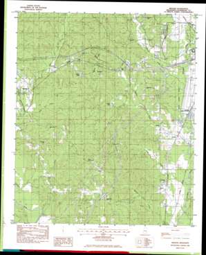
Meehan Topo Map Mississippi
To zoom in, hover over the map of Meehan
USGS Topo Quad 32088c7 - 1:24,000 scale
| Topo Map Name: | Meehan |
| USGS Topo Quad ID: | 32088c7 |
| Print Size: | ca. 21 1/4" wide x 27" high |
| Southeast Coordinates: | 32.25° N latitude / 88.75° W longitude |
| Map Center Coordinates: | 32.3125° N latitude / 88.8125° W longitude |
| U.S. State: | MS |
| Filename: | o32088c7.jpg |
| Download Map JPG Image: | Meehan topo map 1:24,000 scale |
| Map Type: | Topographic |
| Topo Series: | 7.5´ |
| Map Scale: | 1:24,000 |
| Source of Map Images: | United States Geological Survey (USGS) |
| Alternate Map Versions: |
Meehan MS 1982, updated 1983 Download PDF Buy paper map Meehan MS 2012 Download PDF Buy paper map Meehan MS 2015 Download PDF Buy paper map |
1:24,000 Topo Quads surrounding Meehan
> Back to 32088a1 at 1:100,000 scale
> Back to 32088a1 at 1:250,000 scale
> Back to U.S. Topo Maps home
Meehan topo map: Gazetteer
Meehan: Airports
Key Field elevation 88m 288′Meehan: Crossings
Interchange 129 elevation 128m 419′Interchange 142 elevation 146m 479′
Meehan: Dams
Burwell Lake Dam elevation 135m 442′Doctor Slaughter Lake Dam elevation 121m 396′
National Fish Hatchery Ponds Dam elevation 85m 278′
P Coleman Pond Dam elevation 141m 462′
Pigford Lake Dam elevation 122m 400′
R Johnson Lake Dam elevation 81m 265′
Ullyses Lee Pond Dam elevation 121m 396′
Meehan: Lakes
Burwell Lake elevation 110m 360′Meehan: Populated Places
Arunde elevation 86m 282′Graham elevation 95m 311′
Lost Gap elevation 108m 354′
Meehan elevation 103m 337′
Savoy elevation 87m 285′
Sterling elevation 98m 321′
Meehan: Reservoirs
O'Neil Lake elevation 106m 347′Pigford Lake elevation 110m 360′
Usher Lake elevation 101m 331′
Meehan: Springs
Arundel Spring elevation 91m 298′Fairchild Springs elevation 102m 334′
Meehan: Streams
Allen Creek elevation 79m 259′Burwell Creek elevation 84m 275′
Cow Creek elevation 85m 278′
Hognose Creek elevation 84m 275′
Little Creek elevation 79m 259′
Rock Creek elevation 85m 278′
Sowashee Creek elevation 82m 269′
Meehan: Summits
Tunnel Hill elevation 141m 462′Meehan digital topo map on disk
Buy this Meehan topo map showing relief, roads, GPS coordinates and other geographical features, as a high-resolution digital map file on DVD:
Gulf Coast (LA, MS, AL, FL) & Southwestern Georgia
Buy digital topo maps: Gulf Coast (LA, MS, AL, FL) & Southwestern Georgia


