Crowville Topo Map Louisiana
To zoom in, hover over the map of Crowville
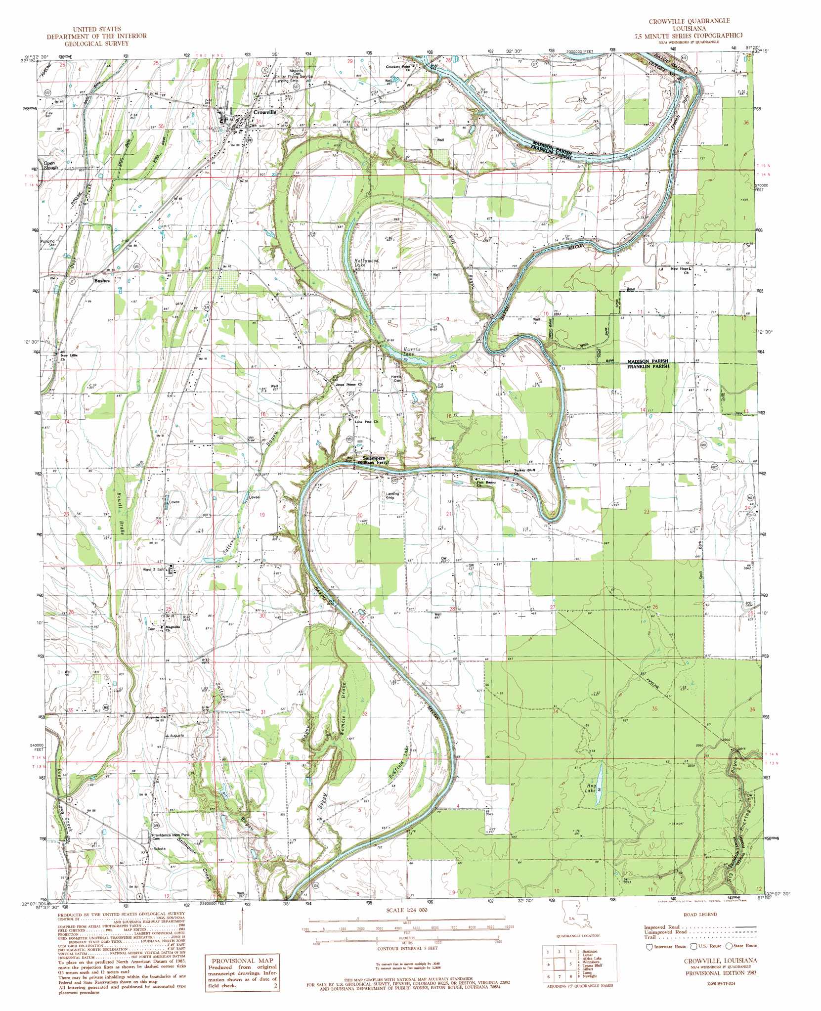
USGS Topo Quad 32091b5 - 1:24,000 scale
| Topo Map Name: | Crowville |
| USGS Topo Quad ID: | 32091b5 |
| Print Size: | ca. 21 1/4" wide x 27" high |
| Southeast Coordinates: | 32.125° N latitude / 91.5° W longitude |
| Map Center Coordinates: | 32.1875° N latitude / 91.5625° W longitude |
| U.S. State: | LA |
| Filename: | o32091b5.jpg |
| Download Map JPG Image: | Crowville topo map 1:24,000 scale |
| Map Type: | Topographic |
| Topo Series: | 7.5´ |
| Map Scale: | 1:24,000 |
| Source of Map Images: | United States Geological Survey (USGS) |
| Alternate Map Versions: |
Crowville LA 1983, updated 1984 Download PDF Buy paper map Crowville LA 1983, updated 1986 Download PDF Buy paper map Crowville LA 2012 Download PDF Buy paper map Crowville LA 2015 Download PDF Buy paper map |
1:24,000 Topo Quads surrounding Crowville
Rayville |
Bee Bayou |
Dunn |
Africa Lake |
Tendal |
Mangham |
Baskinton |
Lamar |
Indian Lake |
Waverly Se |
Liddieville |
Winnsboro |
Crowville |
Tensas Bluff |
Westwood |
Fort Necessity |
Gilbert |
Como |
Newlight |
Saranac |
Extension |
Wisner |
Oakley |
Gretna Green |
Lake Bruin |
> Back to 32091a1 at 1:100,000 scale
> Back to 32090a1 at 1:250,000 scale
> Back to U.S. Topo Maps home
Crowville topo map: Gazetteer
Crowville: Airports
Collier Flying Service Landing Strip elevation 27m 88′Crowville: Bends
French Turn elevation 23m 75′Crowville: Channels
Bayou Macon Cutoff Number 2 elevation 18m 59′Crowville: Crossings
Brannin Ferry (historical) elevation 15m 49′Egypt Ferry (historical) elevation 15m 49′
Crowville: Guts
Boggy Bayou elevation 22m 72′Mill Bayou elevation 19m 62′
Sallers Bayou elevation 26m 85′
Crowville: Lakes
Harris Lake elevation 18m 59′Hog Lake elevation 17m 55′
Hollywood Lake elevation 19m 62′
Redfield Lake elevation 21m 68′
Crowville: Oilfields
Egypt Ferry Gas Field elevation 21m 68′Crowville: Populated Places
Bushes elevation 27m 88′Chelly Landing elevation 21m 68′
Crowville elevation 27m 88′
Swampers elevation 26m 85′
Crowville: Streams
Deep Bayou elevation 21m 68′Hurricane Bayou elevation 27m 88′
Crowville: Swamps
Boggy Womble Brake elevation 20m 65′Howell Brake elevation 24m 78′
Crowville digital topo map on disk
Buy this Crowville topo map showing relief, roads, GPS coordinates and other geographical features, as a high-resolution digital map file on DVD: