Indian Lake Topo Map Louisiana
To zoom in, hover over the map of Indian Lake
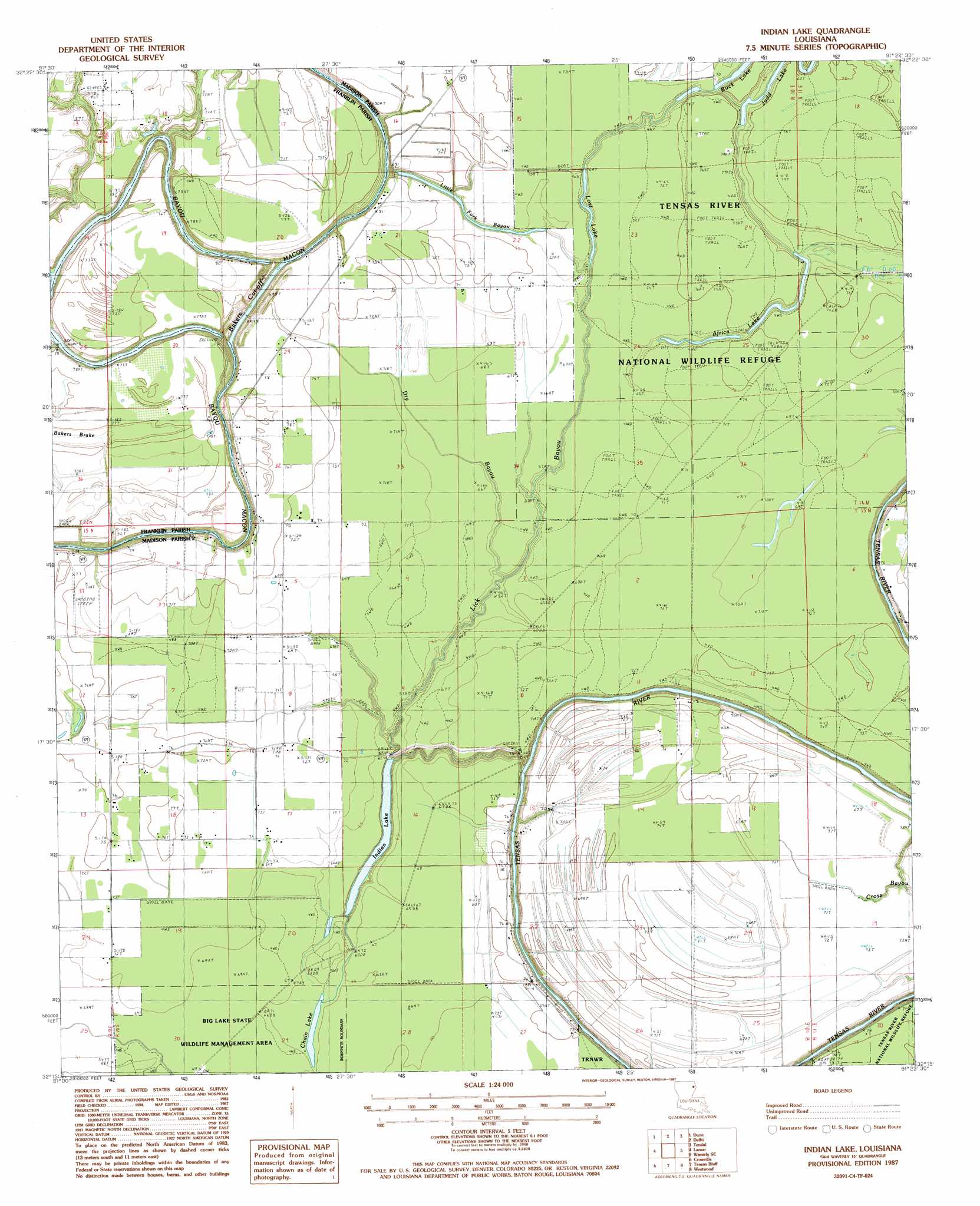
USGS Topo Quad 32091c4 - 1:24,000 scale
| Topo Map Name: | Indian Lake |
| USGS Topo Quad ID: | 32091c4 |
| Print Size: | ca. 21 1/4" wide x 27" high |
| Southeast Coordinates: | 32.25° N latitude / 91.375° W longitude |
| Map Center Coordinates: | 32.3125° N latitude / 91.4375° W longitude |
| U.S. State: | LA |
| Filename: | o32091c4.jpg |
| Download Map JPG Image: | Indian Lake topo map 1:24,000 scale |
| Map Type: | Topographic |
| Topo Series: | 7.5´ |
| Map Scale: | 1:24,000 |
| Source of Map Images: | United States Geological Survey (USGS) |
| Alternate Map Versions: |
Indian Lake LA 1987, updated 1987 Download PDF Buy paper map Indian Lake LA 1998, updated 2002 Download PDF Buy paper map Indian Lake LA 2012 Download PDF Buy paper map Indian Lake LA 2015 Download PDF Buy paper map |
1:24,000 Topo Quads surrounding Indian Lake
Whitney Island South |
Congo Creek |
Epps |
Panther Lake |
Sondheimer |
Bee Bayou |
Dunn |
Africa Lake |
Tendal |
Tallulah |
Baskinton |
Lamar |
Indian Lake |
Waverly Se |
Fortune Fork |
Winnsboro |
Crowville |
Tensas Bluff |
Westwood |
Somerset |
Gilbert |
Como |
Newlight |
Saranac |
Newellton |
> Back to 32091a1 at 1:100,000 scale
> Back to 32090a1 at 1:250,000 scale
> Back to U.S. Topo Maps home
Indian Lake topo map: Gazetteer
Indian Lake: Bridges
Low Water Bridge elevation 14m 45′Indian Lake: Channels
Bakers Cut-off elevation 15m 49′Indian Lake: Guts
Butler Landing elevation 23m 75′Dry Bayou elevation 20m 65′
Lick Bayou elevation 19m 62′
Little Fork Bayou elevation 22m 72′
Indian Lake: Lakes
Africa Lake elevation 21m 68′Chain Lake elevation 20m 65′
Indian Lake elevation 15m 49′
Judd Lake elevation 20m 65′
Lost Lake elevation 20m 65′
Indian Lake: Populated Places
Jackson Landing elevation 16m 52′Indian Lake digital topo map on disk
Buy this Indian Lake topo map showing relief, roads, GPS coordinates and other geographical features, as a high-resolution digital map file on DVD: