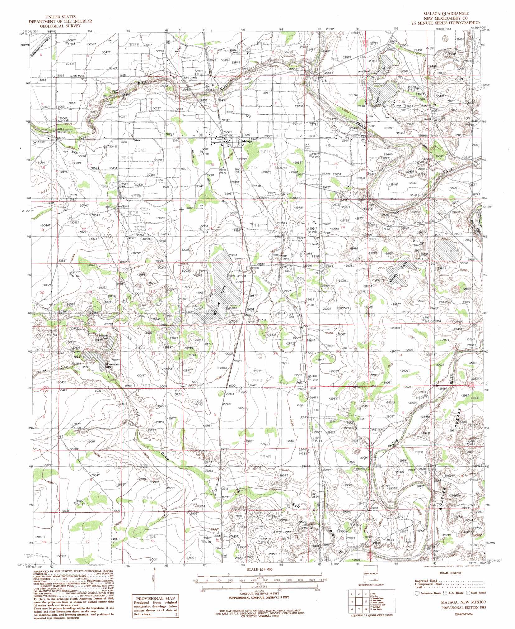
Malaga Topo Map New Mexico
To zoom in, hover over the map of Malaga
USGS Topo Quad 32104b1 - 1:24,000 scale
| Topo Map Name: | Malaga |
| USGS Topo Quad ID: | 32104b1 |
| Print Size: | ca. 21 1/4" wide x 27" high |
| Southeast Coordinates: | 32.125° N latitude / 104° W longitude |
| Map Center Coordinates: | 32.1875° N latitude / 104.0625° W longitude |
| U.S. State: | NM |
| Filename: | o32104b1.jpg |
| Download Map JPG Image: | Malaga topo map 1:24,000 scale |
| Map Type: | Topographic |
| Topo Series: | 7.5´ |
| Map Scale: | 1:24,000 |
| Source of Map Images: | United States Geological Survey (USGS) |
| Alternate Map Versions: |
Malaga NM 1985, updated 1985 Download PDF Buy paper map Malaga NM 2010 Download PDF Buy paper map Malaga NM 2013 Download PDF Buy paper map Malaga NM 2017 Download PDF Buy paper map |
1:24,000 Topo Quads surrounding Malaga
Carlsbad West |
Carlsbad East |
Indian Flats |
Tower Hill South |
Livingston Ridge |
Kitchen Cove |
Otis |
Loving |
Remuda Basin |
Los Medanos |
Black River Village |
Bond Draw |
Malaga |
Pierce Canyon |
Big Sinks |
Jumping Spring |
Cottonwood Hills |
Red Bluff |
Ross Ranch |
Phatom Banks |
Outlaw Spring |
Owl Hills |
Screw Bean Draw Ne |
Red Bluff |
Orla Ne |
> Back to 32104a1 at 1:100,000 scale
> Back to 32104a1 at 1:250,000 scale
> Back to U.S. Topo Maps home
Malaga topo map: Gazetteer
Malaga: Dams
Harroun Lake Dam elevation 900m 2952′Willow Lake Dam elevation 905m 2969′
Malaga: Lakes
Horseshoe Lake elevation 908m 2979′Mexican Lake elevation 905m 2969′
Queen Lake elevation 883m 2896′
Malaga: Parks
Espejos Trail Historical Marker elevation 916m 3005′Malaga: Populated Places
Harroun Crossing elevation 895m 2936′Lookout (historical) elevation 930m 3051′
Lookout Crossing elevation 932m 3057′
Malaga elevation 916m 3005′
Malaga: Post Offices
Malaga Post Office elevation 916m 3005′Malaga: Reservoirs
Willow Lake elevation 905m 2969′Malaga: Streams
Black River elevation 890m 2919′Willow Creek Ditch elevation 915m 3001′
Malaga: Valleys
China Draw elevation 914m 2998′Salt Draw elevation 878m 2880′
Malaga: Wells
Chinaberry Well elevation 912m 2992′Donaldson Well elevation 919m 3015′
Kelly Well elevation 930m 3051′
Salt Draw Well elevation 891m 2923′
South Donaldson Well elevation 910m 2985′
South Reed Well elevation 902m 2959′
Malaga digital topo map on disk
Buy this Malaga topo map showing relief, roads, GPS coordinates and other geographical features, as a high-resolution digital map file on DVD: