Carlsbad Topo Map New Mexico
To zoom in, hover over the map of Carlsbad
USGS Topo Map 32104a1 - 1:100,000 scale
| Topo Map Name: | Carlsbad |
| USGS Topo Quad ID: | 32104a1 |
| Print Size: | ca. 39" wide x 24" high |
| Southeast Coordinates: | 32° N latitude / 104° W longitude |
| Map Center Coordinates: | 32.25° N latitude / 104.5° W longitude |
| U.S. State: | NM |
| Filename: | 32104a1.jpg |
| Download Map JPG Image: | Carlsbad topo map 1:100,000 scale |
| Map Type: | Topographic |
| Topo Series: | 30´x60´ |
| Map Scale: | 1:100,000 |
| Source of Map Images: | United States Geological Survey (USGS) |
| Alternate Map Versions: |
Carlsbad NM 1979, updated 1979 Download PDF Buy paper map Carlsbad NM 1979, updated 1979 Download PDF Buy paper map |
1:100,000 Topos surrounding Carlsbad
Alamogordo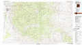 |
Artesia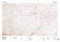 |
Hobbs |
Crow Flats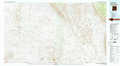 |
Carlsbad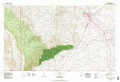 |
Jal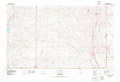 |
Dell City |
Guadalupe Peak |
Kermit |
> Back to 32104a1 at 1:250,000 scale
> Back to U.S. Topo Maps home
1:24,000 Topo Quads covered by the spatial extent of this 100k map (Carlsbad)
|
Packsaddle Canyon 
|
Texas Hill 
|
Cawley Draw 
|
Martha Creek 
|
Azotea Peak 
|
Carlsbad West 
|
Carlsbad East 
|
Indian Flats 
|
|
Algerita Canyon 
|
Ares Peak 
|
Red Bluff Draw 
|
Bandanna Point 
|
Carnero Peak 
|
Kitchen Cove 
|
Otis 
|
Loving 
|
|
La Paloma Canyon 
|
Pickett Hill 
|
Queen 
|
Serpentine Bends 
|
Carlsbad Caverns 
|
Black River Village 
|
Bond Draw 
|
Malaga 
|
|
Panther Canyon 
|
El Paso Gap 
|
Gunsight Canyon 
|
Grapevine Draw 
|
Rattlesnake Spring 
|
Jumping Spring 
|
Cottonwood Hills 
|
Red Bluff 
|
