Holloman Topo Map New Mexico
To zoom in, hover over the map of Holloman
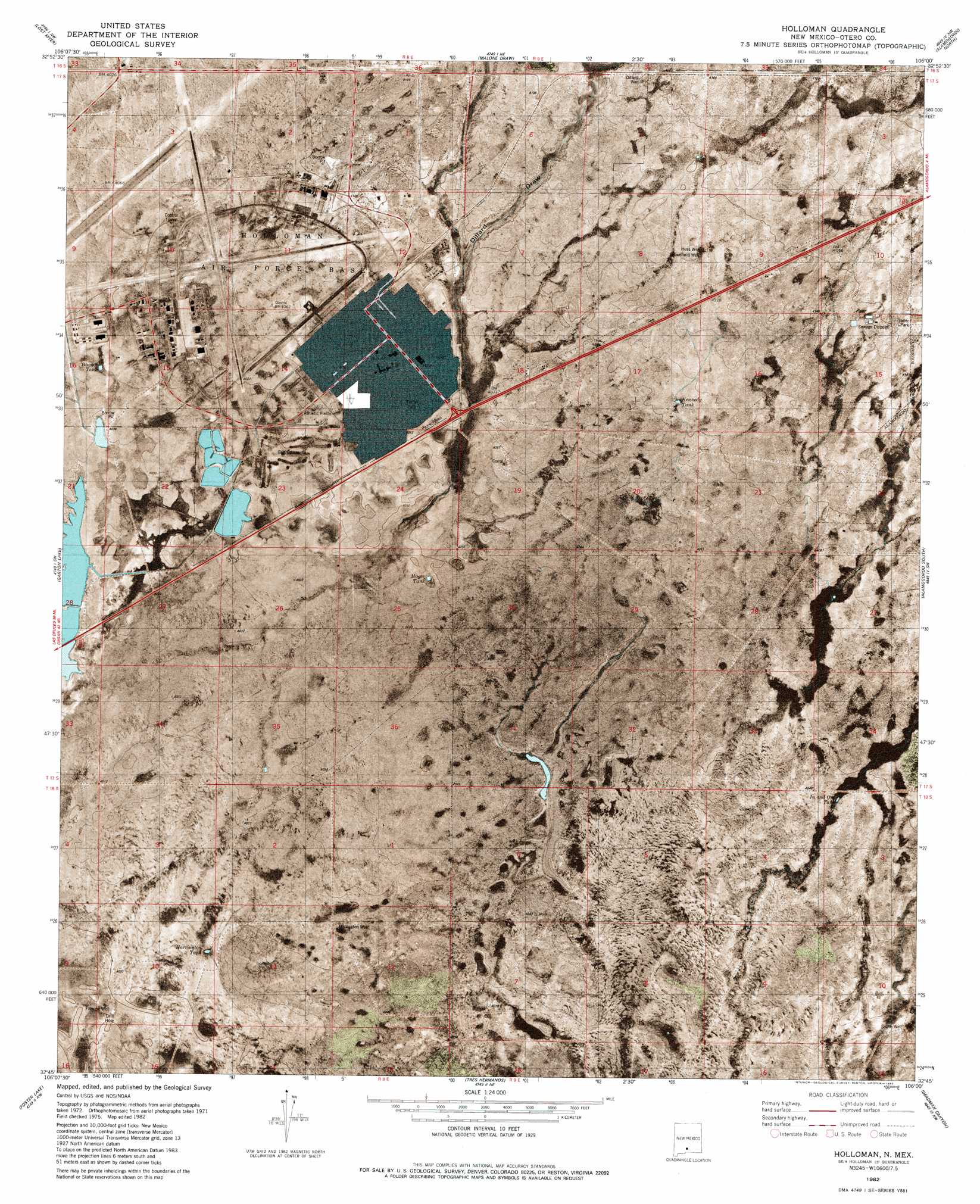
USGS Topo Quad 32106g1 - 1:24,000 scale
| Topo Map Name: | Holloman |
| USGS Topo Quad ID: | 32106g1 |
| Print Size: | ca. 21 1/4" wide x 27" high |
| Southeast Coordinates: | 32.75° N latitude / 106° W longitude |
| Map Center Coordinates: | 32.8125° N latitude / 106.0625° W longitude |
| U.S. State: | NM |
| Filename: | p32106g1.jpg |
| Download Map JPG Image: | Holloman topo map 1:24,000 scale |
| Map Type: | Orthophoto |
| Topo Series: | 7.5´ |
| Map Scale: | 1:24,000 |
| Source of Map Images: | United States Geological Survey (USGS) |
| Alternate Map Versions: |
Holloman SE NM 1976, updated 1980 Download PDF Buy paper map Holloman NM 1982, updated 1982 Download PDF Buy paper map Holloman NM 2010 Download PDF Buy paper map Holloman NM 2013 Download PDF Buy paper map Holloman NM 2017 Download PDF Buy paper map |
1:24,000 Topo Quads surrounding Holloman
Fifteenmile Lake |
Tularosa Peak |
Tularosa |
Sabinata Flat |
Domingo Peak |
Heart Of The Sands Ne |
Lost River |
Malone Draw |
Alamogordo North |
High Rolls |
Heart Of The Sands |
Garton Lake |
Holloman |
Alamogordo South |
Sacramento Peak |
Lake Lucero Ne |
Foster Lake |
Tres Hermanos |
Deadman Canyon |
Bug Scuffle Canyon |
Lake Lucero Se |
Tres Hermanos Sw |
Tres Hermanos Se |
Pipeline Canyon |
Culp Canyon |
> Back to 32106e1 at 1:100,000 scale
> Back to 32106a1 at 1:250,000 scale
> Back to U.S. Topo Maps home
Holloman topo map: Gazetteer
Holloman: Populated Places
Monista (historical) elevation 1241m 4071′Holloman: Post Offices
Holloman Air Force Base Post Office elevation 1244m 4081′Holloman Post Office elevation 1244m 4081′
Holloman: Reservoirs
Arrington Tank elevation 1229m 4032′Dagger Tank elevation 1233m 4045′
Kennedy Tank elevation 1251m 4104′
Mogee Tank elevation 1235m 4051′
Holloman: Streams
Red Arroyo elevation 1255m 4117′Holloman: Wells
10048 Water Well elevation 1259m 4130′Brownfield Well elevation 1259m 4130′
Dillard Water Well elevation 1265m 4150′
Dillard Well elevation 1264m 4146′
Harington Water Well elevation 1228m 4028′
Harrington Well elevation 1228m 4028′
Huss Water Well elevation 1261m 4137′
Huss Well elevation 1259m 4130′
Lewis Water Well elevation 1241m 4071′
Prather Water Well elevation 1229m 4032′
Red Barn Well elevation 1275m 4183′
Holloman digital topo map on disk
Buy this Holloman topo map showing relief, roads, GPS coordinates and other geographical features, as a high-resolution digital map file on DVD: