Sibley Hole Topo Map New Mexico
To zoom in, hover over the map of Sibley Hole
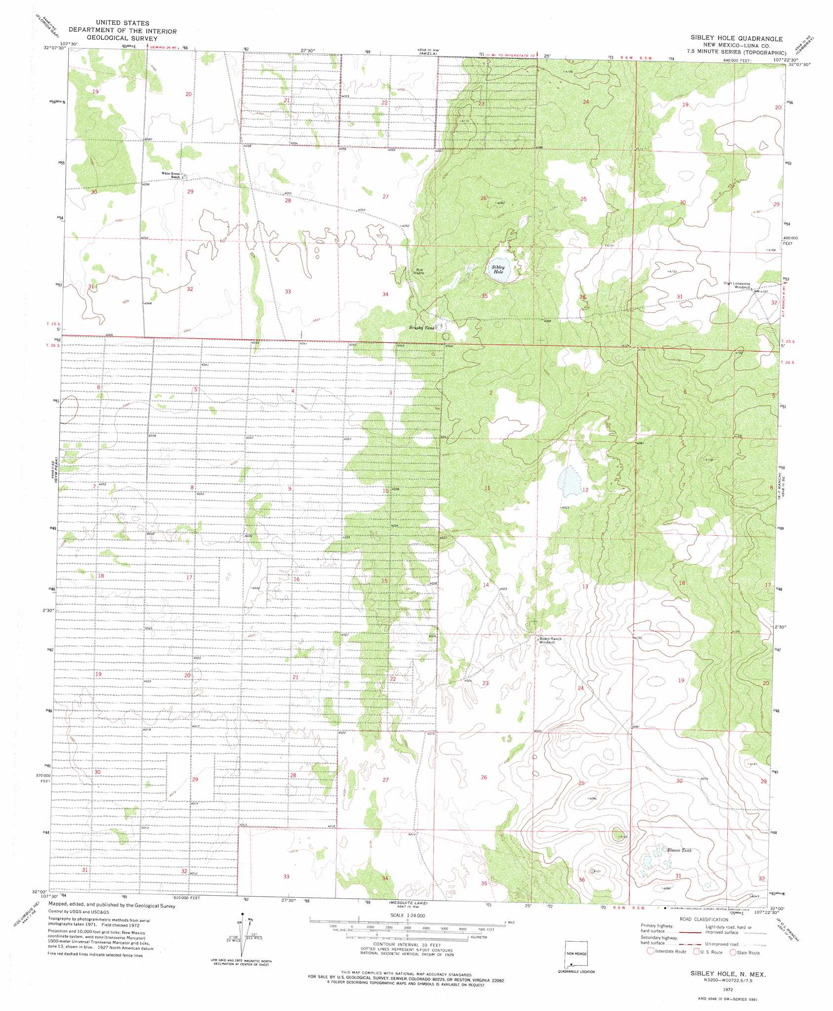
USGS Topo Quad 32107a4 - 1:24,000 scale
| Topo Map Name: | Sibley Hole |
| USGS Topo Quad ID: | 32107a4 |
| Print Size: | ca. 21 1/4" wide x 27" high |
| Southeast Coordinates: | 32° N latitude / 107.375° W longitude |
| Map Center Coordinates: | 32.0625° N latitude / 107.4375° W longitude |
| U.S. State: | NM |
| Filename: | o32107a4.jpg |
| Download Map JPG Image: | Sibley Hole topo map 1:24,000 scale |
| Map Type: | Topographic |
| Topo Series: | 7.5´ |
| Map Scale: | 1:24,000 |
| Source of Map Images: | United States Geological Survey (USGS) |
| Alternate Map Versions: |
Sibley Hole NM 1972, updated 1976 Download PDF Buy paper map Sibley Hole NM 2010 Download PDF Buy paper map Sibley Hole NM 2013 Download PDF Buy paper map Sibley Hole NM 2017 Download PDF Buy paper map |
1:24,000 Topo Quads surrounding Sibley Hole
Deming East |
Carne |
Myndus |
Lazy E Ranch |
Magdalena Gap |
Capitol Dome |
Florida Gap |
Akela |
Cambray |
Mount Aden |
South Peak |
Gym Peak |
Sibley Hole |
X-7 Ranch |
Mount Aden Sw |
North Peak |
Columbus Ne |
Mesquite Lake |
P O L Ranch |
Potrillo Peak |
Columbus |
Columbus Se |
Coyote Hill |
Camel Mountain |
Guzmans Lookout Mountain |
> Back to 32107a1 at 1:100,000 scale
> Back to 32106a1 at 1:250,000 scale
> Back to U.S. Topo Maps home
Sibley Hole topo map: Gazetteer
Sibley Hole: Lakes
Sibley Hole elevation 1233m 4045′Sibley Hole: Mines
Wet King Mine elevation 1227m 4025′Sibley Hole: Reservoirs
Blanco Tank elevation 1227m 4025′Brushy Tank elevation 1235m 4051′
Sibley Hole: Wells
01465 Water Well elevation 1236m 4055′01628 Water Well elevation 1226m 4022′
01629 Water Well elevation 1226m 4022′
01678 Water Well elevation 1266m 4153′
06052 Water Well elevation 1238m 4061′
06053 Water Well elevation 1266m 4153′
06067 Water Well elevation 1226m 4022′
06068 Water Well elevation 1230m 4035′
06069 Water Well elevation 1233m 4045′
10292 Water Well elevation 1240m 4068′
Sibley Hole digital topo map on disk
Buy this Sibley Hole topo map showing relief, roads, GPS coordinates and other geographical features, as a high-resolution digital map file on DVD: