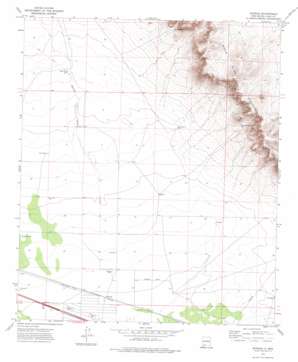
Myndus Topo Map New Mexico
To zoom in, hover over the map of Myndus
USGS Topo Quad 32107c4 - 1:24,000 scale
| Topo Map Name: | Myndus |
| USGS Topo Quad ID: | 32107c4 |
| Print Size: | ca. 21 1/4" wide x 27" high |
| Southeast Coordinates: | 32.25° N latitude / 107.375° W longitude |
| Map Center Coordinates: | 32.3125° N latitude / 107.4375° W longitude |
| U.S. State: | NM |
| Filename: | o32107c4.jpg |
| Download Map JPG Image: | Myndus topo map 1:24,000 scale |
| Map Type: | Topographic |
| Topo Series: | 7.5´ |
| Map Scale: | 1:24,000 |
| Source of Map Images: | United States Geological Survey (USGS) |
| Alternate Map Versions: |
Myndus NM 1972, updated 1974 Download PDF Buy paper map Myndus NM 2010 Download PDF Buy paper map Myndus NM 2013 Download PDF Buy paper map Myndus NM 2017 Download PDF Buy paper map |
1:24,000 Topo Quads surrounding Myndus
> Back to 32107a1 at 1:100,000 scale
> Back to 32106a1 at 1:250,000 scale
> Back to U.S. Topo Maps home
Myndus topo map: Gazetteer
Myndus: Airports
Solo Ranch Airport elevation 1269m 4163′Myndus: Flats
Lewis Flats elevation 1272m 4173′Myndus: Populated Places
Myndus elevation 1265m 4150′Myndus: Post Offices
Myndus Post Office (historical) elevation 1265m 4150′Myndus: Streams
Macho Creek elevation 1274m 4179′Myndus: Wells
01582 Water Well elevation 1383m 4537′01588 Water Well elevation 1364m 4475′
01593 Water Well elevation 1291m 4235′
01594 Water Well elevation 1293m 4242′
01595 Water Well elevation 1298m 4258′
01596 Water Well elevation 1278m 4192′
01597 Water Well elevation 1278m 4192′
01599 Water Well elevation 1272m 4173′
01601 Water Well elevation 1268m 4160′
01602 Water Well elevation 1269m 4163′
01603 Water Well elevation 1264m 4146′
06112 Water Well elevation 1302m 4271′
06113 Water Well elevation 1292m 4238′
06114 Water Well elevation 1276m 4186′
06115 Water Well elevation 1265m 4150′
Coyote Well elevation 1291m 4235′
Fox Well elevation 1278m 4192′
Good Sight Well elevation 1388m 4553′
Number 1210 Water Well elevation 1303m 4274′
Pipe Tower Well elevation 1296m 4251′
Plain Mountain Well elevation 1357m 4452′
Plain Well elevation 1293m 4242′
Plank Well elevation 1271m 4169′
Salt Well elevation 1271m 4169′
Myndus digital topo map on disk
Buy this Myndus topo map showing relief, roads, GPS coordinates and other geographical features, as a high-resolution digital map file on DVD:


