Horn Topo Map Arizona
To zoom in, hover over the map of Horn
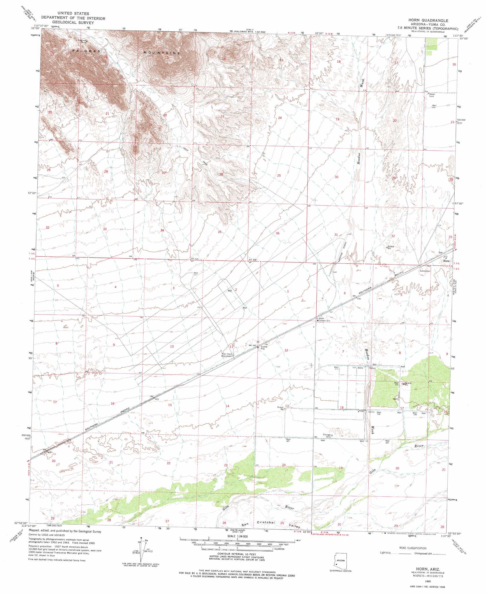
USGS Topo Quad 32113h5 - 1:24,000 scale
| Topo Map Name: | Horn |
| USGS Topo Quad ID: | 32113h5 |
| Print Size: | ca. 21 1/4" wide x 27" high |
| Southeast Coordinates: | 32.875° N latitude / 113.5° W longitude |
| Map Center Coordinates: | 32.9375° N latitude / 113.5625° W longitude |
| U.S. State: | AZ |
| Filename: | o32113h5.jpg |
| Download Map JPG Image: | Horn topo map 1:24,000 scale |
| Map Type: | Topographic |
| Topo Series: | 7.5´ |
| Map Scale: | 1:24,000 |
| Source of Map Images: | United States Geological Survey (USGS) |
| Alternate Map Versions: |
Horn AZ 1965, updated 1966 Download PDF Buy paper map Horn AZ 1965, updated 1978 Download PDF Buy paper map Horn AZ 2011 Download PDF Buy paper map Horn AZ 2014 Download PDF Buy paper map |
1:24,000 Topo Quads surrounding Horn
Engesser Pass |
Palomas Mountains Nw |
Palomas Mountains Ne |
Turtleback Mountain |
Hyder Ne |
Neversweat Ridge |
Palomas Mountains Sw |
Palomas Mountains Se |
Baragan Mountain |
Hyder |
Mesquite Jim Well |
Kofa |
Horn |
Aztec Nw |
Agua Caliente |
Growler |
Texas Hill |
Dateland |
Aztec Hills |
Aztec Se |
Mohawk |
Mohawk Mountains Nw |
Hohawk Mountains Ne |
Aguila Mountains Nw |
Aguila Mountains Ne |
> Back to 32113e1 at 1:100,000 scale
> Back to 32112a1 at 1:250,000 scale
> Back to U.S. Topo Maps home
Horn topo map: Gazetteer
Horn: Mines
England Mine elevation 258m 846′Engles Mine elevation 229m 751′
Horn: Parks
Fort Horn Monument elevation 134m 439′Horn: Populated Places
Horn elevation 141m 462′Horn: Streams
Hoodoo Wash elevation 116m 380′Horn digital topo map on disk
Buy this Horn topo map showing relief, roads, GPS coordinates and other geographical features, as a high-resolution digital map file on DVD: