Bowdon West Topo Map Georgia
To zoom in, hover over the map of Bowdon West
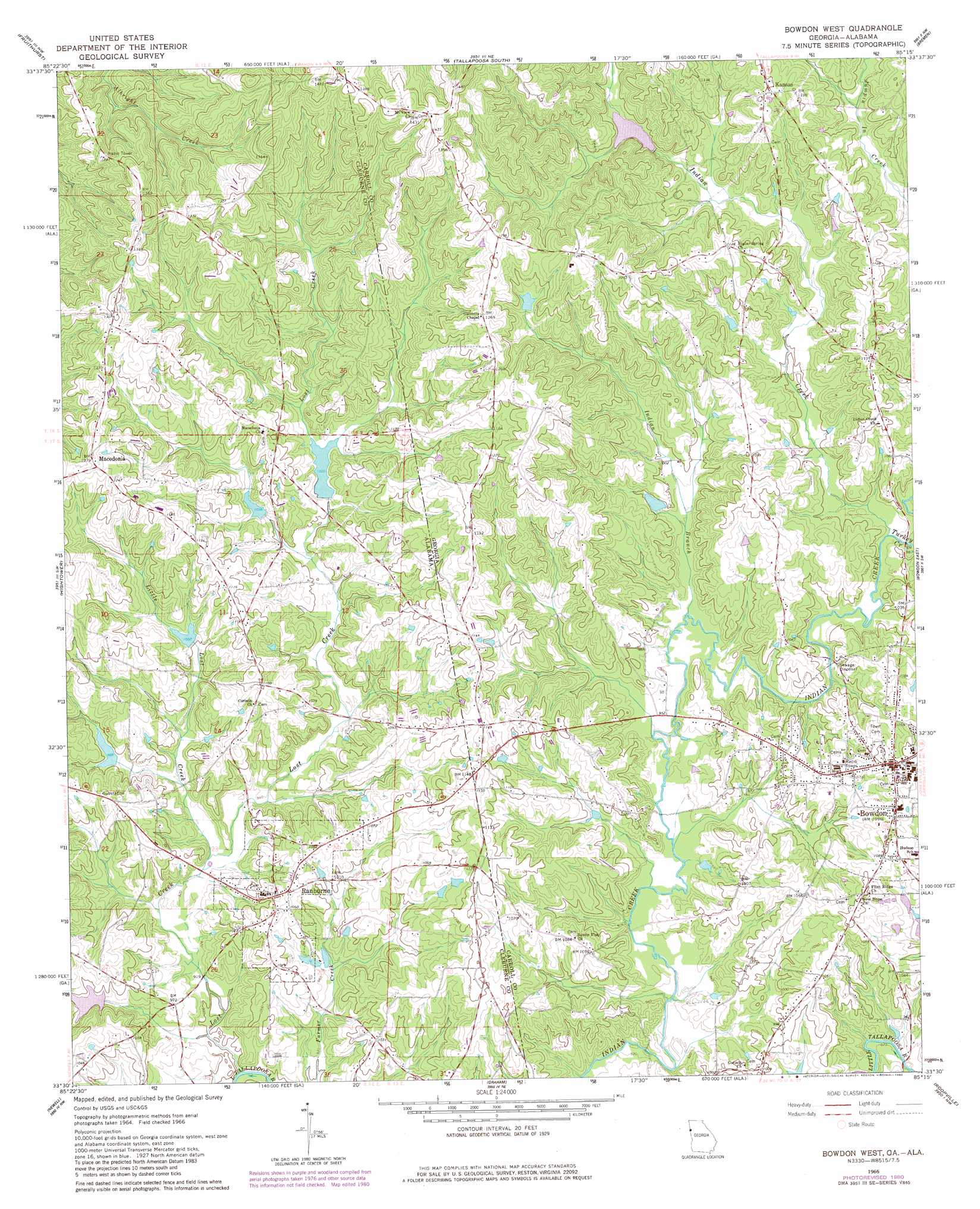
USGS Topo Quad 33085e3 - 1:24,000 scale
| Topo Map Name: | Bowdon West |
| USGS Topo Quad ID: | 33085e3 |
| Print Size: | ca. 21 1/4" wide x 27" high |
| Southeast Coordinates: | 33.5° N latitude / 85.25° W longitude |
| Map Center Coordinates: | 33.5625° N latitude / 85.3125° W longitude |
| U.S. States: | GA, AL |
| Filename: | o33085e3.jpg |
| Download Map JPG Image: | Bowdon West topo map 1:24,000 scale |
| Map Type: | Topographic |
| Topo Series: | 7.5´ |
| Map Scale: | 1:24,000 |
| Source of Map Images: | United States Geological Survey (USGS) |
| Alternate Map Versions: |
Bowdon West GA 1966, updated 1968 Download PDF Buy paper map Bowdon West GA 1966, updated 1980 Download PDF Buy paper map Bowdon West GA 1966, updated 1980 Download PDF Buy paper map Bowdon West GA 1975, updated 1977 Download PDF Buy paper map Bowdon West GA 2011 Download PDF Buy paper map Bowdon West GA 2014 Download PDF Buy paper map |
1:24,000 Topo Quads surrounding Bowdon West
Piedmont Se |
Oak Level |
Tallapoosa North |
Buchanan |
Draketown |
Heflin |
Fruithurst |
Tallapoosa South |
Bremen |
Temple |
Ross Mountain |
Hightower |
Bowdon West |
Bowdon East |
Carrollton |
Micaville |
Newell |
Graham |
Roopville |
Lowell |
Ofelia |
Wedowee |
Napoleon |
Frolona |
Franklin |
> Back to 33085e1 at 1:100,000 scale
> Back to 33084a1 at 1:250,000 scale
> Back to U.S. Topo Maps home
Bowdon West topo map: Gazetteer
Bowdon West: Dams
Lost Creek Watershed Dam Number 1 elevation 311m 1020′Lost Creek Watershed Dam Number 2 elevation 316m 1036′
Lost Creek Watershed Dam Number 3 elevation 305m 1000′
Lost Creek Watershed Dam Number 4 elevation 301m 987′
Robinson Number 2 Dam elevation 302m 990′
Stitcher Lake Dam elevation 301m 987′
Zuejnieks Lake Dam elevation 357m 1171′
Bowdon West: Mines
Chewacla Lime Works (historical) elevation 321m 1053′Bowdon West: Parks
Bulldog Stadium elevation 305m 1000′Bowdon West: Populated Places
Bowdon elevation 329m 1079′Cedar Valley elevation 311m 1020′
Macedonia elevation 389m 1276′
Ranburne elevation 311m 1020′
Bowdon West: Post Offices
Bowdon Post Office elevation 335m 1099′Winston Post Office (historical) elevation 293m 961′
Bowdon West: Reservoirs
Lost Creek Lake Number 1 elevation 311m 1020′Lost Creek Lake Number 2 elevation 316m 1036′
Lost Creek Lake Number 3 elevation 305m 1000′
Lost Creek Lake Number 4 elevation 301m 987′
Robinson Lake Number 2 elevation 302m 990′
Stitcher Lake elevation 301m 987′
Teague Lake elevation 353m 1158′
Zuejnieks Lake elevation 357m 1171′
Bowdon West: Streams
Indian Creek elevation 291m 954′Little Lost Creek elevation 288m 944′
Lost Creek elevation 274m 898′
Turkey Creek elevation 299m 980′
Bowdon West digital topo map on disk
Buy this Bowdon West topo map showing relief, roads, GPS coordinates and other geographical features, as a high-resolution digital map file on DVD: